0
0 items
No products in the cart.
0
0 items
No products in the cart.

المسار 304: عيون الذيب إلى وادي زرقاء ماعين

  • مسارات المشي في المنطقة

  • اليوم الرابع: عيون الذيب إلى وادي زرقاء ماعين

  • المسافة: 21.2 كم

  • الوقت اللازم للمسير: 7 ساعات

  • التحدي البدني: صعب

  • صعوبة المسار: صعب

  • اجمالي الصعوبة: صعب

  • تعليم المسار: نعم

لتحميل مسار GPS، اضغط هنا.  

The Jordan Trail is a newly established trail, and is not marked. It is therefore our strong recommendation that you hire a local guide for your safety as many sections are remote with limited water sources and at times no connectivity.
By downloading these maps/GPX you take full responsibility for their use and accuracy; Jordan Trail Association does not warrant the accuracy or completeness of the information, materials or the reliability of any maps as they provided AS IS without warranty of any kind, either express or implied, including but not limited to, fitness for a particular purpose, or non-infringement ;You acknowledge that any reliance on any such maps, shall be at your sole risk and responsibility as Hiking, backpacking, and other outdoor activities all have potential hazards involving risk of injury or death. Outdoor activities have inherent risks and you should ensure you have the skill level and abilities suitable for the activities in Jordan to partake in them and to take all precaution measures.  Check the data on Google Earth or other Apps or Programs before using them.  The Jordan Trail Association shall not be held responsible for any incidents that may occur during your participation in any activity and/or by using any of the maps/GPX.
AGREE
close-link

أنقر هنا

The Jordan Trail is a newly established trail, and is not marked. It is therefore our strong recommendation that you hire a local guide for your safety as many sections are remote with limited water sources and at times no connectivity.
By downloading these maps/GPX you take full responsibility for their use and accuracy; Jordan Trail Association does not warrant the accuracy or completeness of the information, materials or the reliability of any maps as they provided AS IS without warranty of any kind, either express or implied, including but not limited to, fitness for a particular purpose, or non-infringement ;You acknowledge that any reliance on any such maps, shall be at your sole risk and responsibility as Hiking, backpacking, and other outdoor activities all have potential hazards involving risk of injury or death. Outdoor activities have inherent risks and you should ensure you have the skill level and abilities suitable for the activities in Jordan to partake in them and to take all precaution measures.  Check the data on Google Earth or other Apps or Programs before using them.  The Jordan Trail Association shall not be held responsible for any incidents that may occur during your participation in any activity and/or by using any of the maps/GPX.
AGREE
close-link
لتحميل الخريطة
أرقام مهمة

الشرطة السياحية:

الخط الساخن: 117777
واتساب: +962770992690

*في حال التواصل مع شرطة السياحة في حالة طارئة، يُرجى تحديد أنك تسير على درب الأردن، وذكر جنسيتك، موقعك الحالي، واسم ورقم الخريطة.

مكتب جمعية درب الأردن: +962 6 461 0999

(ساعات العمل: من 9:00 صباحًا حتى 5:00 مساءً، من الأحد إلى الخميس)

معلومات عامة

Easy walking in wild, barren surrounds as you continue S, still close to higher hills to your E, meeting remnants of the old Roman road from Jerusalem to Mukawir, and following a track left of a camel racing track before crossing the upper reaches of Wadi Himara. On the S side, a track rises up E to meet a road on the skyline, after which the Roman road is found again winding down a surprisingly easy and spectacular descent to above the basalt columned cliffs of the Zerqa Main canyon, which is easily crossed by a path which descends through the cliffs to reach it. The area is dotted with Bedouin camps and you are likely to come across cultural scenes of shepherds grazing their flocks of sheep and goats.

وسائل النقل
  • النقل متاح فقط عبر المركبات الخاصة. يمكن الوصول إلى نقطة انطلاق المرحلة وطريق البانوراما بالسيارة، بينما تتمكن شاحنات البيك أب من الوصول إلى قرب وادي زرقاء ماعين عند نهاية المرحلة، على بُعد كيلومتر واحد تقريبًا، وذلك بحسب حالة الطريق في ذلك الوقت.
  • تنطلق الحافلات العامة من مجمع الجنوب في عمّان إلى مدينة مادبا، ومن هناك يمكن استقلال سيارة أجرة للوصول إلى المسار.
أماكن الإقامة

التخييم البري فقط

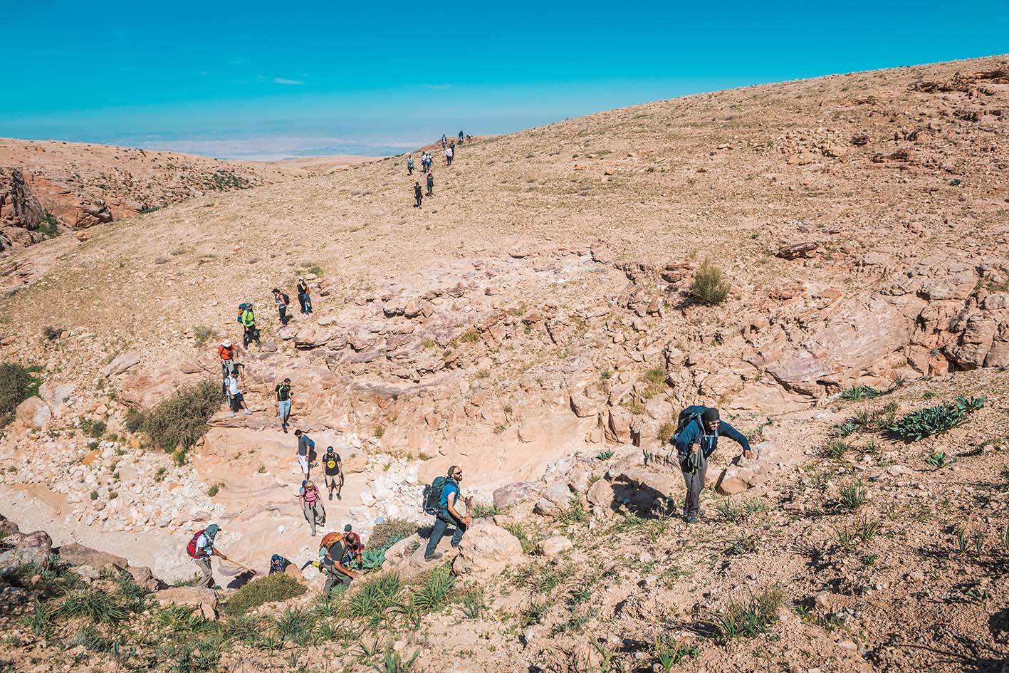
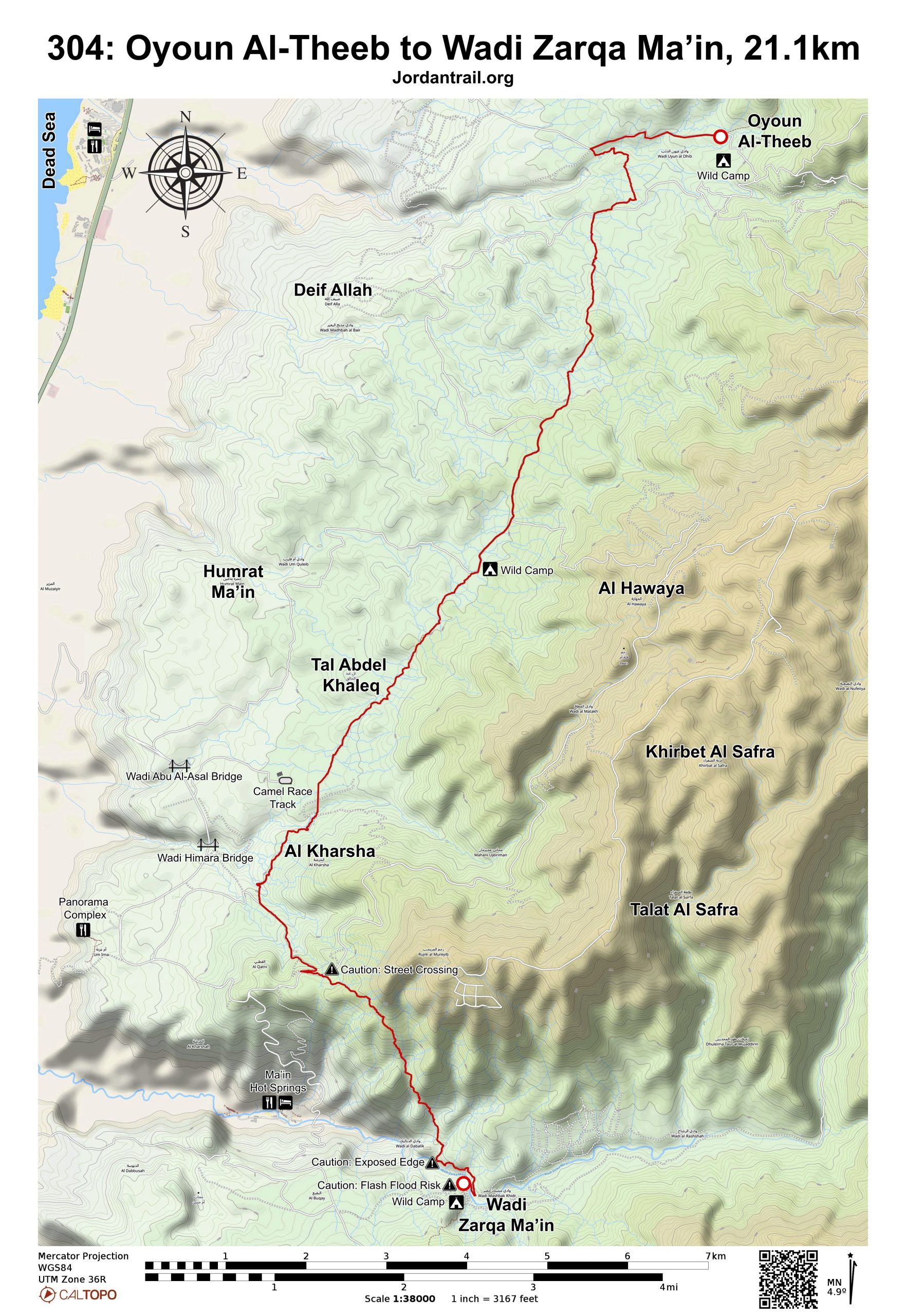
حيث يدخل المسار إلى وادي مُخَيرِس، يوجد موقع تخييم متوسط المستوى، يتميز بظلّ محدود وأرض غير مستوية تمامًا، ويمكن الوصول إليه سيرًا على الأقدام بمسافة قصيرة من الطريق المعبد.

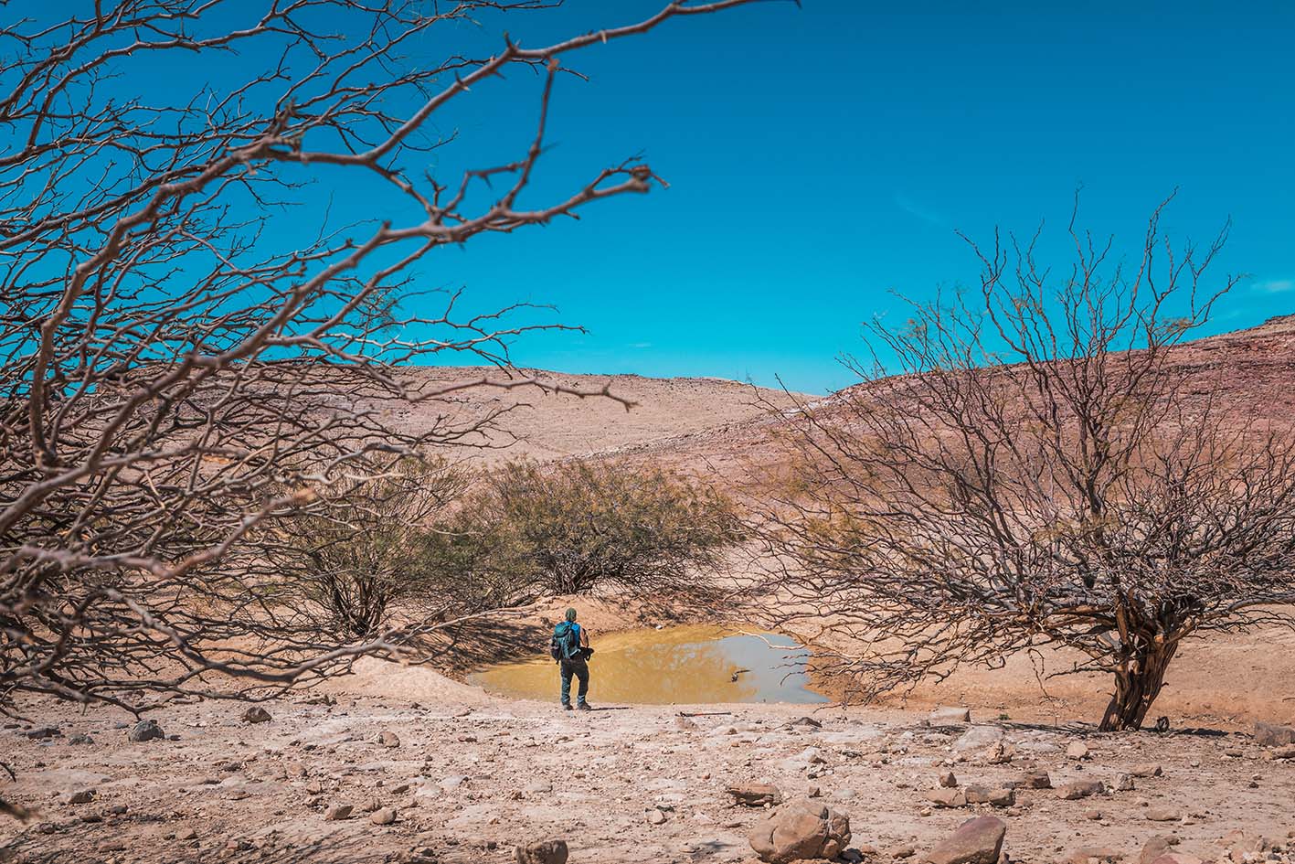
ينتهي هذا المقطع عند وادي زرقاء ماعين حيث يوجد موقع تخييم مميز قرب النهر، يقع على حافة مرتفعة قليلاً فوق قاع الوادي. يتدفق الماء فيه على مدار العام، لكن يجب تنقيته قبل الاستخدام. ومن غير المرجح أن تتمكن الشاحنات من الاقتراب لمسافة أقل من كيلومتر واحد من الوادي بسبب تضرر الطريق بفعل السيول.

أهم المعالم التي يمكن مشاهدتها
الأودية على طول هذا المقطع:
 1. وادي مخيرس
2. وادي دردور
3. وادي حِمارة
4. وادي زرقاء ماعين

من طريق بانوراما إلى وادي زرقاء ماعين.

متحف البحر الميت في مجمع بانوراما البحر الميت (خارج المسار, رقم الهاتف. 0782488880)

الطعام والماء

الطعام:

الماء:

  • وادي زرقاء ماعين (يرجى تنقية المياه قبل الإستخدام)
  • بعض خيام البدو (تتواجد فقط في فصل الشتاء) يمكن اللجوء إليها في حالات الطوارئ.
 
النصائح والسلامة العامة

النصائح:

  • يحتوي المسار على العديد من الحجارة الصغيرة والصخور الحادة، ومن السهل أن تتشكل تقرّحات في القدمين وتلتوي الكاحلين إذا لم تكن حذراً. يوصى بارتداء أحذية طويلة واستخدام عصي المشي.
  • المسار ناءٍ ولا تتوفر فيه مصادر للمياه حتى نهايته، لذا احرص على التخطيط المسبق والتزوّد بما يكفي من المؤن والمياه ووسائل النقل.

السلامة العامة:

  • الحواف المكشوفة: لا توجد؛ يبدو المسار النازل إلى وادي الزرقاء ماعين مكشوفًا من الأعلى، لكنه في الحقيقة ليس كذلك، وإنما بسبب زاوية الرؤية فقط.
  • مخاطر السيول: عند عبور عدة أودية، من المهم توخي الحذر إذا كان الجو ماطرًا، وقد يكون من الأفضل الانتظار في حال هطول أمطار غزيرة.
  • الأرضية غير الثابتة: هناك أقسام تحتوي على حجارة زلقة وحادة.
  • الجفاف/الإرهاق الحراري: مع قلة الظل وانخفاض الارتفاع في معظم أجزاء المرحلة، من المهم البدء مبكرًا وتجنب المشي في فصل الصيف.
 
جهات الاتصال المحلية

أبو مجد - 0776501901 (وسيلة نقل حول وادي الزرقاء ماعين)

The Jordan Trail is a newly established trail, and is not marked. It is therefore our strong recommendation that you hire a local guide for your safety as many sections are remote with limited water sources and at times no connectivity.
By downloading these maps/GPX you take full responsibility for their use and accuracy; Jordan Trail Association does not warrant the accuracy or completeness of the information, materials or the reliability of any maps as they provided AS IS without warranty of any kind, either express or implied, including but not limited to, fitness for a particular purpose, or non-infringement ;You acknowledge that any reliance on any such maps, shall be at your sole risk and responsibility as Hiking, backpacking, and other outdoor activities all have potential hazards involving risk of injury or death. Outdoor activities have inherent risks and you should ensure you have the skill level and abilities suitable for the activities in Jordan to partake in them and to take all precaution measures.  Check the data on Google Earth or other Apps or Programs before using them.  The Jordan Trail Association shall not be held responsible for any incidents that may occur during your participation in any activity and/or by using any of the maps/GPX.
AGREE
close-link
AR