- التخييم البري, صالح الحُمران, 962776840606+, ختم سجل الدرب: وادي الهيدان, وادي الزرقاء ماعين, وادي موجب
القسم 401: وادي الزرقاء ماعين إلى وادي الهيدان
-
مسارات المشي في المنطقة
-
اليوم الأول: وادي الزرقاء ماعين إلى وادي الهيدان
-
المسافة: 17.7 كم
-
الوقت اللازم للمسير: 6 ساعات
-
التحدي البدني: صعب
-
صعوبة المسار: صعب جدًا
-
اجمالي الصعوبة: صعب
-
تعليم المسار: نعم

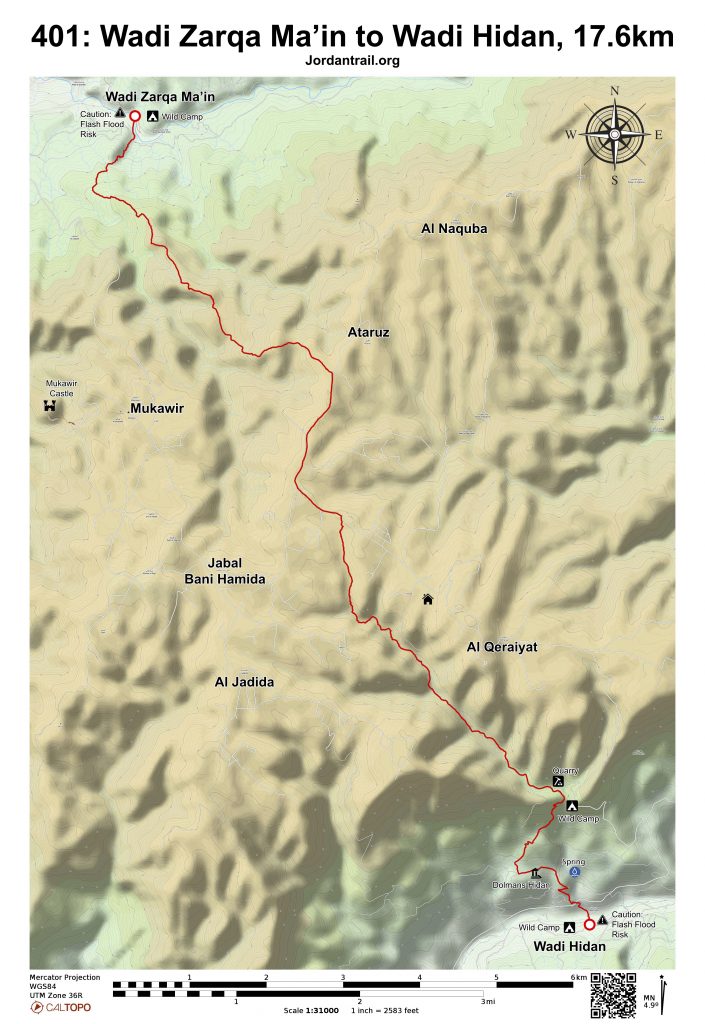
- خريطة المسار
- خريطة جوجل
- نظام تحديد المواقع
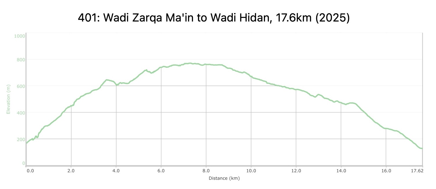
- مخطط الارتفاعات
لتحميل مسار GPS، اضغط هنا.

The Jordan Trail is a newly established trail, and is not marked. It is therefore our strong recommendation that you hire a local guide for your safety as many sections are remote with limited water sources and at times no connectivity.
By downloading these maps/GPX you take full responsibility for their use and accuracy; Jordan Trail Association does not warrant the accuracy or completeness of the information, materials or the reliability of any maps as they provided AS IS without warranty of any kind, either express or implied, including but not limited to, fitness for a particular purpose, or non-infringement ;You acknowledge that any reliance on any such maps, shall be at your sole risk and responsibility as Hiking, backpacking, and other outdoor activities all have potential hazards involving risk of injury or death. Outdoor activities have inherent risks and you should ensure you have the skill level and abilities suitable for the activities in Jordan to partake in them and to take all precaution measures. Check the data on Google Earth or other Apps or Programs before using them. The Jordan Trail Association shall not be held responsible for any incidents that may occur during your participation in any activity and/or by using any of the maps/GPX.

أنقر هنا

 لتحميل الخريطة

The Jordan Trail is a newly established trail, and is not marked. It is therefore our strong recommendation that you hire a local guide for your safety as many sections are remote with limited water sources and at times no connectivity.
By downloading these maps/GPX you take full responsibility for their use and accuracy; Jordan Trail Association does not warrant the accuracy or completeness of the information, materials or the reliability of any maps as they provided AS IS without warranty of any kind, either express or implied, including but not limited to, fitness for a particular purpose, or non-infringement ;You acknowledge that any reliance on any such maps, shall be at your sole risk and responsibility as Hiking, backpacking, and other outdoor activities all have potential hazards involving risk of injury or death. Outdoor activities have inherent risks and you should ensure you have the skill level and abilities suitable for the activities in Jordan to partake in them and to take all precaution measures. Check the data on Google Earth or other Apps or Programs before using them. The Jordan Trail Association shall not be held responsible for any incidents that may occur during your participation in any activity and/or by using any of the maps/GPX.

أرقام مهمة
الشرطة السياحية:
الخط الساخن: 117777
واتساب: +962770992690
*في حال التواصل مع شرطة السياحة في حالة طارئة، يُرجى تحديد أنك تسير على درب الأردن، وذكر جنسيتك، موقعك الحالي، واسم ورقم الخريطة.
مكتب جمعية درب الأردن: +962 6 461 0999
(ساعات العمل: من 9:00 صباحًا حتى 5:00 مساءً، من الأحد إلى الخميس)
معلومات عامة
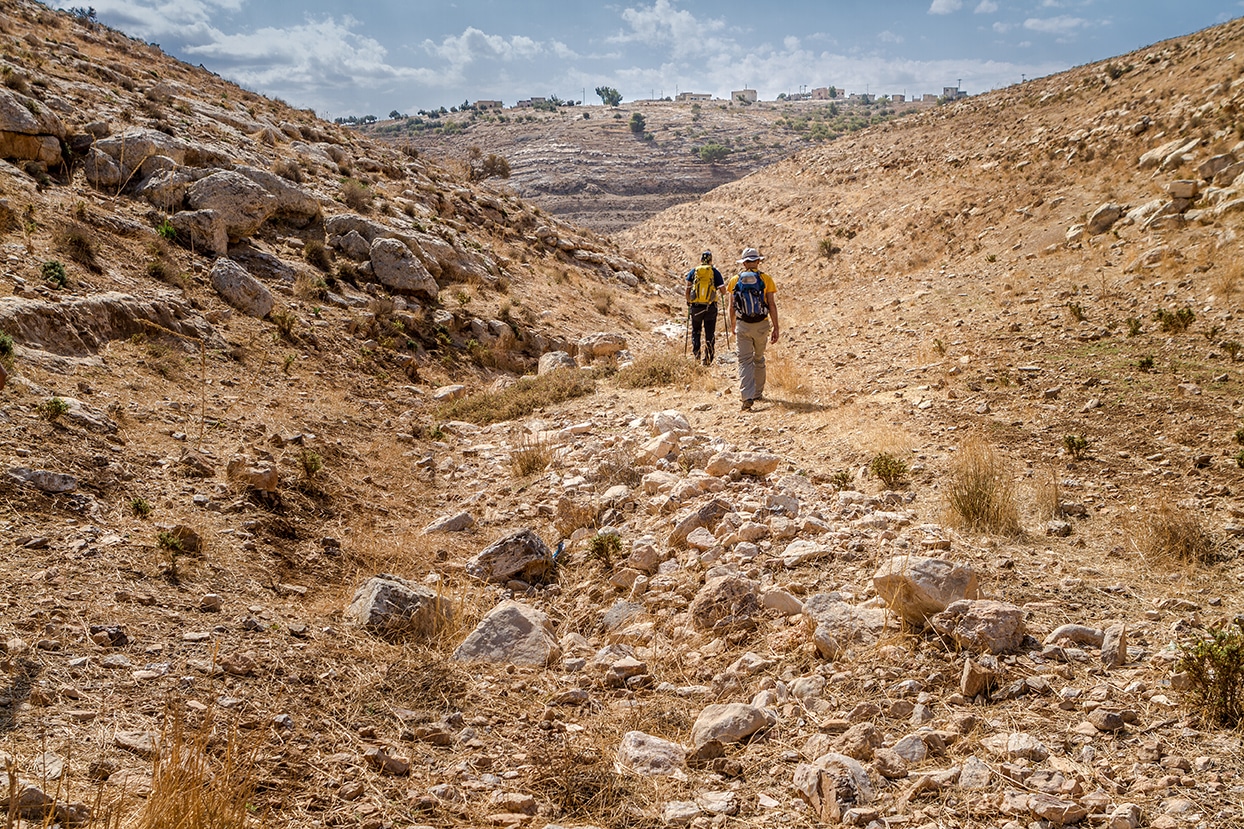
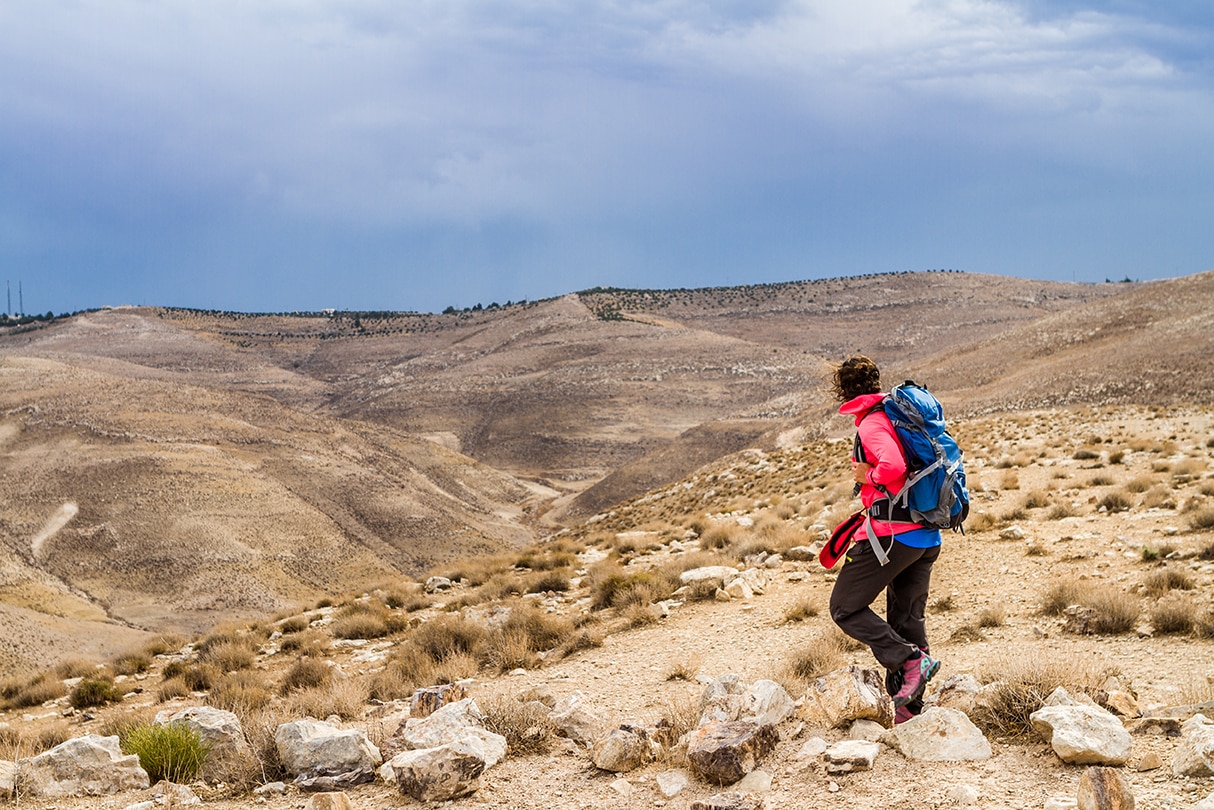
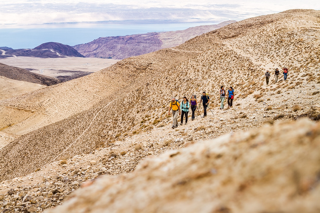
يبدأ اليوم بصعود طويل على سلسلة تلال متموجة ممتعة، حيث يظهر أحيانًا الطريق الروماني القديم بالقرب منك. تستمتع خلالها بإطلالات رائعة على البحر الميت، ووادي الأردن، والمنحدرات والتلال في فلسطين. بعد الوصول إلى القمة الجميلة، يؤدي مسار إلى الطريق الذي يُتبع لفترة قصيرة نحو الجنوب الغربي، قبل النزول إلى وادي طويل يلتقي بمسلك آخر. بعد عبور الوادي، ينحدر المسار مرورًا بالمقابر الحجرية نحو أعماق وادي الهيدان الخضراء، الذي يتميز بجماله الساحر وشلالاته وبرك المياه في مجرى النهر
وسائل النقل
- توجد حافلات تنطلق من محطة الحافلات الجنوبية في عمان إلى مادبا. ومن مادبا يمكن استقلال سيارة أجرة للوصول إلى نقطة بداية أو نهاية المرحلة.
- الوصول بالسيارة متاح بالقرب من بداية المرحلة (على بعد مئات الأمتار من وادي الزرقاء ماعين) باستخدام سيارات الدفع الرباعي، وفي منتصف الطريق (عطروز/بني حميدة)، وكذلك عند النهاية (وادي الهيدان). يمكن الوصول إلى طرق الدفع الرباعي لمعظم أجزاء المسار.
جهات الاتصال المحلية / أماكن الإقامة
أهم المعالم التي يمكن مشاهدتها
- وادي الهيدان
- عطروز وقبيلة بني حميدة
- قلعة مكاور (مكايروس)
- الآثارالرومانية والطريق الروماني
- سلسلة جبال تطل على البحر الميت البحر الميت
الطعام والماء
الطعام:
- سوبر ماركت صغير لبيع الماء والطعام في بني حميدة / عطروز، يقع مباشرة على المسار.
الماء:
- يتدفق الماء على مدار السنة في وادي زرقا ماعين ووادي الهيدان (يرجى تنقية الماء قبل الشرب).
- نبع جردبة قبل وادي الهيدان
النصائح والسلامة العامة
النصائح:
- الصعود من وادي الزرقاء ماعين يتبع طريقًا رومانيًا ممهدًا جيدًا لمعظم المسافة.
- احصل على وجبة خفيفة ومشروب بارد من السوق الصغير في بني حميدة.
- خذ استراحة من التخييم في بيت أبو سيف، القريب من منتصف المسار.
- الوصول بالسيارة متاح في البداية (زرقا ماعين)، والنصف (عطروز)، والنهاية (وادي الهيدان).
- الظل محدود.
- خدمة الهاتف المحمول متاحة معظم الوقت ما عدا الربع الأخير من الطريق.
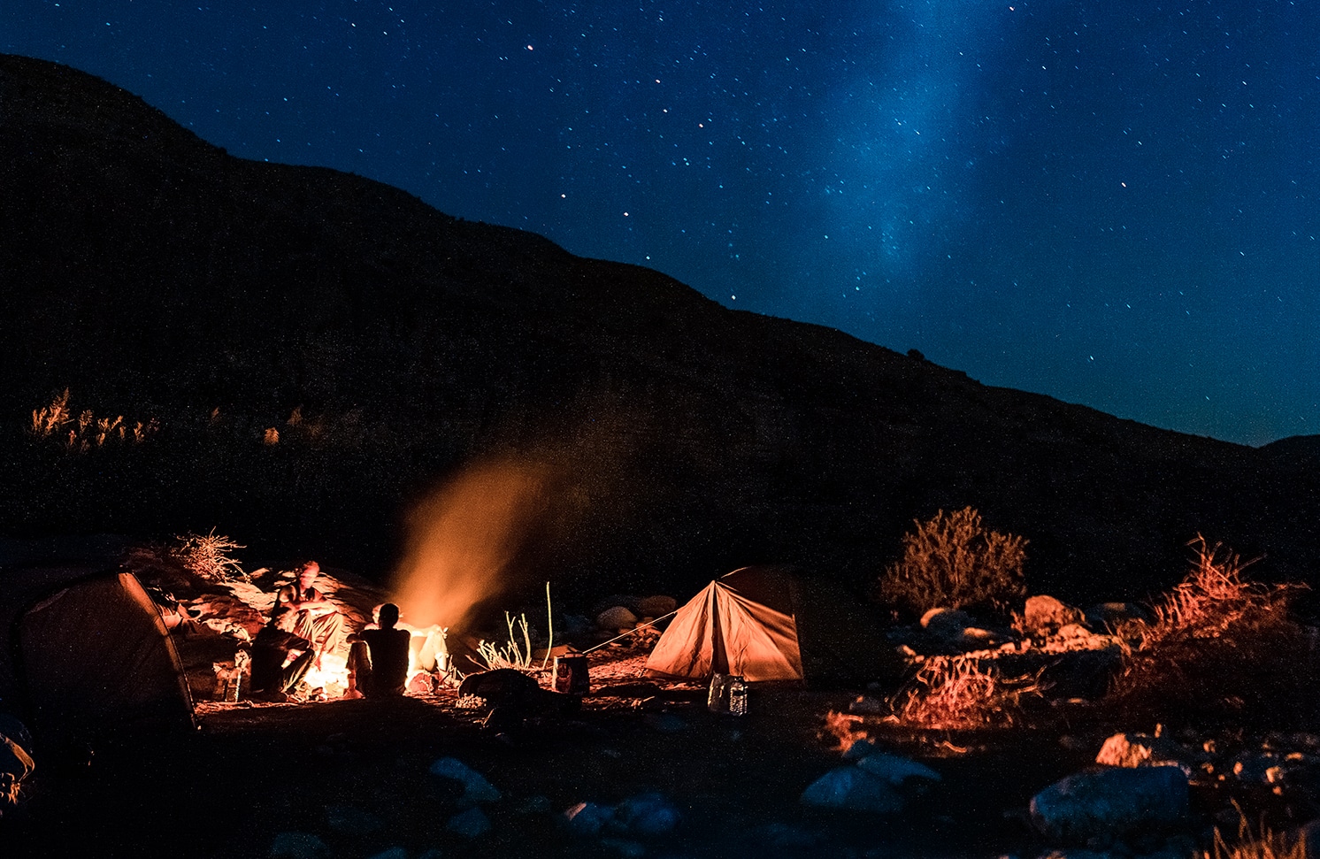
- التخييم البري ممكن في أي مكان على طول المسار.
السلامة العامة:
- الحواف المكشوفة – توجد بعض الصخور الكبيرة وحواف قصيرة يجب السير حولها في الوادي أسفل عطروز، وحافة قصيرة ومكشوفة قليلاً على درجات حجرية عند النهاية قبل وادي الهيدان.
- خطر الفيضانات المفاجئة – في الوادي الذي ينحدر من عطروز.
- الأرض غير الثابتة – في الجزء الأول حتى الطريق الروماني، والنزول من عطروز، والنزول الأخير من الجزء العالي المخصص للسيارات الرباعية الدفع.
- الجفاف / الإنهاك الحراري – الظل محدود، وقد يكون الجو شديد الحرارة في المناطق المنخفضة على قاع الأودية.
وسائل النقل الإقليمية
نحن لا نزال نجمع هذه المعلومات. هل لديك أي تفاصيل قد تكون مفيدة؟ شاركها معنا!


