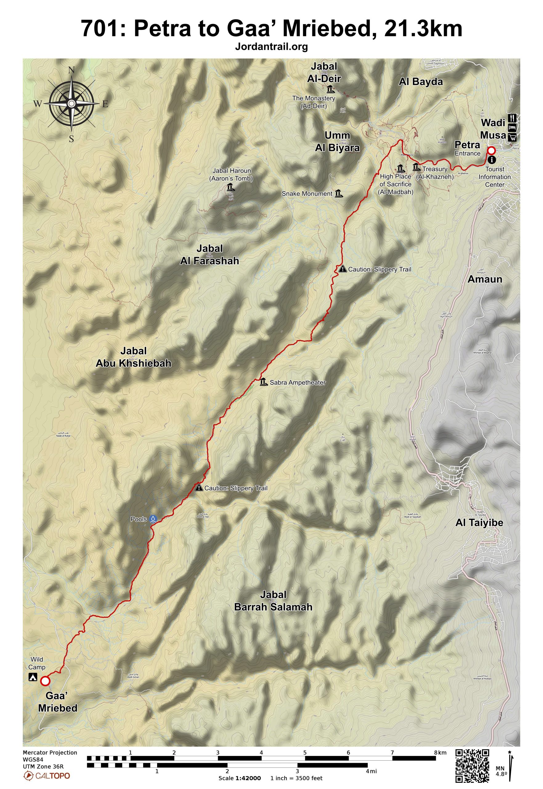
0
0 items
No products in the cart.

القسم 701: البتراء إلى قاع مريبض

  • مسارات المشي في المنطقة

  • اليوم الأول: البتراء إلى قاع مريبض

  • المسافة: 21.3 كم

  • الوقت اللازم للمسير: من 6 إلى 8 ساعات (دون احتساب الالتفافات أو المسارات الجانبية)

  • التحدي البدني: صعب

  • صعوبة المسار: صعب

  • اجمالي الصعوبة: صعب

  • تعليم المسار: لا

لتحميل مسار GPS، اضغط هنا.  

The Jordan Trail is a newly established trail, and is not marked. It is therefore our strong recommendation that you hire a local guide for your safety as many sections are remote with limited water sources and at times no connectivity.
By downloading these maps/GPX you take full responsibility for their use and accuracy; Jordan Trail Association does not warrant the accuracy or completeness of the information, materials or the reliability of any maps as they provided AS IS without warranty of any kind, either express or implied, including but not limited to, fitness for a particular purpose, or non-infringement ;You acknowledge that any reliance on any such maps, shall be at your sole risk and responsibility as Hiking, backpacking, and other outdoor activities all have potential hazards involving risk of injury or death. Outdoor activities have inherent risks and you should ensure you have the skill level and abilities suitable for the activities in Jordan to partake in them and to take all precaution measures.  Check the data on Google Earth or other Apps or Programs before using them.  The Jordan Trail Association shall not be held responsible for any incidents that may occur during your participation in any activity and/or by using any of the maps/GPX.
AGREE
close-link
اضغط هنا لتحميل الخريطة

أرقام مهمة

الشرطة السياحية:

الخط الساخن: 117777
واتساب: +962770992690

*في حال التواصل مع شرطة السياحة في حالة طارئة، يُرجى تحديد أنك تسير على درب الأردن، وذكر جنسيتك، موقعك الحالي، واسم ورقم الخريطة.

مكتب جمعية درب الأردن: +962 6 461 0999

(ساعات العمل: من 9:00 صباحًا حتى 5:00 مساءً، من الأحد إلى الخميس)

معلومات عامة

من المدخل الرئيسي للبتراء ومكتب التذاكر، اتجه نزولاً عبر السيق حتى تصل إلى الخزنة الشهيرة التي تظهر من خلال الشق الضيق لوادي السيق. استمر بالتوجه نحو اليمين، وتابع السير في السيق، وعندما تصل إلى المسرح، استمر في المشي لمسافة تقارب 230 متراً.
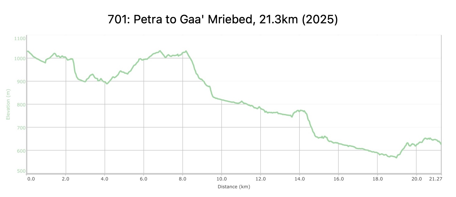
اتجه يساراً عن المسار الرئيسي في البتراء نحو ممر مشي خفيف قد يصعب ملاحظته، لذا يُنصح باستخدام نظام تحديد المواقع (GPS) للانتباه. اتبع هذا المسار الذي يبدأ بالوضوح تدريجياً، متجهاً نحو الجنوب مع وجود جبال وعرة وكبيرة على يسارك. استمر حتى تصل إلى المنطقة المسطحة المعروفة باسم "ستوع نبي هارون" التي تضم حقولاً مزروعة. ابحث عن طريق روماني قديم واتّبعها متجهًا نزولاً نحو اليسار على طول التلّة في الجانب الشرقي فوق وادي الصبرة، حيث يتعرج الطريق نزولاً إلى قاع الوادي. تابع السير مباشرةً على طول الوادي، واختر أسهل سطح للمشي إما على الجوانب أو في مجرى الوادي نفسه. ستصل إلى مدرج الصبرة عند المسافة 11.7 كيلومتر، وهو مكان مناسب لأخذ قسط من الراحة.

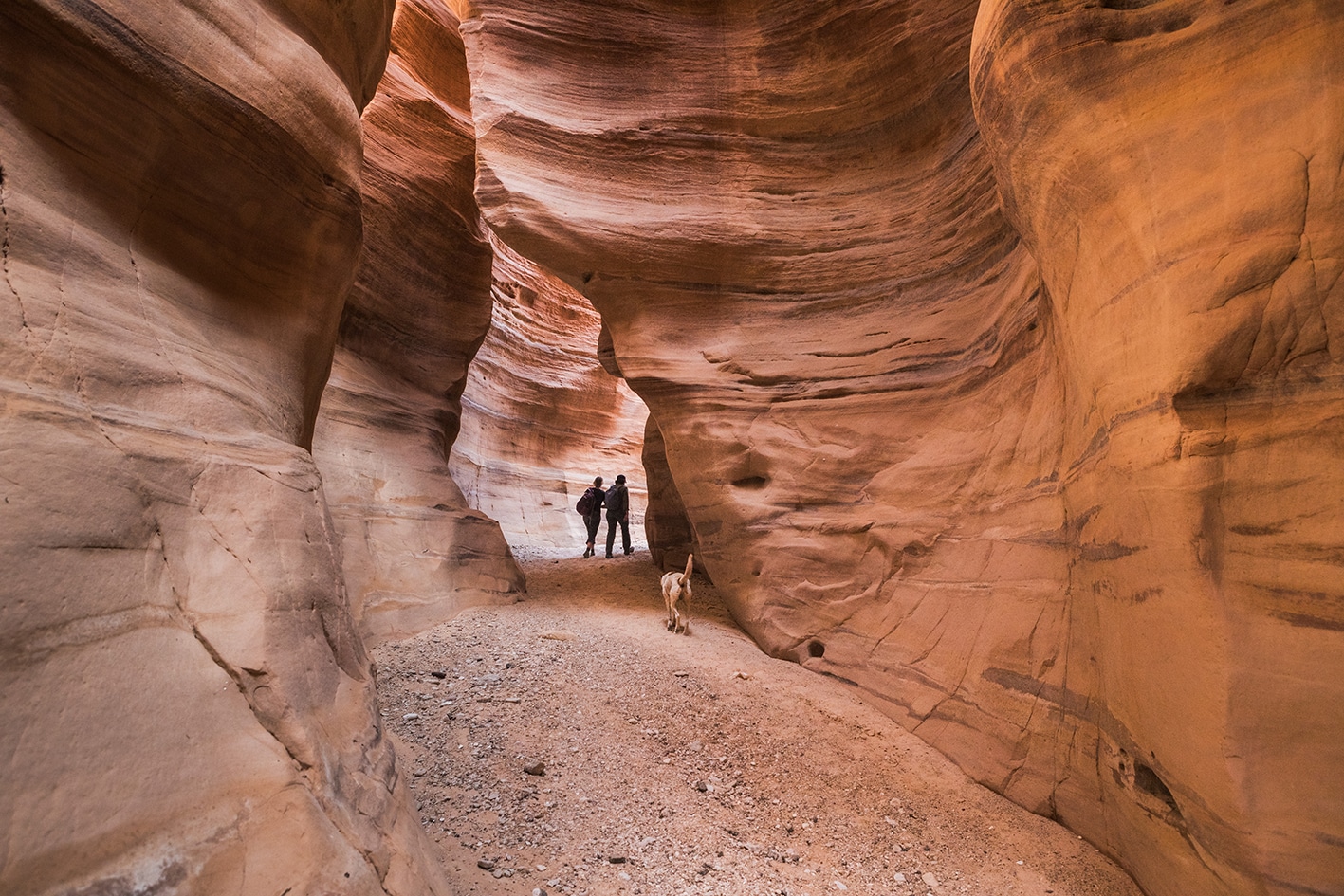
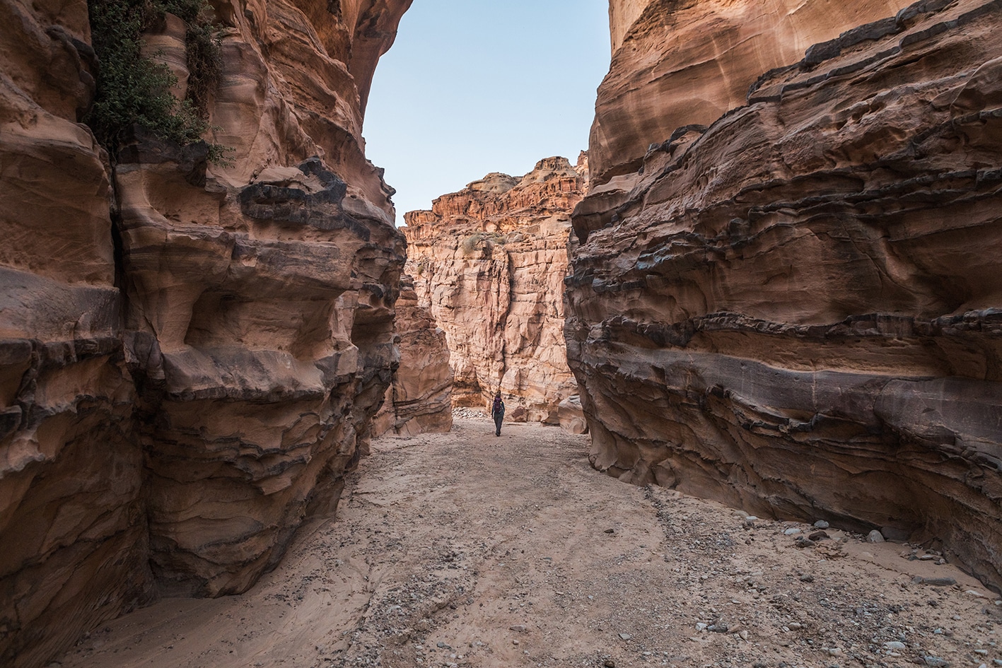
من مدرج الصبرة، واصل السير واعبر إلى الجانب الغربي من الوادي، مارًّا عبر أطلال متداعية لقلعة، حيث يبدأ المسار بالتآكل (وإن كان الأمر أسهل، يمكنك البقاء في قاع الوادي). استمر في نزول وادي الصبرة مع تعمقه وارتفاع جدران الصخور على الجانبين بشكل متزايد. مرّ بمناطق من الحجر الرملي الأبيض، وكن دقيقًا في البحث عن تلال الحجارة على الجانب الأيمن التي تشير إلى مسار خفيف يستخدمه الحمير، يتعرج صعودًا على الجانب الأيمن من الوادي، ويوفّر طريقًا لتفادي الشلال الجاف الكبير في الوادي أسفله. احرص أثناء المشي على هذا المسار، فهو مرتفع فوق أرضية الوادي وقد يكون صخريًا بعض الشيء، لكنه مسار مبني بشكل جيد ويمكن حتى للحمار المرور فيه. اتبع هذا المسار الخلاب لترى المشهد الرائع لانحدار الوادي قرب الشلال، واستمر على جانب الوادي لجزء من المسار حتى يبدأ الوادي في الاتساع، ويتجه المسار أقرب إلى مجرى الوادي. توجد نباتات أكثر وقسم رطب من الوادي قد يوفر ماءً في حالات الطوارئ، لكن تأكد من تنقية الماء قبل الشرب.

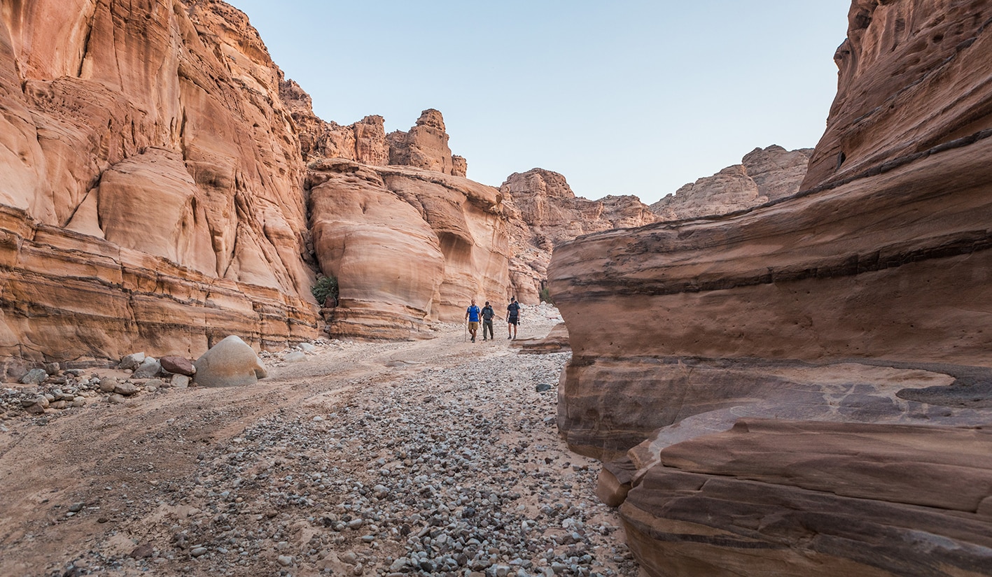
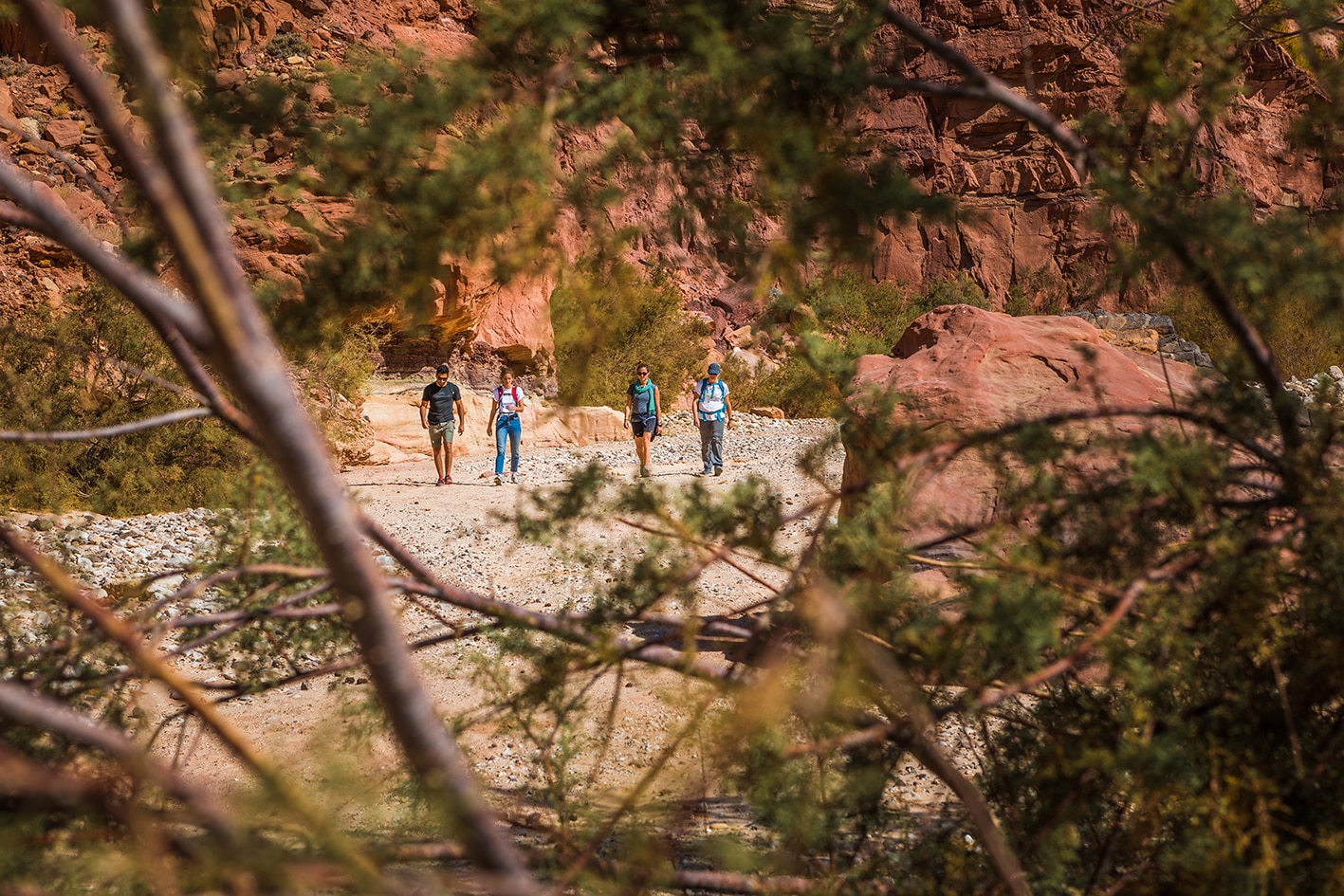
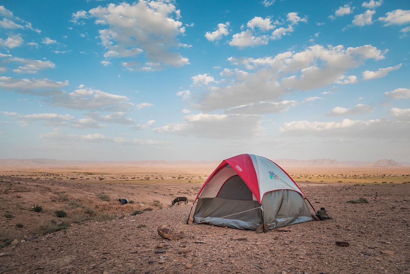
تابع المسار الرئيسي لوادي الصبرة لحوالي 3 كيلومترات، واختر أفضل طريق للمشي تجده على طول الطريق، والذي يتغير بين جوانب الوادي ومجرى الوادي نفسه. عندما تصل إلى مسار سيارات رباعية الدفع (4×4) يصعد بشدة من الجانب الشرقي/اليسار من الوادي، اتخذ هذا المسار وصعد عليه متجهًا نحو الجنوب الغربي عبر أودية صغيرة، مغادرًا ومسافرًا عبر مسار الرباعية وطريق معبّد للوصول إلى موقع التخييم في منطقة تُسمى غاس’ مريبد، قرب مخيمات بدوية متناثرة ومناطق مزروعة بالجوار. يمكن الوصول إلى هذه المنطقة عبر الطريق المعبّد القادم من وادي موسى، وتستغرق الرحلة حوالي ساعة ونصف في كل اتجاه.

ملاحظات مهمه:

دخول مدينة البتراء يتطلب تصريحًا يمكن شراؤه فقط من المدخل الرئيسي. هذا المسار لا يقترب من البتراء عبر ذلك المدخل، لذا يجب شراء التصريح مسبقًا.

وسائل النقل
  • يمكن الوصول بسيارة جيب إلى منطقة نصب الثعبان من وادي موسى.
  • لا يوجد نقل عام إلى منطقة قاع مريبض ولكن هناك وصول عبر الطريق.
  • تربط الحافلات العامة محطة الحافلات الجنوبية في عمّان بوادي موسى، أما التاكسي الخاص فتبلغ تكلفته حوالي 50 ديناراً (يُفضل الاتفاق على السعر مسبقاً).
  • تغادر الحافلات الصغيرة العامة من محطة حافلات العقبة إلى وادي موسى في الصباح وبداية الظهيرة. وللعودة إلى العقبة، تحقق مع مكان إقامتك في وادي موسى بشأن جدول الحافلات الصغيرة. تكلف رحلة التاكسي الخاص في اتجاه واحد حوالي 40 ديناراً أردنياً.
جهات الاتصال المحلية / أماكن الإقامة
  • التخييم البري, محمود عبدالسلام, 962778332061+,  ختم سجل الدرب البتراء الصغيرة, قاع مريبض, والبتراء
أهم المعالم التي يمكن مشاهدتها
  • البتراء
  • وادي صبرة والمدرج
  • مستنقعات قاع مريبض الطينية
الطعام والماء

الطعام:

  • يتوفر الطعام في محلات السوبرماركت بوادي موسى وفي المطاعم ومحلات الوجبات السريعة في البتراء. ولا توجد محطات لتزويد المؤن الغذائية على طول المسار حتى تصل إلى قرية الحُميمة بعد عدة أيام.

الماء:

  • يتوفر الماء في البتراء، ويمكن الحصول على الماء الطبيعي من البرك فيه
  • وادي الصبرة إذا دعت الحاجة (مع ضرورة التنقية).
النصائح والسلامة العامة

النصائح:

هناك عدة طرق للخروج من البتراء، منها المسار الأسهل الذي تمرّ بسيارة الدفع الرباعي بجانب نصب الثعبان. أما المسار المختار في درب الأردن فهو ممر مشي جميل يستفيد من الطريق الروماني الهابط إلى وادي الصبرة.

يحتوي وادي صبرة على أجزاء من المسار تكون مرتفعة ومعرضة على جانب الوادي، لكنّ معظم المجموعات التي سلكت هذا الطريق أبلغت أنه مناسب للمشي. من المهم ارتداء الأحذية المناسبة لأن هناك العديد من الصخور في الأودية.

السلامة العامة:

  • الحواف المكشوفة – مسار الحمير القديم الذي يتجاوز الشلال الجاف مرتفع قليلاً ومعرض، لكنه ليس مخيفًا للغاية. قد يشكل هذا الجزء تحديًا لمن يعانون من رهاب المرتفعات.
  • خطر الفيضانات المفاجئة – وادي الصبرة.
  • الطرق غير الثابتة – المسار على طول الوادي وعِر جدًا، وقد يكون زلقًا عند البلل.
  • الجفاف والإرهاق الحراري – قد تكون هذه المنطقة شديدة الحرارة، ويمكن العثور على بعض الظل من جدران الوادي العالية. ونظرًا لطول المرحلة، يُنصح بالانطلاق مبكرًا لتجنب الحرارة الشديدة.

The Jordan Trail is a newly established trail, and is not marked. It is therefore our strong recommendation that you hire a local guide for your safety as many sections are remote with limited water sources and at times no connectivity.
By downloading these maps/GPX you take full responsibility for their use and accuracy; Jordan Trail Association does not warrant the accuracy or completeness of the information, materials or the reliability of any maps as they provided AS IS without warranty of any kind, either express or implied, including but not limited to, fitness for a particular purpose, or non-infringement ;You acknowledge that any reliance on any such maps, shall be at your sole risk and responsibility as Hiking, backpacking, and other outdoor activities all have potential hazards involving risk of injury or death. Outdoor activities have inherent risks and you should ensure you have the skill level and abilities suitable for the activities in Jordan to partake in them and to take all precaution measures.  Check the data on Google Earth or other Apps or Programs before using them.  The Jordan Trail Association shall not be held responsible for any incidents that may occur during your participation in any activity and/or by using any of the maps/GPX.
AGREE
close-link