0
0 items
No products in the cart.

القسم 705: وادي أحيمر إلى الحميمة

  • مسارات المشي في المنطقة

  • اليوم الخامس: وادي أحيمر إلى الحميمة

  • المسافة: 26.4 كم

  • الوقت اللازم للمسير: 7-9 ساعات

  • التحدي البدني: صعب

  • صعوبة المسار: صعب

  • اجمالي الصعوبة: صعب

  • تعليم المسار: نعم

لتحميل مسار GPS، اضغط هنا.  

The Jordan Trail is a newly established trail, and is not marked. It is therefore our strong recommendation that you hire a local guide for your safety as many sections are remote with limited water sources and at times no connectivity.
By downloading these maps/GPX you take full responsibility for their use and accuracy; Jordan Trail Association does not warrant the accuracy or completeness of the information, materials or the reliability of any maps as they provided AS IS without warranty of any kind, either express or implied, including but not limited to, fitness for a particular purpose, or non-infringement ;You acknowledge that any reliance on any such maps, shall be at your sole risk and responsibility as Hiking, backpacking, and other outdoor activities all have potential hazards involving risk of injury or death. Outdoor activities have inherent risks and you should ensure you have the skill level and abilities suitable for the activities in Jordan to partake in them and to take all precaution measures.  Check the data on Google Earth or other Apps or Programs before using them.  The Jordan Trail Association shall not be held responsible for any incidents that may occur during your participation in any activity and/or by using any of the maps/GPX.
AGREE
close-link
اضغط هنا لتحميل الخريطة
أرقام مهمة

الشرطة السياحية:

الخط الساخن: 117777
واتساب: +962770992690

*في حال التواصل مع شرطة السياحة في حالة طارئة، يُرجى تحديد أنك تسير على درب الأردن، وذكر جنسيتك، موقعك الحالي، واسم ورقم الخريطة.

مكتب جمعية درب الأردن: +962 6 461 0999

(ساعات العمل: من 9:00 صباحًا حتى 5:00 مساءً، من الأحد إلى الخميس)

معلومات عامة

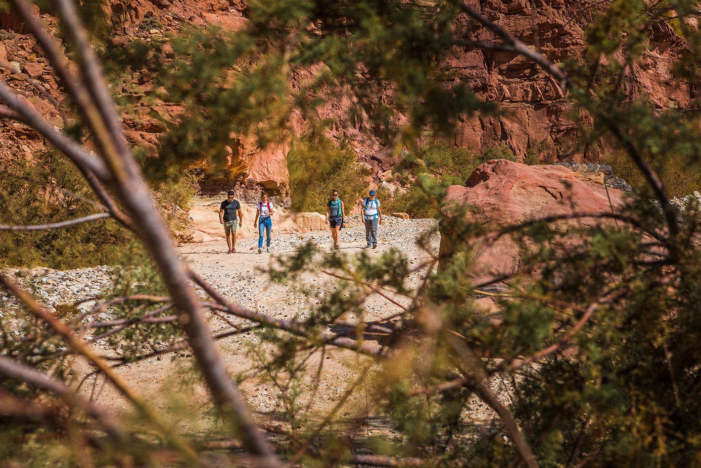
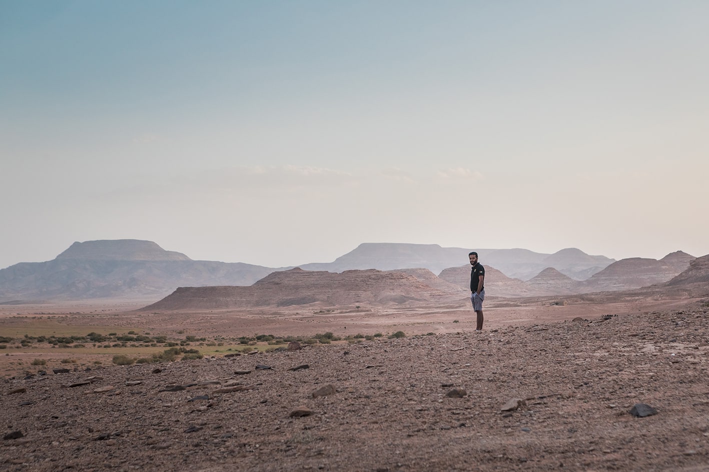
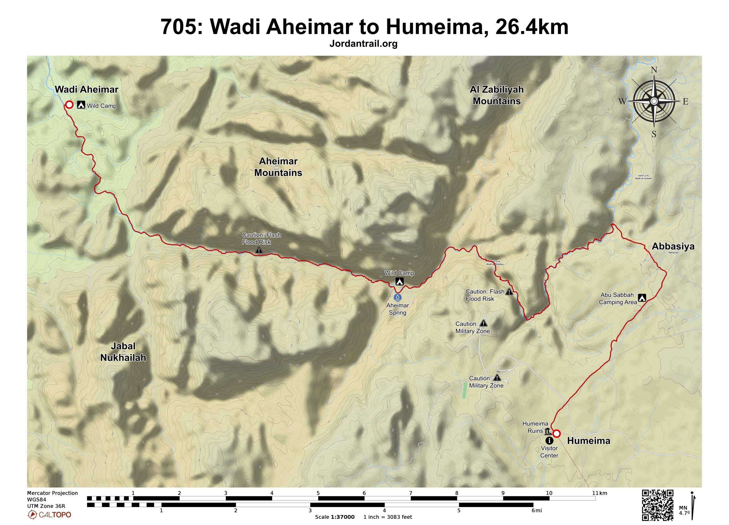
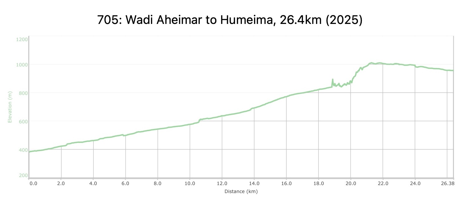
من موقع تخييم وادي أحيمر، اتجه يسارًا صعودًا في وادي أحيمر نحو الجنوب، وابقَ في نفس الوادي طوال الطريق حتى تصل إلى الهضبة عند النقطة 21 كيلومترًا. سيصلك إلى وادي أحيمر عدة أودية فرعية أثناء صعودك، لكن تأكد من البقاء في مجرى الوادي الرئيسي وستكون التنقلات سهلة لمعظم اليوم.

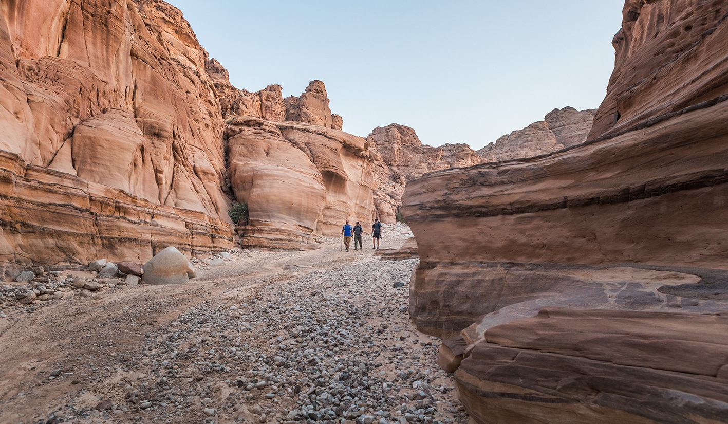
تابع السير في هذا المجرى الواسع للوادي باتجاه الجنوب الشرقي، حيث سينتهي مسار سيارات الدفع الرباعي خلال عدة كيلومترات. عند هذه النقطة، يزداد عمق الوادي ويصبح أضيق، مع تحولات متكررة في الاتجاه. عند التقسيم الرئيسي للوادي، اتجه يسارًا في الوادي الرئيسي. ستتغير الصخور إلى الجرانيت الداكن، وعندما تتجه شرقًا في خط مستقيم، ستظل في الظل حتى تصل إلى علامة 11 كيلومترًا.

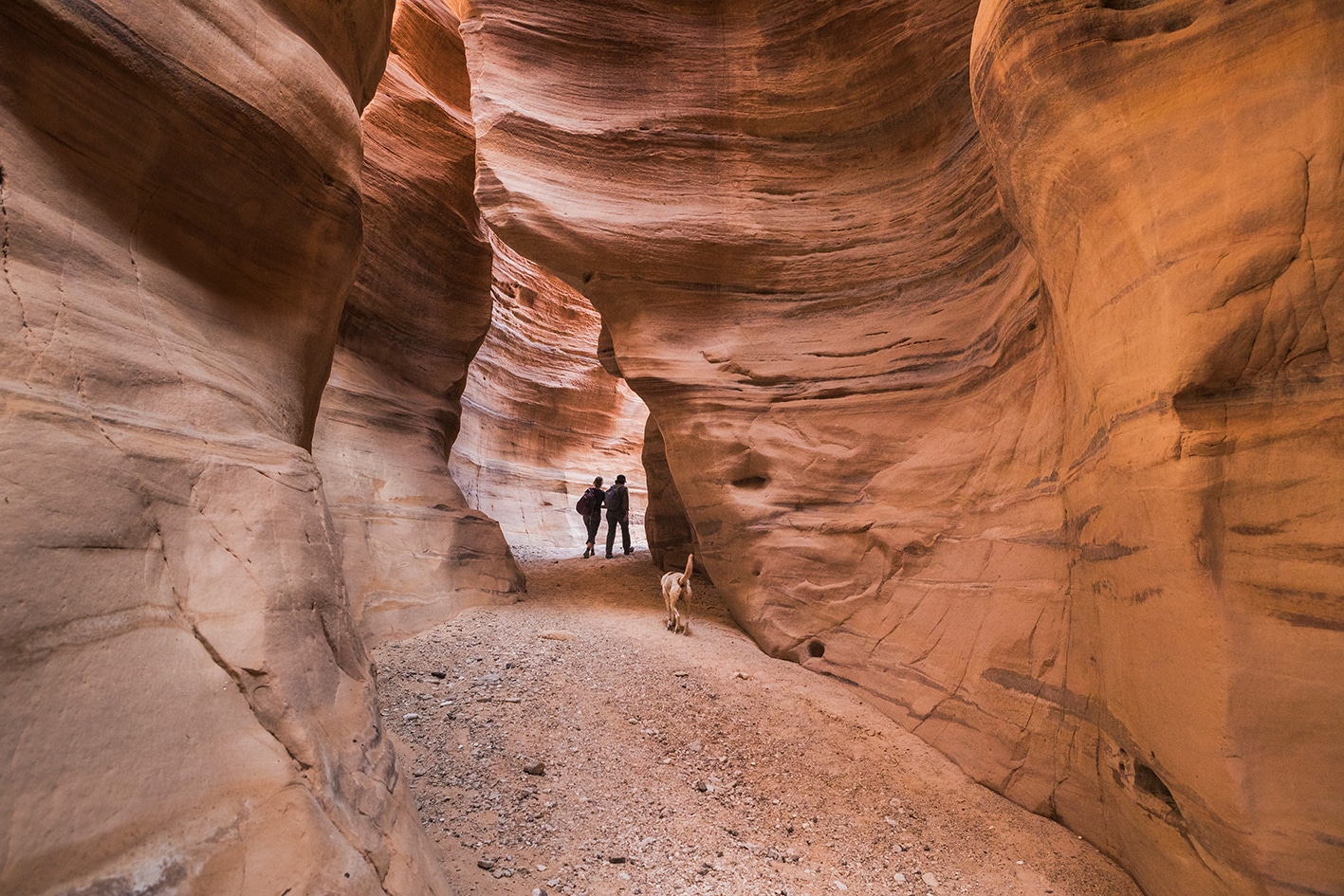
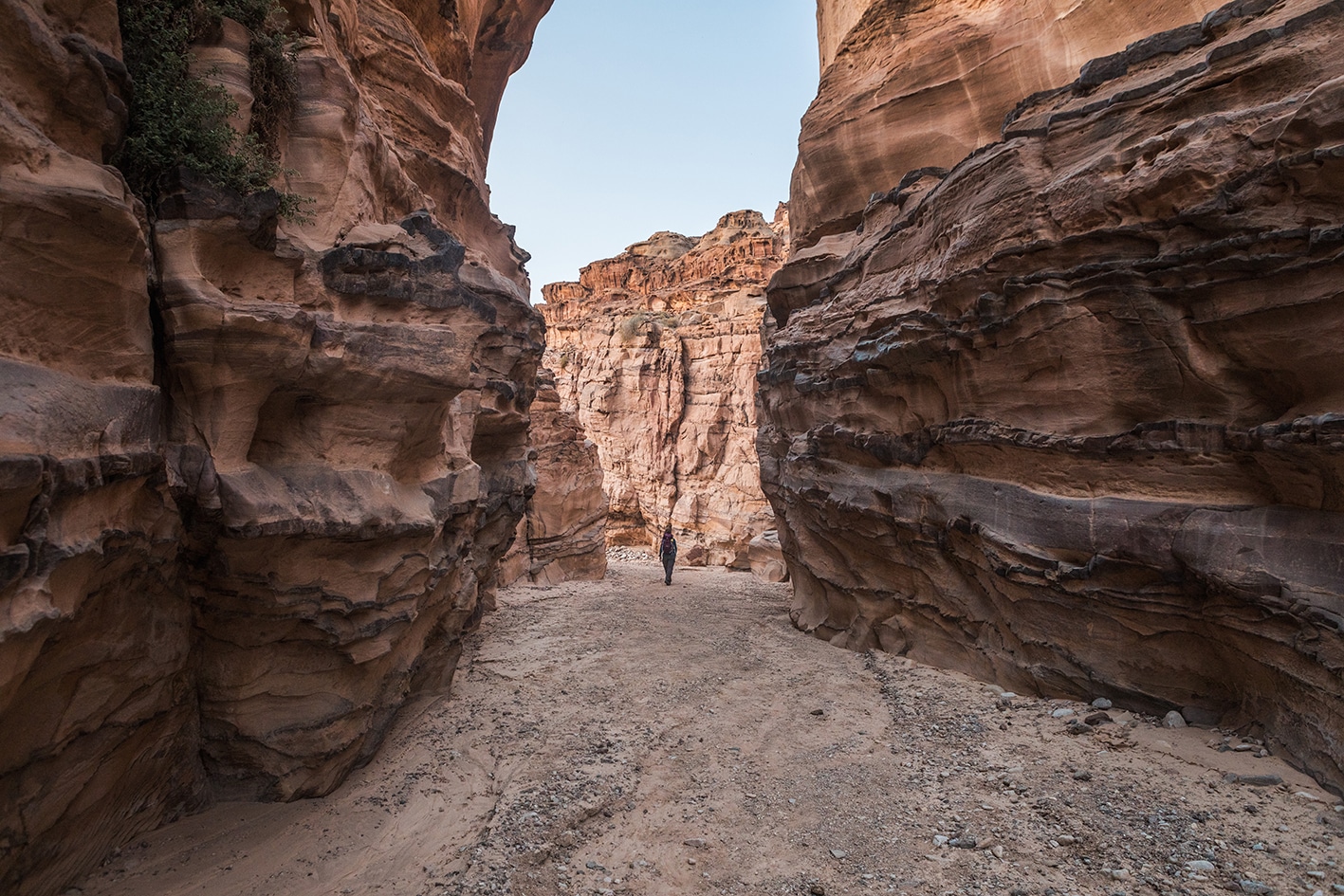
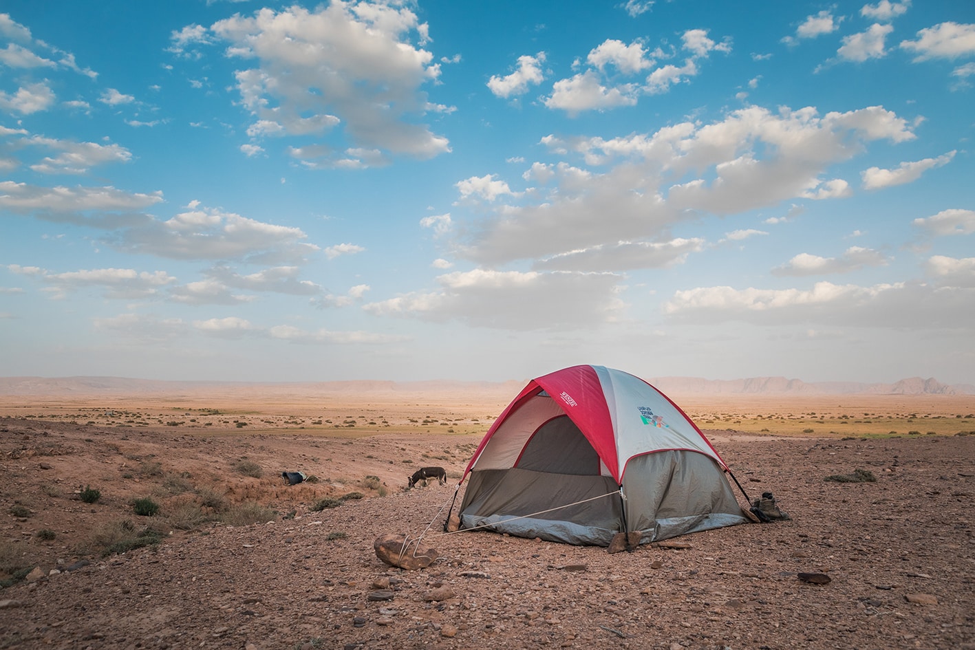
مع اتساع الوادي، يوجد موقع مناسب للتخييم البري بالقرب من عين أحيمر إلى يمين المسار، حيث تتحول جدران الوادي إلى الحجر الرملي. قد تتواجد بعض البرك المائية في الوادي إذا هطل المطر مؤخرًا. يمكن الوصول إلى النبع عبر ممر ضيق بجانب شجرة تين كبيرة إلى الجنوب، مقابل الجزء الأوسع من الوادي. استمر في المسير عبر تضاريس الوادي، وابقَ يمينًا عند التقسيم الرئيسي التالي بين مزيج من صخور الجرانيت والحجر الرملي. قريبًا، ينحرف الوادي نحو اليسار (الشرق) مرة أخرى عبر سيق جميل من الحجر الرملي، وهو أبرز مشهد في اليوم مع ألوان الحجر الرملي الأحمر والأبيض. تابع الصعود مع تحول الحجر إلى حجر طباشيري أبيض، وبعد أن ترى سياجًا حجريًا صغيرًا على اليسار، ابحث عن ممر مشي خفيف على اليمين، يتعرج صعودًا ليخرج من الوادي.

استمر في الصعود على هذا الممر حتى تصل إلى الهضبة، ثم توجه مباشرة إلى قرية البدو العباسية. اخرج إلى الطريق الترابي الرئيسي، وواصل السير جنوب غرب مرورًا بخيمة أبو صباح على حافة القرية، واستمر لمسافة 3.7 كيلومتر حتى تصل إلى أطلال حميمة حيث تنتهي المرحلة. مركز زوار حميمة متدهور قليلاً ولا يوجد فيه ماء أو خدمات، لكن من المحتمل أن يساعدك أحد القائمين على العناية بالمنطقة في طلب سيارة أجرة. تأكد من الابتعاد عن المنطقة العسكرية الواقعة إلى الغرب.

وسائل النقل
  • وادي أحيمر غير قابل للوصول بسيارات الدفع الرباعي بعد 4 كيلومترات.
  • النقل الخاص فقط من العباسية وحميمة.
  • النقل العام إلى حميمة الجديدة على الطريق الرئيسي.
جهات الاتصال المحلية / أماكن الإقامة
  • التخييم البري, صباح المنجى, 962778377254+, ختم سجل الدرب الحميمة وجبل خرزة 
  • التخييم البري, عيد المنجى, 96276318709+, ختم سجل الدرب وادي أحيمر 
أهم المعالم التي يمكن مشاهدتها
  • وادي أحيمر
  • قرية العباسية
  • حميمة
  • قرية حميمة
الطعام والماء

الطعام:

  • لا توجد إمدادات على طول المسار؛ يمكن الحصول على المؤن خارج المسار في حميمة الجديدة بعد نهاية المرحلة.

الماء:

  • عين أحيمر في الوادي عند 10.9 كم (يجب تنقية المياه)
  • برك مياه على طول الوادي عمومًا إذا هطل المطر مؤخرًا (يجب تنقية المياه)
  • مسجد قرية العباسية عند 21.8 كم
  • لا توجد مصادر مياه في مركز زوار حميمة
  • موجودة خارج المسار في حميمة الجديدة
النصائح والسلامة العامة

النصائح:

  • كن حذرًا جدًا من حالة الطقس ومخاطر الفيضانات المفاجئة في هذا القسم. من المرجح أن يكون هذا الجزء هو الأعلى خطورة في كامل درب الأردن، نظرًا لطول المسار داخل الوادي الضيق وبُعده في منطقة نائية تفتقر إلى تغطية الهاتف المحمول لمعظم اليوم السابق.
  • بعض أجزاء وادي أحيمر صخرية، لكن المشي فيها غالبًا ما يكون سهلاً نسبيًا. المسافة اليومية طويلة قليلًا، لكن الصعود فيها تدريجي جداً بشكل عام.
  • إذا بدأت الصعود من الغرب مبكرًا، فستكون في الظل تقريبًا طوال الوادي مع تغير موقع الشمس على مدار اليوم.
  • لا تحاول اختصار الطريق من الوادي الضيق في وادي أحيمر إلى أطلال حميمة. المسار المرسوم بعناية يهدف إلى إيجاد طريق آمن للخروج من الوادي، وتجنب المنطقة العسكرية التي تشكل خطرًا على المتنزهين الذين يحيدون عن المسار.
  • إذا لم تكن ستتوقف عند أطلال حميمة، يمكنك أخذ اختصار من العباسية والمشي باتجاه حميمة الجديدة حيث تتوفر المؤن.

السلامة العامة:

  • خطر الفيضانات المفاجئة – هناك خطر على طول معظم وادي أحيمر (خاصة في الوادي الضيق/ السيق)، وهو أطول وادي يمكن المشي فيه على طول درب الأردن. من الضروري التحقق من حالة الطقس مسبقًا وعدم المجازفة.
  • الأرض غير المستقرة – يوجد بعض الحصى والرمل في الوادي، لكنه ليس خطيرًا.
  • الجفاف والإرهاق الحراري – ليس عاملًا كبيرًا نظرًا لوجود الظل من جدران الوادي العالية.
  • المنطقة العسكرية – توجد منطقة عسكرية كبيرة وقاعدة قرب أطلال حميمة، قد تُجرى فيها تدريبات حية. قد يخرج الضباط للتحقق من زوار أطلال حميمة. من المفيد الحصول على تصريح من هيئة درب الأردن مسبقًا لحمله معك وتوضيح سبب وجودك.

تغطية الهاتف المحمول: لا يوجد تغطية في وادي أحيمر. بمجرد الخروج من الوادي والوصول إلى المنطقة المرتفعة (وادي السرج)، تتوفر تغطية جيدة طوال الطريق.

The Jordan Trail is a newly established trail, and is not marked. It is therefore our strong recommendation that you hire a local guide for your safety as many sections are remote with limited water sources and at times no connectivity.
By downloading these maps/GPX you take full responsibility for their use and accuracy; Jordan Trail Association does not warrant the accuracy or completeness of the information, materials or the reliability of any maps as they provided AS IS without warranty of any kind, either express or implied, including but not limited to, fitness for a particular purpose, or non-infringement ;You acknowledge that any reliance on any such maps, shall be at your sole risk and responsibility as Hiking, backpacking, and other outdoor activities all have potential hazards involving risk of injury or death. Outdoor activities have inherent risks and you should ensure you have the skill level and abilities suitable for the activities in Jordan to partake in them and to take all precaution measures.  Check the data on Google Earth or other Apps or Programs before using them.  The Jordan Trail Association shall not be held responsible for any incidents that may occur during your participation in any activity and/or by using any of the maps/GPX.
AGREE
close-link