0
0 items
No products in the cart.

القسم 803: الشاكرية إلى وادي رم

  • مسارات المشي في المنطقة

  • اليوم الثالث: الشاكرية إلى قرية رم

  • المسافة: 12 كم

  • الوقت اللازم للمسير: 3-4 ساعات

  • التحدي البدني: متوسط

  • صعوبة المسار: سهل

  • اجمالي الصعوبة: سهل

  • تعليم المسار: لا

لتحميل مسار GPS، اضغط هنا.  


The Jordan Trail is a newly established trail, and is not marked. It is therefore our strong recommendation that you hire a local guide for your safety as many sections are remote with limited water sources and at times no connectivity.
Seperate SEO fact from fiction & stop wasting your time on SEO strategies that dont work.
AGREE
close-link

أنقر هنا

The Jordan Trail is a newly established trail, and is not marked. It is therefore our strong recommendation that you hire a local guide for your safety as many sections are remote with limited water sources and at times no connectivity.
By downloading these maps/GPX you take full responsibility for their use and accuracy; Jordan Trail Association does not warrant the accuracy or completeness of the information, materials or the reliability of any maps as they provided AS IS without warranty of any kind, either express or implied, including but not limited to, fitness for a particular purpose, or non-infringement ;You acknowledge that any reliance on any such maps, shall be at your sole risk and responsibility as Hiking, backpacking, and other outdoor activities all have potential hazards involving risk of injury or death. Outdoor activities have inherent risks and you should ensure you have the skill level and abilities suitable for the activities in Jordan to partake in them and to take all precaution measures.  Check the data on Google Earth or other Apps or Programs before using them.  The Jordan Trail Association shall not be held responsible for any incidents that may occur during your participation in any activity and/or by using any of the maps/GPX.
AGREE
close-link
لتحميل الخريطة
أرقام مهمة

الشرطة السياحية:

الخط الساخن: 117777
واتساب: +962770992690

*في حال التواصل مع شرطة السياحة في حالة طارئة، يُرجى تحديد أنك تسير على درب الأردن، وذكر جنسيتك، موقعك الحالي، واسم ورقم الخريطة.

مكتب جمعية درب الأردن: +962 6 461 0999

(ساعات العمل: من 9:00 صباحًا حتى 5:00 مساءً، من الأحد إلى الخميس)

معلومات عامة

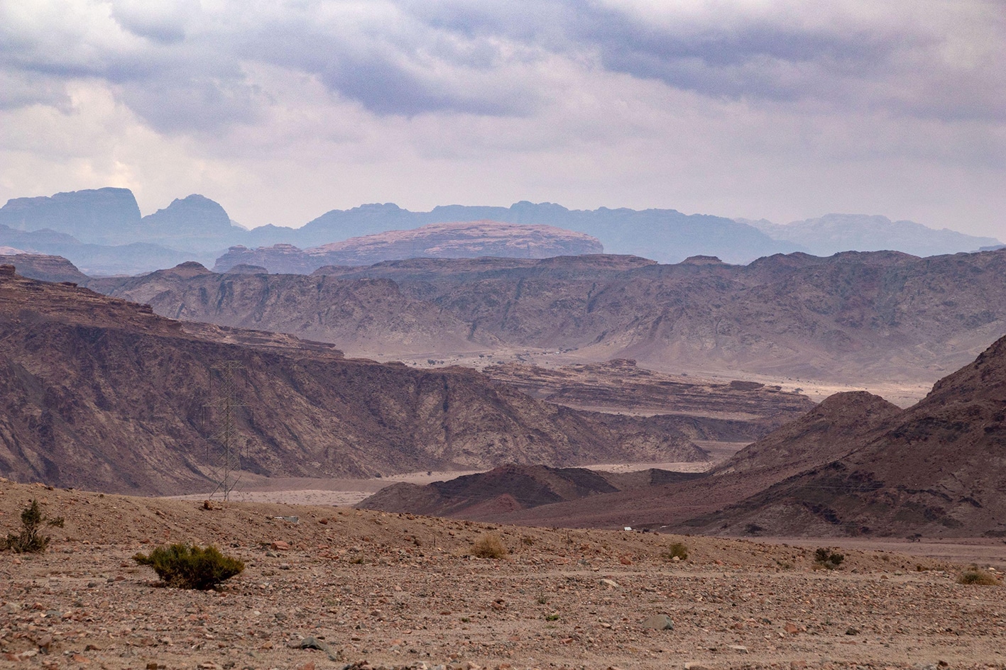
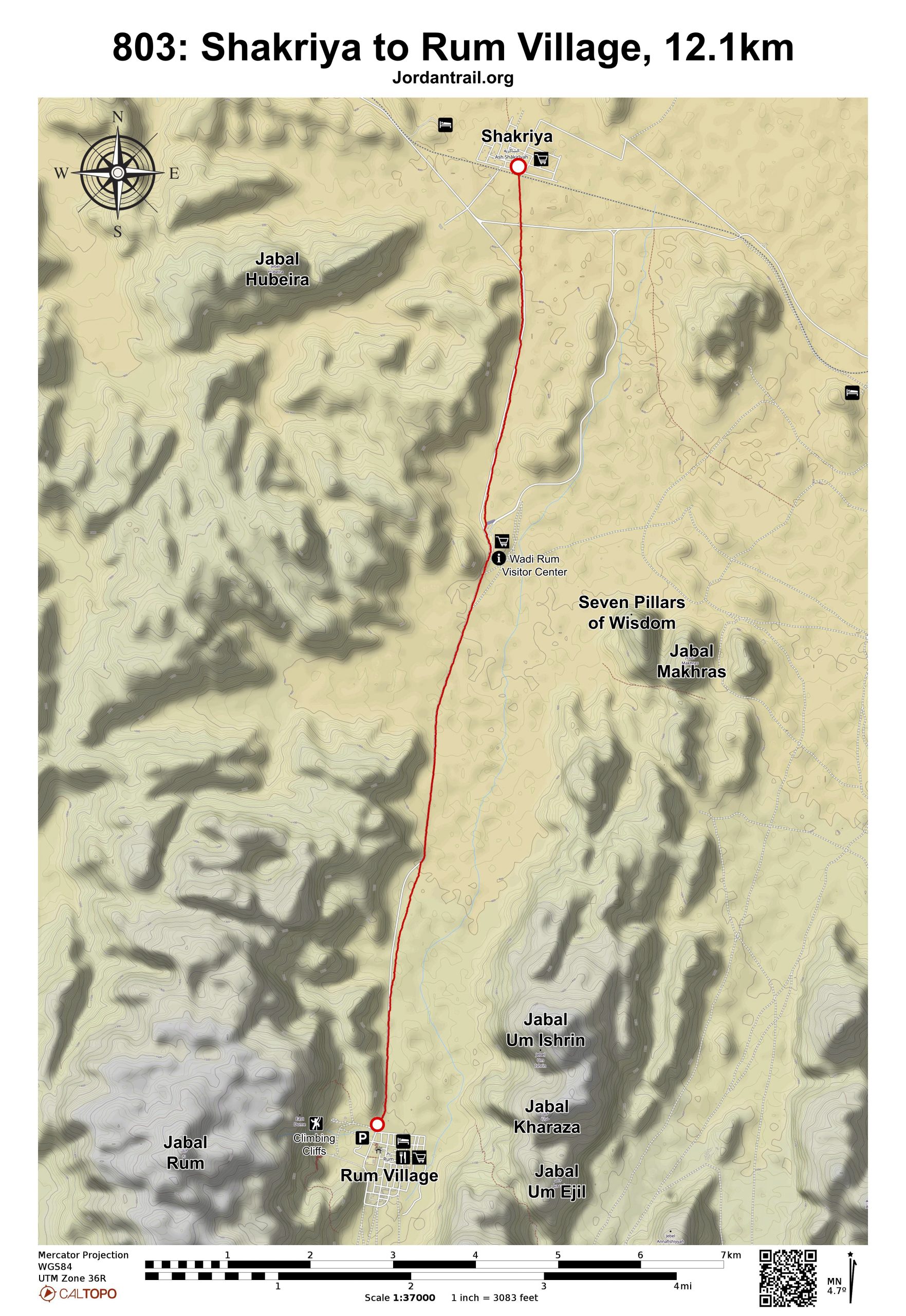
من الشاكرية، اتجه مباشرة جنوبًا، عابرًا خط السكة الحديد وطريقًا معبدًا للانضمام إلى الطريق الرئيسي المؤدي إلى مركز زوار وادي رم، الظاهر أمامك ببوابته الكبيرة. من مركز الزوار، تكون قرية رم مرئية مباشرة أمامك على بعد 7 كم إلى الجنوب.

واصل السير على طول الوادي شرق الطريق لتبتعد أكثر عن حركة المرور، أو يمكنك بديلًا السير مباشرة بمحاذاة الطريق طوال الطريق إلى القرية للوصول بشكل أسرع وأخذ استراحة من السير على الرمال. يقع بيت استراحة وادي رم على اليمين عند مدخل قرية رم، مع وجود متاجر صغيرة للتزود بالمؤن بالقرب منه.

وسائل النقل
  • حافلة رم – العقبة: لا يوجد جدول زمني ثابت، حيث تغادر الحافلة عندما يقرر السائق ذلك.
  • لا توجد حافلة من رم إلى البتراء.
  • تتوفر سيارات الأجرة الخاصة على الطرق المعبدة، والجيبات/البيك أب على الطرق الصحراوية غير المعبدة.
جهات الاتصال المحلية / أماكن الإقامة
  • التخييم البري, عبدالله الزلابية, 962776976356+
  • التخييم البري, عبدالله الصوالحين, 962797177347+
  • التخييم البري, سلامة زلابية, 962775355605+
  • التخييم البري, فرج زلابية, 962776145920+
  • التخييم البري, محمد زلابية, 962777629856+
  • التخييم البري, عطا الله دخيل الله زلابية, 962777247899+
أهم المعالم التي يمكن مشاهدتها
  • وادي رم
  • أعمدة الحكمة السبعة
  • جبل رم
  • جبل أم العشرين
الطعام والماء

الطعام:

  • وجبات خفيفة ومشروبات متوفرة في مركز زوار وادي رم
  • محلات صغيرة في قرية رم

الماء:

  • الشاكرية، مركز الزوار، وقرية رم
النصائح والسلامة العامة

النصائح:

  • اليوم قصير وقريب من الطريق. قد يفضل الكثيرون السير على الطريق للوصول بسرعة، أو دمج هذه المرحلة مع مرحلة اليوم السابق.

السلامة العامة:

  • الأرض غير الثابتة – ستسير على الرمال ما لم تختر السير على الطريق المعبد.
  • الجفاف/الإجهاد الحراري – القليل من الظل، لكن المسافات بين القرى ومركز الزوار قصيرة نسبيًا.
  • القاعدة العسكرية – توجد مدرسة عسكرية في قرية الشاكرية، ولم تشكّل أي مشكلة للمتنزهين.


The Jordan Trail is a newly established trail, and is not marked. It is therefore our strong recommendation that you hire a local guide for your safety as many sections are remote with limited water sources and at times no connectivity.
Seperate SEO fact from fiction & stop wasting your time on SEO strategies that dont work.
AGREE
close-link

The Jordan Trail is a newly established trail, and is not marked. It is therefore our strong recommendation that you hire a local guide for your safety as many sections are remote with limited water sources and at times no connectivity.
By downloading these maps/GPX you take full responsibility for their use and accuracy; Jordan Trail Association does not warrant the accuracy or completeness of the information, materials or the reliability of any maps as they provided AS IS without warranty of any kind, either express or implied, including but not limited to, fitness for a particular purpose, or non-infringement ;You acknowledge that any reliance on any such maps, shall be at your sole risk and responsibility as Hiking, backpacking, and other outdoor activities all have potential hazards involving risk of injury or death. Outdoor activities have inherent risks and you should ensure you have the skill level and abilities suitable for the activities in Jordan to partake in them and to take all precaution measures.  Check the data on Google Earth or other Apps or Programs before using them.  The Jordan Trail Association shall not be held responsible for any incidents that may occur during your participation in any activity and/or by using any of the maps/GPX.
AGREE
close-link