Search
Close this search box.

القسم 204.1: رميمين إلى الفحيص

  • مسارات المشي في المنطقة

  • اليوم الرابع: رميمين إلى الفحيص

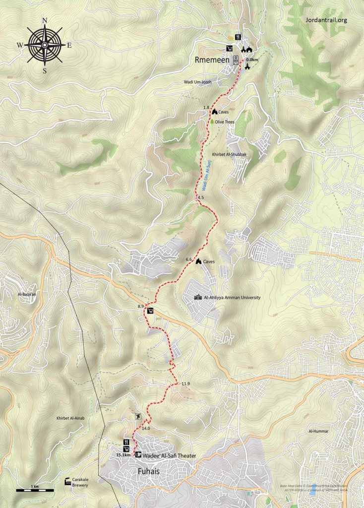
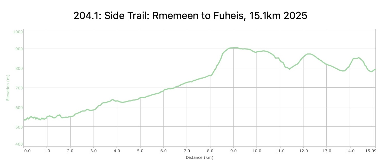
  • المسافة: 15.1 كيلومتر

  • الوقت: 6 ساعات

  • التحديات الجسدية: متوسط

  • تحديات المسار: متوسط

  • التحديد على المسار: لا

لتحميل مسار GPS، اضغط هنا.  

The Jordan Trail is a newly established trail, and is not marked. It is therefore our strong recommendation that you hire a local guide for your safety as many sections are remote with limited water sources and at times no connectivity.
By downloading these maps/GPX you take full responsibility for their use and accuracy; Jordan Trail Association does not warrant the accuracy or completeness of the information, materials or the reliability of any maps as they provided AS IS without warranty of any kind, either express or implied, including but not limited to, fitness for a particular purpose, or non-infringement ;You acknowledge that any reliance on any such maps, shall be at your sole risk and responsibility as Hiking, backpacking, and other outdoor activities all have potential hazards involving risk of injury or death. Outdoor activities have inherent risks and you should ensure you have the skill level and abilities suitable for the activities in Jordan to partake in them and to take all precaution measures.  Check the data on Google Earth or other Apps or Programs before using them.  The Jordan Trail Association shall not be held responsible for any incidents that may occur during your participation in any activity and/or by using any of the maps/GPX.
AGREE
close-link

أنقر هنا

The Jordan Trail is a newly established trail, and is not marked. It is therefore our strong recommendation that you hire a local guide for your safety as many sections are remote with limited water sources and at times no connectivity.
By downloading these maps/GPX you take full responsibility for their use and accuracy; Jordan Trail Association does not warrant the accuracy or completeness of the information, materials or the reliability of any maps as they provided AS IS without warranty of any kind, either express or implied, including but not limited to, fitness for a particular purpose, or non-infringement ;You acknowledge that any reliance on any such maps, shall be at your sole risk and responsibility as Hiking, backpacking, and other outdoor activities all have potential hazards involving risk of injury or death. Outdoor activities have inherent risks and you should ensure you have the skill level and abilities suitable for the activities in Jordan to partake in them and to take all precaution measures.  Check the data on Google Earth or other Apps or Programs before using them.  The Jordan Trail Association shall not be held responsible for any incidents that may occur during your participation in any activity and/or by using any of the maps/GPX.
AGREE
close-link
لتحميل الخريطة
أرقام مهمة

الشرطة السياحية:

الخط الساخن: 117777
واتساب: +962770992690

*في حال التواصل مع شرطة السياحة في حالة طارئة، يُرجى تحديد أنك تسير على درب الأردن، وذكر جنسيتك، موقعك الحالي، واسم ورقم الخريطة.

مكتب جمعية درب الأردن: +962 6 461 0999

(ساعات العمل: من 9:00 صباحًا حتى 5:00 مساءً، من الأحد إلى الخميس)

معلومات عامة

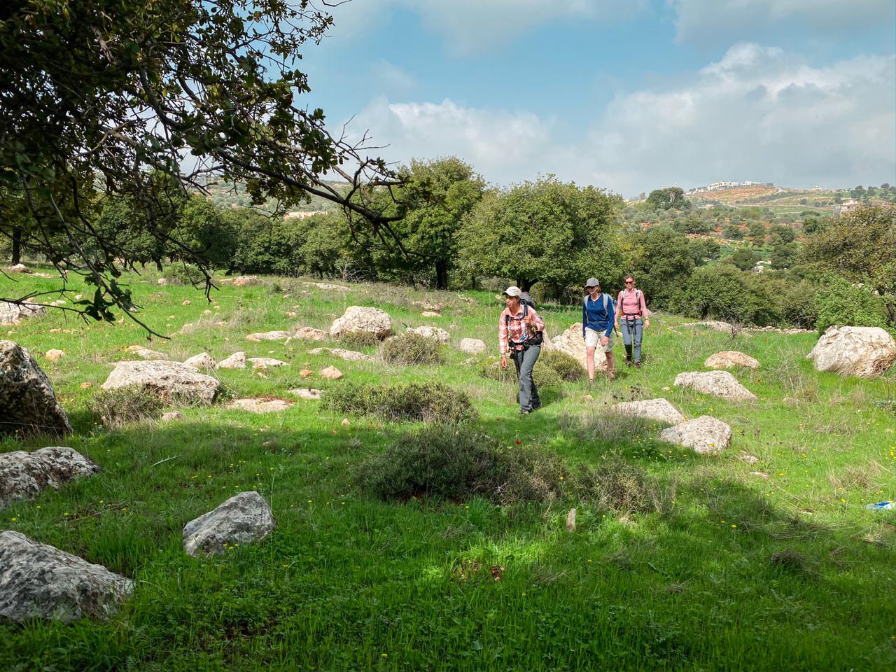
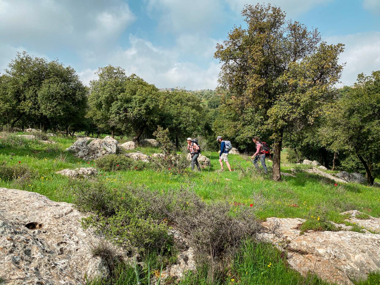
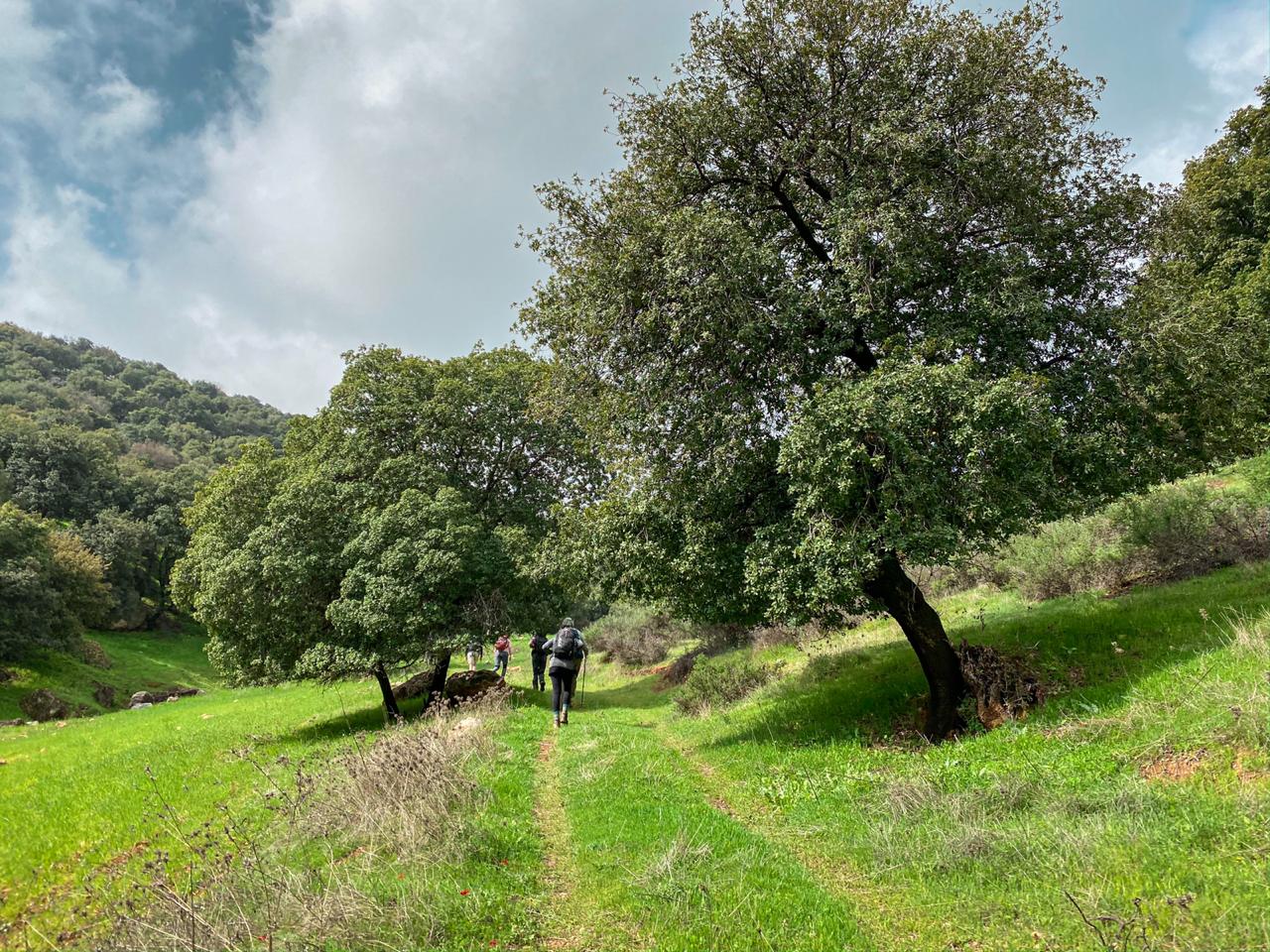
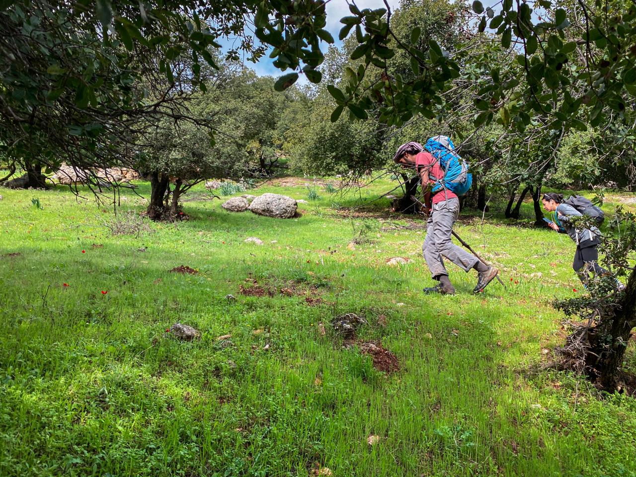
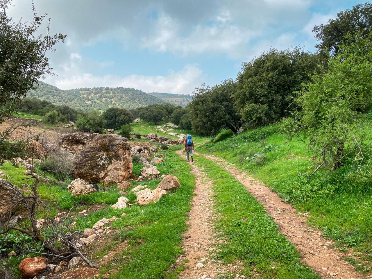
غادر القرية عبر الطريق الرئيسي، واتبع دربًا جميلًا يصعد بك تدريجيًا عبر وادٍ عميق تحفّه الحدائق والمزارع، حتى تعبر الطريق السريع قرب جامعة الأهليّة. بعد ذلك، يواصل المسار الالتفاف حول رأس وادٍ جديد، مارًا بأطراف بلدة الفحيص ذات الطابع المسيحي الهادئ. أما مصنع كركَلي للبيرة، فيقع على بُعد عدّة كيلومترات من نهاية هذه المرحلة، لمن يرغب في الاستكشاف بعد انتهاء الرحلة.

وسائل النقل

يمكنك استقلال مركبة على طريق السلط-عمان الرئيسي.

تتوفر حافلة من عمّان إلى الفحيص، وتنطلق من عمان (حديقة الحسين الرئيسية).

أماكن الإقامة

الفحيص-يشاع وجود فنادق داخل البلدة، ولكن لا يمكن حجز أيٍّ منها عبر الإنترنت. يُنصح بالتواصل مع جمعية درب الأردن (JTA) للحصول على أحدث المعلومات.

أهم المعالم التي يمكن مشاهدتها
  • مساجد وكنائس رميمين
  • كهوف
  • الكنائس القديمة
  • جامعة عمان الأهلية.
  • خطوط التسلق الرياضي في الفحيص
  • كنيسة الفحيص
  • مسرح وادي الصافي (الفحيص)
  • مصنع كراكلي
الطعام والماء

الطعام:

  • تتوفر المتاجر والمطاعم في كل من رميمين والفحيص.
  • متجر عند إشارة المرور – سوبرماركت بلاك آيرس ومطعم فلافل.
  • في الفحيص، بالقرب من تمثال القديس جورج، يوجد متجر يملكه باسل، وهو شخص قضى وقتاً في الولايات المتحدة ويتحدث الإنجليزية بطلاقة.
  • مطعم الزوادة.

الماء:

  • عند إشارة المرور في منتصف الطريق، توجد عدة محال صغيرة تبيع المشروبات.
  • يوجد بئران ارتوازيان في الوادي، وهما محاطان بسياج ومكتوب على اللوحة أن الدخول ممنوع، ولكن إذا كان هناك حارس موجود، فقد يُسمح لك بالحصول على الماء.
  • رميمين والفحيص
النصائح والسلامة العامة

النصائح::

  • يوجد ظل أكثر في النصف الأول من هذه المرحلة.
  • تتوفر أجهزة الصراف الآلي (ATM) في مدينة الفحيص.
  • تتوفر دورات المياه في المطاعم والمساجد على طول المرحلة.
  • تتوفر تغطية الهاتف المحمول طوال الطريق.
     

السلامة العامة:

  • الحيوانات: توجد بعض كلاب الحراسة العدوانية على الطريق.
  • الجفاف/الإجهاد الحراري: تقل أماكن الظل في النصف الثاني من المسار، لذا يُنصح بأخذ الاحتياطات اللازمة مثل شرب كميات كافية من الماء وارتداء قبعة.
جهات الاتصال المحلية

وسائل النقل الإقليمية

نحن لا نزال نجمع هذه المعلومات. هل لديك أي تفاصيل قد تكون مفيدة؟

لمزيد من المعلومات حول وسائل النقل في الأردن، اضغط هنا.

The Jordan Trail is a newly established trail, and is not marked. It is therefore our strong recommendation that you hire a local guide for your safety as many sections are remote with limited water sources and at times no connectivity.
By downloading these maps/GPX you take full responsibility for their use and accuracy; Jordan Trail Association does not warrant the accuracy or completeness of the information, materials or the reliability of any maps as they provided AS IS without warranty of any kind, either express or implied, including but not limited to, fitness for a particular purpose, or non-infringement ;You acknowledge that any reliance on any such maps, shall be at your sole risk and responsibility as Hiking, backpacking, and other outdoor activities all have potential hazards involving risk of injury or death. Outdoor activities have inherent risks and you should ensure you have the skill level and abilities suitable for the activities in Jordan to partake in them and to take all precaution measures.  Check the data on Google Earth or other Apps or Programs before using them.  The Jordan Trail Association shall not be held responsible for any incidents that may occur during your participation in any activity and/or by using any of the maps/GPX.
AGREE
close-link