0
0 items
No products in the cart.

تم تبني هذا المسار من قبل: شركة الحكمة للأدوية

القسم 301: السلط إلى عراق الأمير

  • مسارات المشي في المنطقة

  • اليوم الأول: السلط إلى عراق الأمير

  • المسافة: 22.9 كم

  • الوقت اللازم للمسير: 7 ساعات

  • التحدي البدني: صعب

  • صعوبة المسار: صعب

  • اجمالي الصعوبة: صعب

  • تعليم المسار: نعم

لتحميل مسار GPS، اضغط هنا.  

The Jordan Trail is a newly established trail, and is not marked. It is therefore our strong recommendation that you hire a local guide for your safety as many sections are remote with limited water sources and at times no connectivity.
By downloading these maps/GPX you take full responsibility for their use and accuracy; Jordan Trail Association does not warrant the accuracy or completeness of the information, materials or the reliability of any maps as they provided AS IS without warranty of any kind, either express or implied, including but not limited to, fitness for a particular purpose, or non-infringement ;You acknowledge that any reliance on any such maps, shall be at your sole risk and responsibility as Hiking, backpacking, and other outdoor activities all have potential hazards involving risk of injury or death. Outdoor activities have inherent risks and you should ensure you have the skill level and abilities suitable for the activities in Jordan to partake in them and to take all precaution measures.  Check the data on Google Earth or other Apps or Programs before using them.  The Jordan Trail Association shall not be held responsible for any incidents that may occur during your participation in any activity and/or by using any of the maps/GPX.
AGREE
close-link
اضغط هنا لتحميل الخريطة
أرقام مهمة

الشرطة السياحية:

الخط الساخن: 117777
واتساب: +962770992690

*في حال التواصل مع شرطة السياحة في حالة طارئة، يُرجى تحديد أنك تسير على درب الأردن، وذكر جنسيتك، موقعك الحالي، واسم ورقم الخريطة.

مكتب جمعية درب الأردن: +962 6 461 0999

(ساعات العمل: من 9:00 صباحًا حتى 5:00 مساءً، من الأحد إلى الخميس)

معلومات عامة

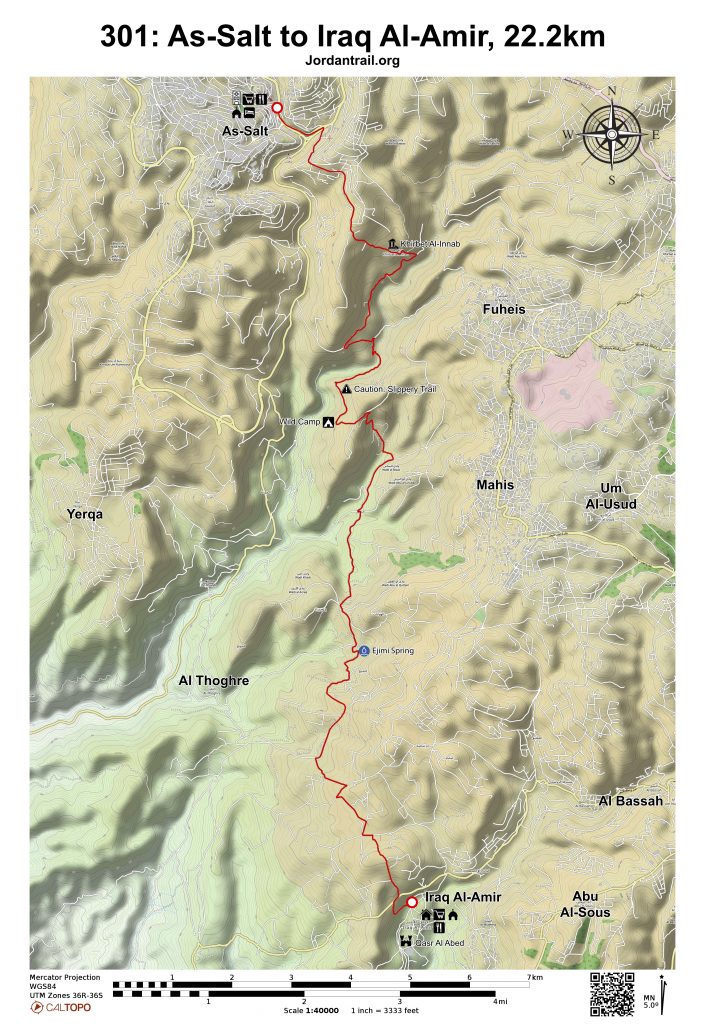
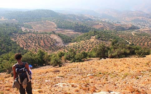
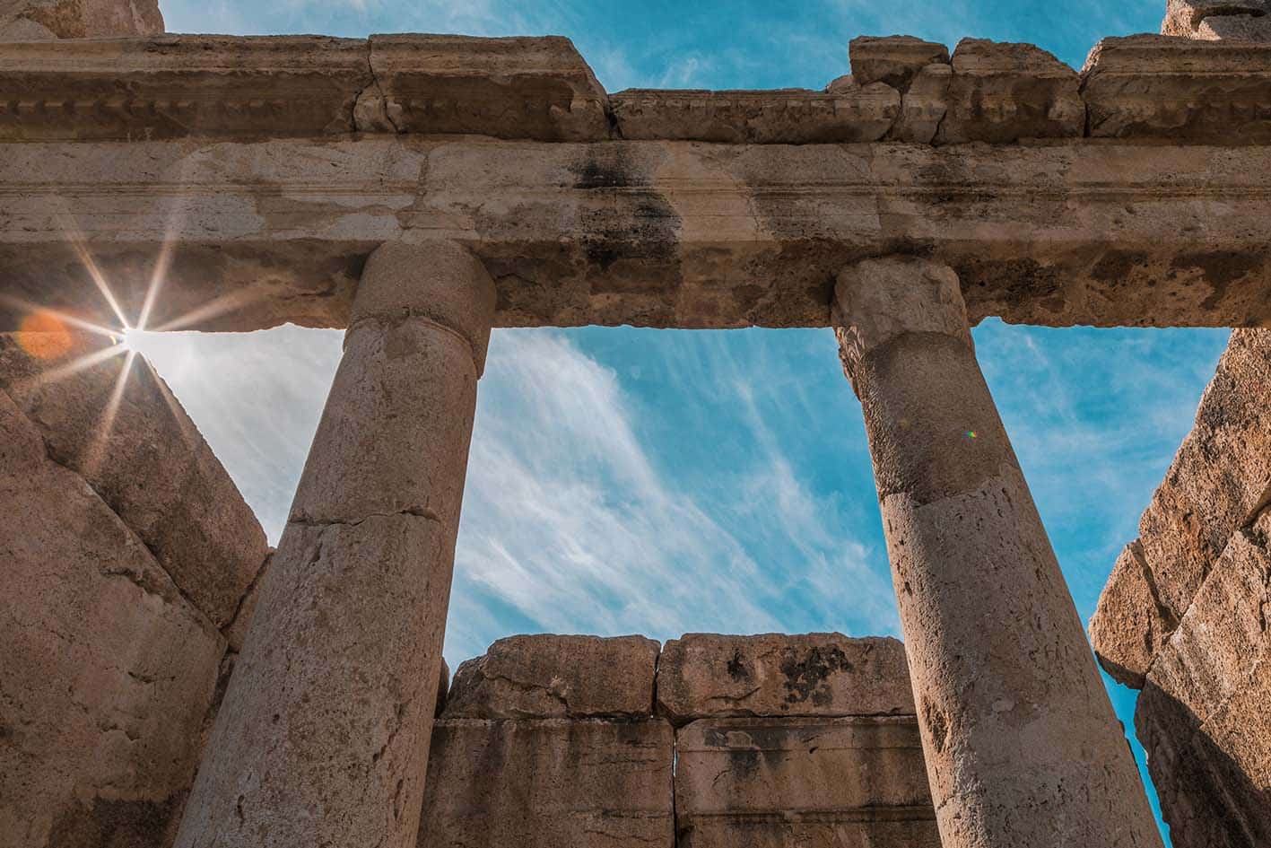
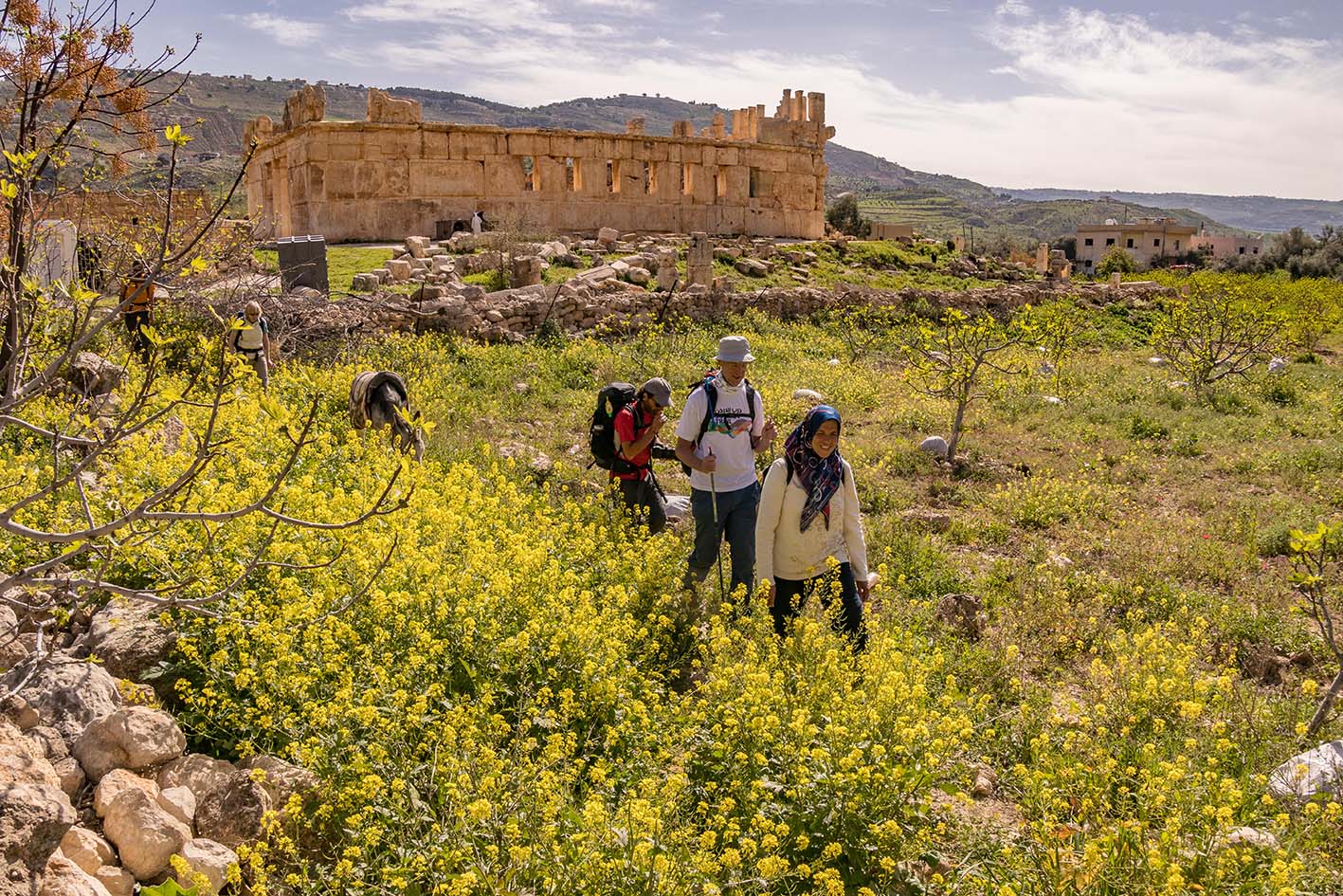
اتجه إلى وسط مدينة السلط، ثم انزل عبر الوادي متبعًا المسارات والطرق الريفية التي تمر بين المزارع الصغيرة، لتصعد بعد ذلك فوق التلال وتنحدر إلى موقع عراق الأمير الهلنستي، والذي تحيط به كهوف تعود إلى العصر النحاسي قبل أكثر من 5000 عام. في الموقع، توجد تعاونية نسائية للحرف اليدوية بالإضافة إلى خيارات للإقامة المنزلية، مما يتيح تجربة ثقافية أصيلة ومميزة للزوار.

وسائل النقل
كما تتنقل الحافلات ذهابًا وإيابًا بين السلط ودوّار صويلح (في الأطراف الشمالية الغربية من عمّان).

تتوفر سيارات الأجرة من السلط ويمكنها إيصالك إلى عراق الأمير.

جهات الاتصال المحلية / أماكن الإقامة
  • بيت الضيافة, جمعية عراق الأمير التعاونية للنساء, 962775391563+, 962772053102+, 962775931563+ ختم سجل الدرب عراق الأمير
أهم المعالم التي يمكن مشاهدتها
  • مركز السلط لتدريب الحرف اليدوية
  • الكنائس الأرثودوكسية في السلط
  • المسجد العثماني في السلط
  • بيت أبو جابر في السلط
  • قصر العبد (لايوجد رسوم دخول, مفتوح طوال اليوم)
  • جمعية عراق الأمير التعاونية للنساء (دورات مياه، طعام، مشروبات غازية، مبيت)
  •  
الطعام والماء

الطعام:

  • مطاعم ومتاجر صغيرة في السلط وعراق الأمير

الماء:

  • العديد من المنازل على طول الطريق
  • عين عجيمي – يوجد صهريج على الجانب الأيمن من الطريق يتدفق منه ماء (ينبغي تنقيته قبل الشرب)
  • منتزه تلال البلوط – بيت استراحة مع حديقة، ظلال، دورات مياه، ومشروبات باردة
النصائح والسلامة العامة

النصائح:

  • معظم اليوم يكون السير فيه على طرق معبّدة.
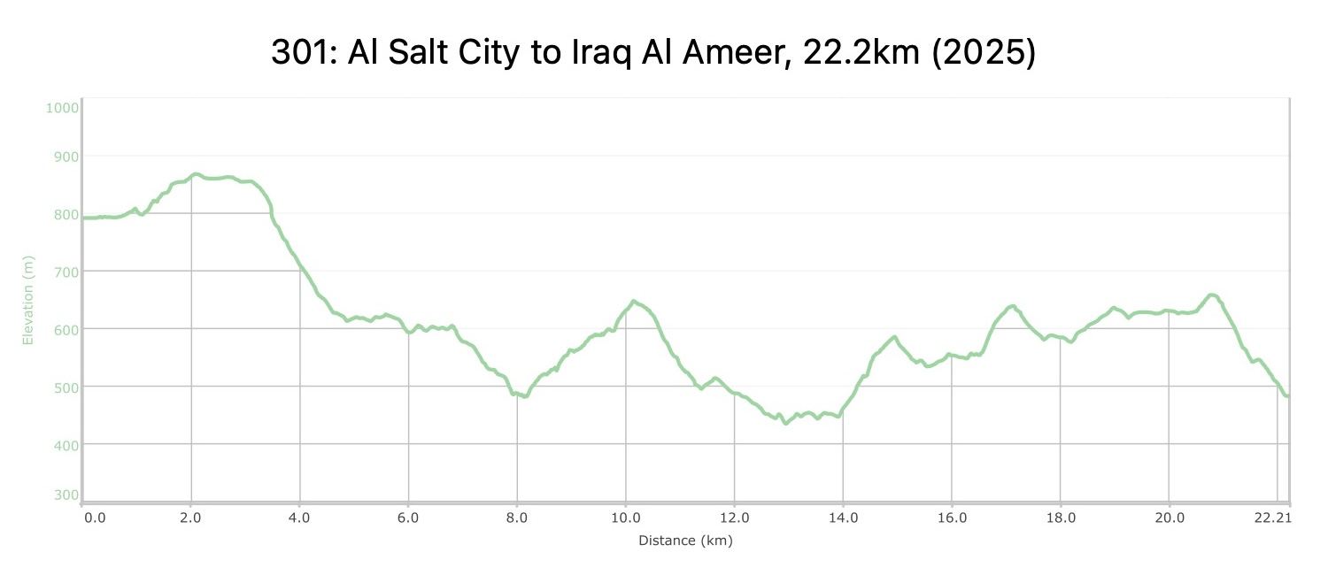
  • كن مستعدًا لعدد من المقاطع شديدة الانحدار سواء على الطرق المعبدة أو الوعرة خلال اليوم.
  • تتوفر ماكينات الصراف الآلي (ATM) في مدينة السلط.
  • المرافق الصحية متوفرة في المطاعم في السلط و عراق الأمير
  • تتوفر تغطية الهاتف المحمول طوال الطريق.

السلامة العامة:

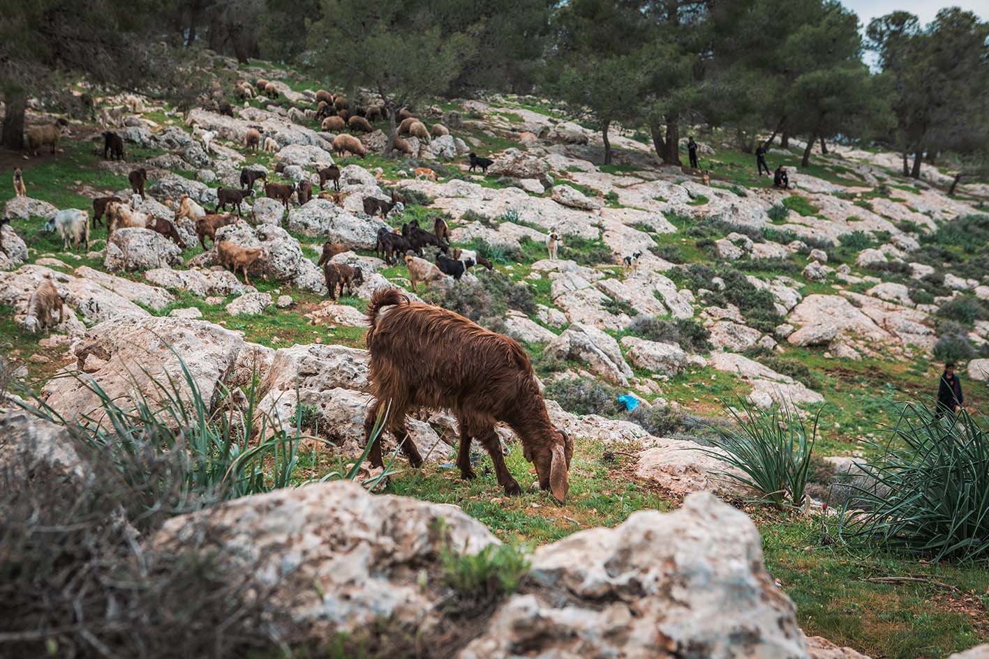
  • الحيوانات: يوجد العديد من الكلاب على طول الطريق، خاصة في بدايته.
  • الجفاف/الإرهاق الحراري: يمكن العثور على الظل على طول الطريق، وإذا بدأت باكرًا ستجد أن معظم المسار يكون مظلّلًا على الجانب الغربي من التلة. كما تساعد الارتفاعات المعتدلة في الحفاظ على درجات حرارة أكثر برودة.
جهات الاتصال المحلية

السلط:

شركة في الأردن

  • هاشم عواملة: 00962796666782

https://in-jordan.business.site


عراق الأمير:
  • غالب عبادي (سائق سيارة أجرة من عراق الأمير) - 0772193218
  • أبو عمر (قرية عراق الأمير, حارس قصر العبد) - 0777780115
  • جمعية عراق الأمير التعاونية للنساء:
    • الهاتف الأرضي: 5481385 06
    • إنعام السكارنة: 0777351620
    • يسرى: 0775931563

The Jordan Trail is a newly established trail, and is not marked. It is therefore our strong recommendation that you hire a local guide for your safety as many sections are remote with limited water sources and at times no connectivity.
By downloading these maps/GPX you take full responsibility for their use and accuracy; Jordan Trail Association does not warrant the accuracy or completeness of the information, materials or the reliability of any maps as they provided AS IS without warranty of any kind, either express or implied, including but not limited to, fitness for a particular purpose, or non-infringement ;You acknowledge that any reliance on any such maps, shall be at your sole risk and responsibility as Hiking, backpacking, and other outdoor activities all have potential hazards involving risk of injury or death. Outdoor activities have inherent risks and you should ensure you have the skill level and abilities suitable for the activities in Jordan to partake in them and to take all precaution measures.  Check the data on Google Earth or other Apps or Programs before using them.  The Jordan Trail Association shall not be held responsible for any incidents that may occur during your participation in any activity and/or by using any of the maps/GPX.
AGREE
close-link