Search
Close this search box.

القسم 402: وادي الهيدان إلى وادي موجب

  • مسارات المشي في المنطقة

  • اليوم الثاني: وادي الهيدان إلى وادي موجب

  • المسافة: 14.7 كيلومتر

  • الوقت: 7 ساعات

  • التحديات الجسدية: شديد الصعوبة

  • تحديات المسار: شديد الصعوبة

  • التحديات الكلية: شديد الصعوبة

  • التحديد على المسار: نعم

لتحميل مسار GPS، اضغط هنا.  

The Jordan Trail is a newly established trail, and is not marked. It is therefore our strong recommendation that you hire a local guide for your safety as many sections are remote with limited water sources and at times no connectivity.
By downloading these maps/GPX you take full responsibility for their use and accuracy; Jordan Trail Association does not warrant the accuracy or completeness of the information, materials or the reliability of any maps as they provided AS IS without warranty of any kind, either express or implied, including but not limited to, fitness for a particular purpose, or non-infringement ;You acknowledge that any reliance on any such maps, shall be at your sole risk and responsibility as Hiking, backpacking, and other outdoor activities all have potential hazards involving risk of injury or death. Outdoor activities have inherent risks and you should ensure you have the skill level and abilities suitable for the activities in Jordan to partake in them and to take all precaution measures.  Check the data on Google Earth or other Apps or Programs before using them.  The Jordan Trail Association shall not be held responsible for any incidents that may occur during your participation in any activity and/or by using any of the maps/GPX.
AGREE
close-link

أنقر هنا

The Jordan Trail is a newly established trail, and is not marked. It is therefore our strong recommendation that you hire a local guide for your safety as many sections are remote with limited water sources and at times no connectivity.
By downloading these maps/GPX you take full responsibility for their use and accuracy; Jordan Trail Association does not warrant the accuracy or completeness of the information, materials or the reliability of any maps as they provided AS IS without warranty of any kind, either express or implied, including but not limited to, fitness for a particular purpose, or non-infringement ;You acknowledge that any reliance on any such maps, shall be at your sole risk and responsibility as Hiking, backpacking, and other outdoor activities all have potential hazards involving risk of injury or death. Outdoor activities have inherent risks and you should ensure you have the skill level and abilities suitable for the activities in Jordan to partake in them and to take all precaution measures.  Check the data on Google Earth or other Apps or Programs before using them.  The Jordan Trail Association shall not be held responsible for any incidents that may occur during your participation in any activity and/or by using any of the maps/GPX.
AGREE
close-link
لتحميل الخريطة
أرقام مهمة

الشرطة السياحية:

الخط الساخن: 117777
واتساب: +962770992690

*في حال التواصل مع شرطة السياحة في حالة طارئة، يُرجى تحديد أنك تسير على درب الأردن، وذكر جنسيتك، موقعك الحالي، واسم ورقم الخريطة.

مكتب جمعية درب الأردن: +962 6 461 0999

(ساعات العمل: من 9:00 صباحًا حتى 5:00 مساءً، من الأحد إلى الخميس)

معلومات عامة

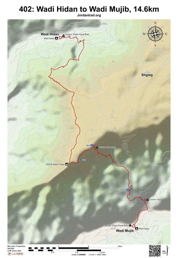
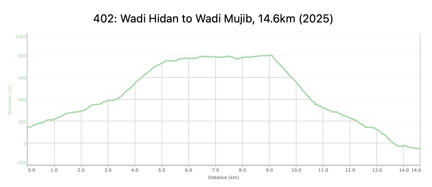
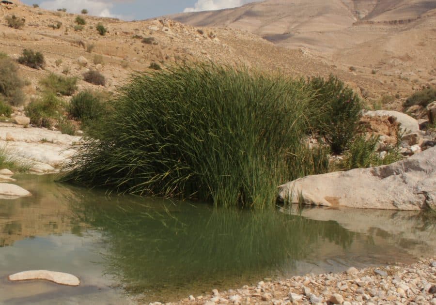
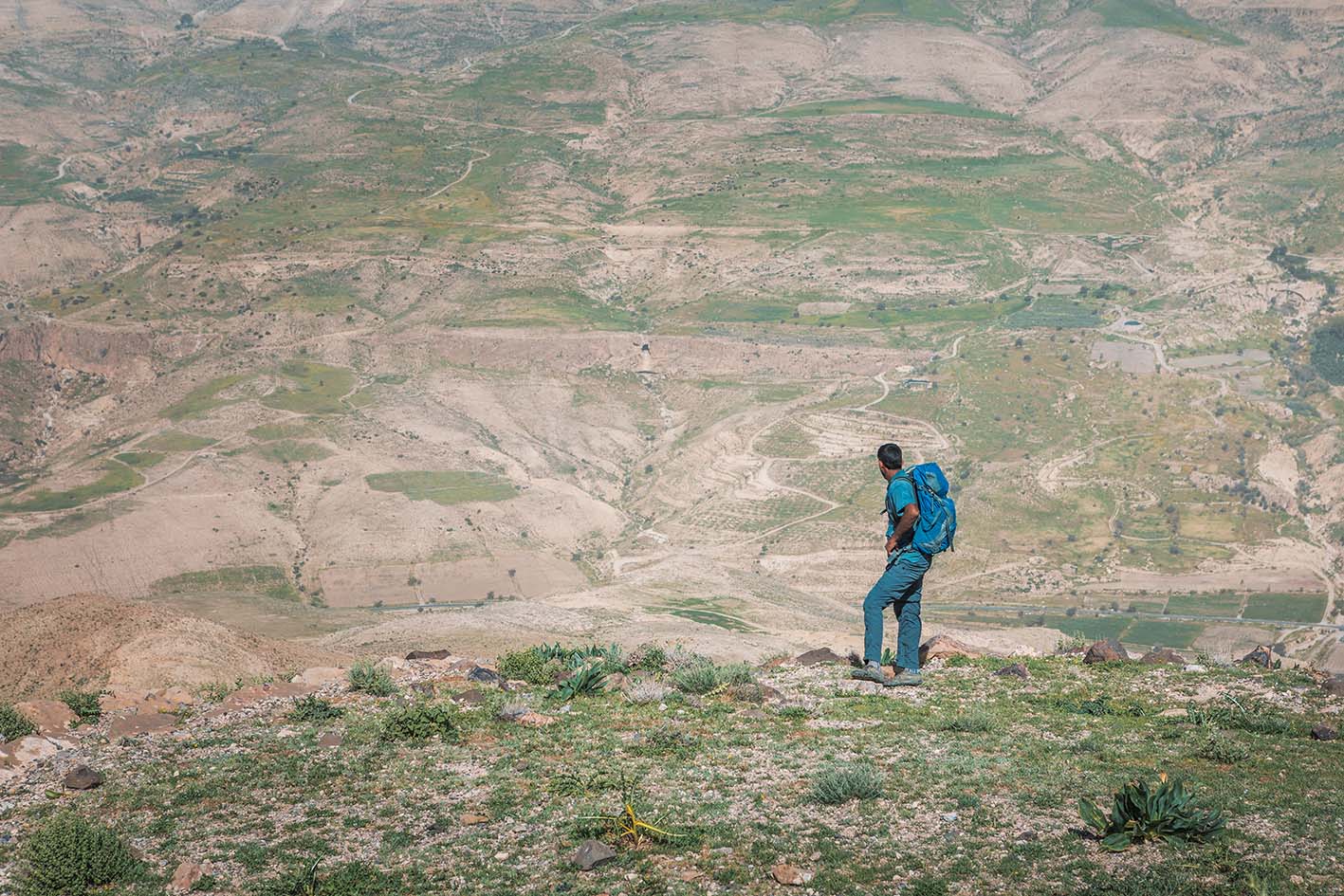
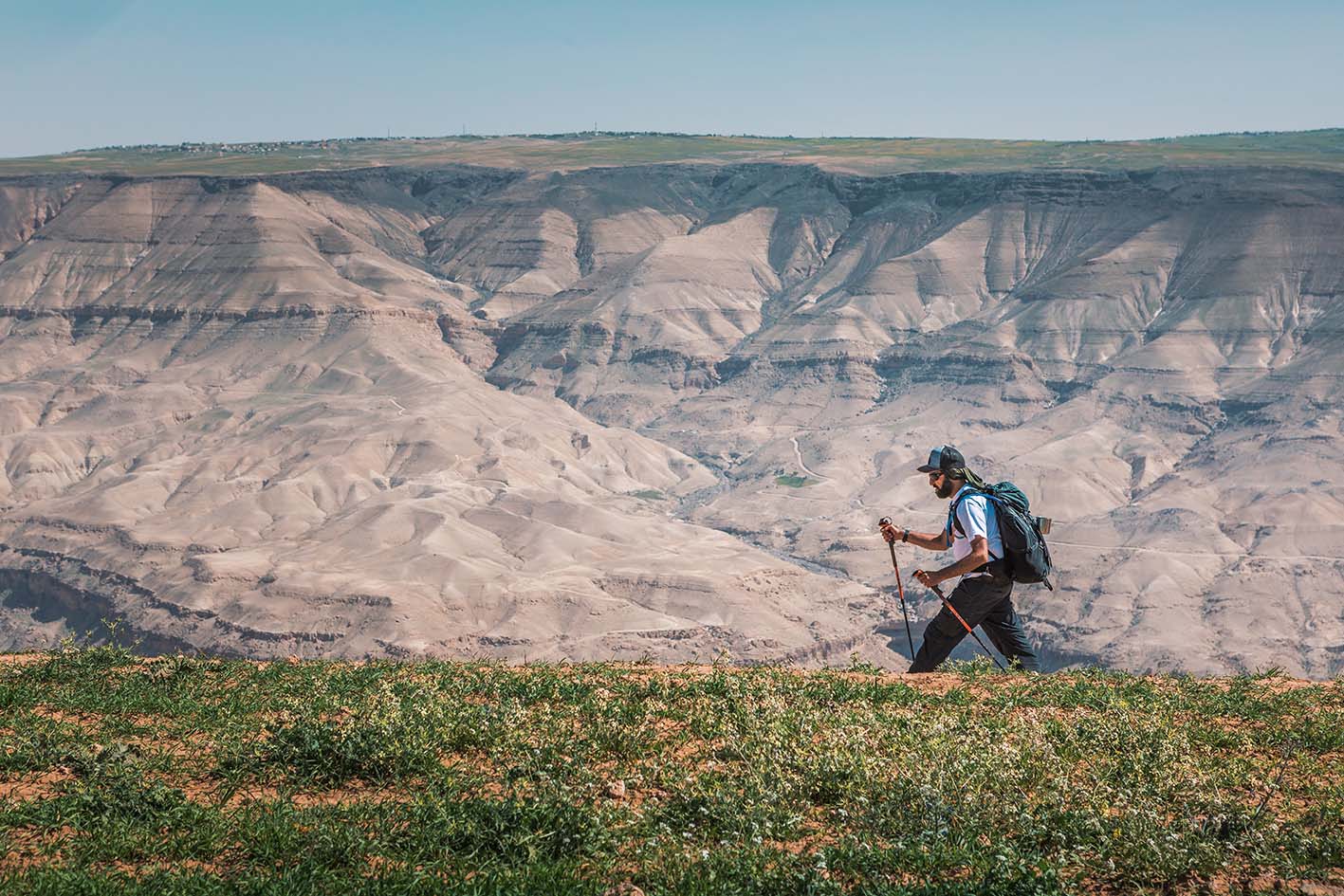
اعبر النهر (إذا سمح مستوى المياه)، واتبع المسار الذي يرتفع بلطف نحو الجنوب الغربي على مراحل سهلة حتى تصل إلى سلسلة تلال. واصل الصعود على نفس المسار، وسط مناظر طبيعية خلّابة تحيط بك من كل جانب، إلى الحافة الجنوبية للوادي. بعد ذلك، يتبع المسار الحافة باتجاه الجنوب فوق أرض مستوية وسهلة، وصولًا إلى نقطة مراقبة تابعة لجمعية حماية الطبيعة (RSCN) في موقع فريد على طرف الهضبة تُطل على وادييّ الهيدان والموجب. ومن هناك، ينحدر بشكل مفاجئ ولكن مذهل مرة أخرى مسار رُعاة بدو قديم، يهبط بشكل حاد عبر المنحدرات وعلى امتداد سلسلة تلال أخرى نحو أعماق وادي الموجب الهائل، والذي يُعرف بـ "الجراند كانيون الأردني"، ليصل إلى مناطقه السفلية التي تبدو غير قابلة للوصول، عبر مسار مبني على جرف صخري. بعد النزول، تابع المسير بمحاذاة النهر لمسافة قصيرة، قبل الخوض في المياه للوصول إلى مناطق مخصصة للتخييم البري.

وسائل النقل

تنطلق حافلات من مجمّع الجنوب في عمّان إلى مدينة مادبا. ومن هناك، يمكنك استخدام وسيلة نقل خاصة للوصول إلى نقطة بداية المسار في وادي الهيدان وهضبة الموجب.

جهات الاتصال المحلية / أماكن الإقامة
  • التخييم البري: صالح الزيدان, 962777248449+, JT Pass Stamps: Wadi Zarqa Ma'in, Wadi Mujib, Wadi Hidan
أهم المعالم التي يمكن مشاهدتها
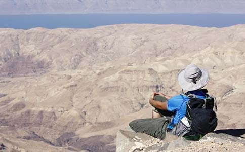
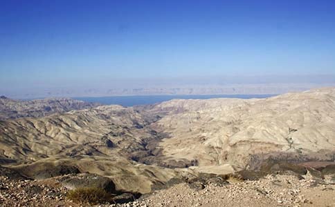
  • وادي الهيدان – إطلالات ساحرة من القمم والمرتفعات العليا.
  • وادي الموجب وبرك السباحة
  • الشقيق
  • الوبر الصخري
  • مسار محفور في الصخور مع خزان مياه وبعض الأطلال مقابل المكان الذي تحدثنا فيه مع الراعي. شلالات جافة، تجاويف وكهوف.
الطعام والماء

الطعام:

  • أقرب المتاجر في فقوع
  • محل صغير في شقيق، وربما متجر صغير في مثلوثة.
  • قد تتمكن من الحصول على خضروات من المزارعين القريبين من الوادي.

الماء:

  • في وادي الهيدان ووادي الموجب، تتوفر مياه جارية طوال السنة ويمكن شربها بعد تنقيتها. يُفضل شرب المياه من الجداول كلما أمكن، لأن النفايات والحيوانات تتجمع في الجداول مما يؤثر على جودة المياه الصالحة للشرب.
  • الينابيع والآبار على طول المسار تعتبر موثوقة إلى حد كبير.
    • عين دافلي
    • الينابيع قرب وادي الموجب
  • يمكن الحصول على المياه من الشغيّغ (خارج المسار) ومن عدة آبار متنوعة.
النصائح والسلامة العامة

النصائح:

  • استخدم الحذاء المناسب والعصي، وكن حذرًا في خطواتك. مع وجود تغيرات كبيرة في الارتفاع، المسار تحدي وجميل في آن واحد. يحتوي المسار على حافة قصيرة قليلاً مكشوفة على درجات حجرية مبنية بالقرب من النهاية قبل الوصول إلى وادي الموجب.
  • احرص على ارتداء الحذاء المناسب واستخدام العصي. وإذا كنت تحمل حقيبة ثقيلة، تأكد من أنك مرتاح مع النزول على مسار زلق. تأكد أن كل من يحاول هذه المرحلة واثق الخطى ومغامر، فهي ربما أصعب نزول في كامل درب الأردن. أما الصعود إلى الهضبة، فالمسار فيه ثبات جيد.
  • حاول اتباع منعطفات دروب الحمير قدر الإمكان.
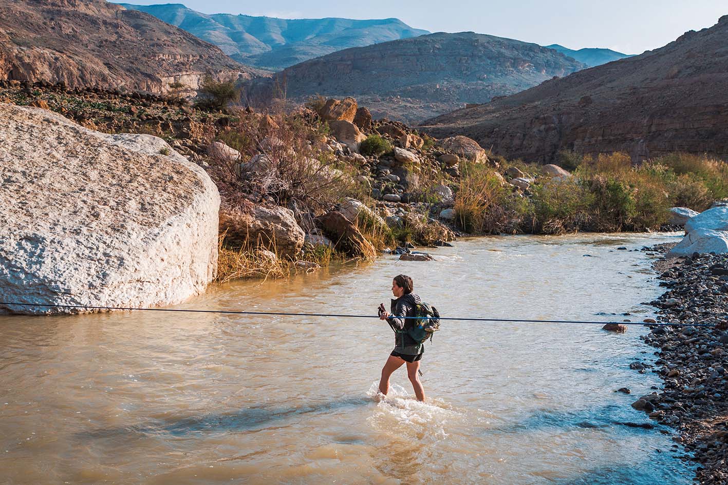
  • اعبر وادي الموجب وأنت مرتديًا الصنادل، وكن حذرًا ألا تبتل حذاءك. إذا كنت تمشي مع مجموعة، اعبروا في نفس المكان وافصلوا حزام الخصر، لأن التيار قد يكون قويًا عند ارتفاع مستوى المياه.
  • تجنب الاقتراب كثيرًا من مخيمات البدو، ومر على مسافة بعيدة مع إلقاء التحية إذا كنت قريبًا منهم.
  • كن مستعدًا في حال لم تتمكن فرقة الدعم من الوصول في الوقت المتوقع.
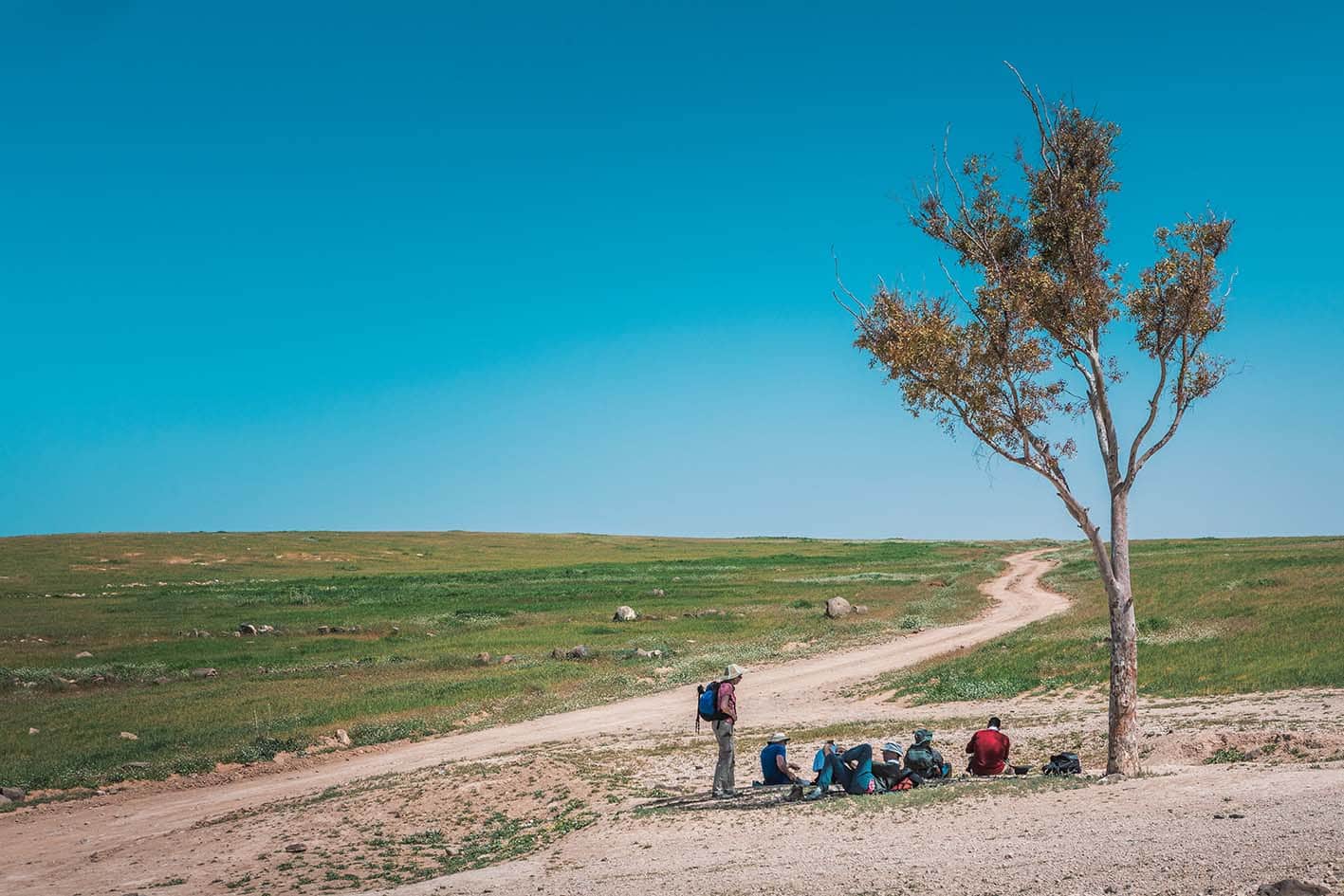
  • يوجد ظل معتدل خلف الصخور الكبيرة في النصف الأخير من المرحلة، وإذا بدأت مبكرًا ستجد ظلًا لمعظم الصعود.
  • يوجد وصول للسيارات الرباعية الدفع فوق نصف الطريق إلى وادي الموجب، وكذلك على الهضبة في منتصف المرحلة.
  • معظم الطرق الترابية التي تنزل إلى الوادي مخصصة فقط للمركبات الرباعية الدفع. طوال اليوم، لن تكون بعيدًا كثيرًا عن طريق ترابي.
  • توجد كمية معتدلة من الظل في النصف الثاني من المسار، حيث الصخور الكبيرة والتجاويف والمنحدرات، بالإضافة إلى الهضبة والنصف الأول من الوادي. ولا يوجد ظل في باقي المناطق.

السلامة العامة:

  • الحواف المكشوفة: كن حذرًا في بعض المقاطع القصيرة أثناء النزول، خاصة على الدرب المحصّن بالحجارة قبل النزول الأخير إلى وادي الموجب.
  • خطر السيول المفاجئة: عند عبور وادي حيدان ووادي الموجب، احذر من التخييم بالقرب من مجرى المياه أو في أرض السيل.
  • الأرض الزلقة: معظم أجزاء المسار تتطلب انتباهاً خاصاً للخطوات بسبب عدم ثبات الأرض؛ راجع قسم "النصائح" لمزيد من الإرشادات.
  • الجفاف/الإرهاق الحراري: معظم المسار مكشوف لأشعة الشمس وقد يكون شديد الحرارة، خصوصًا في المناطق المنخفضة. تأكد من تبريد نفسك في الجداول المتدفقة عند كل فرصة!
  • البدو شمال وادي الموجب: بعض التجمعات البدوية تنصح المتنزهين بإصدار أصوات عند المرور بجانبهم، خاصةً في الليل، حتى لا يفاجئوهم ويثيروا قلقهم.

وسائل النقل الإقليمية

نحن لا نزال نجمع هذه المعلومات. هل لديك أي تفاصيل قد تكون مفيدة؟  شاركها معنا!

لمزيد من المعلومات حول وسائل النقل في الأردن، اضغط هنا.

The Jordan Trail is a newly established trail, and is not marked. It is therefore our strong recommendation that you hire a local guide for your safety as many sections are remote with limited water sources and at times no connectivity.
By downloading these maps/GPX you take full responsibility for their use and accuracy; Jordan Trail Association does not warrant the accuracy or completeness of the information, materials or the reliability of any maps as they provided AS IS without warranty of any kind, either express or implied, including but not limited to, fitness for a particular purpose, or non-infringement ;You acknowledge that any reliance on any such maps, shall be at your sole risk and responsibility as Hiking, backpacking, and other outdoor activities all have potential hazards involving risk of injury or death. Outdoor activities have inherent risks and you should ensure you have the skill level and abilities suitable for the activities in Jordan to partake in them and to take all precaution measures.  Check the data on Google Earth or other Apps or Programs before using them.  The Jordan Trail Association shall not be held responsible for any incidents that may occur during your participation in any activity and/or by using any of the maps/GPX.
AGREE
close-link