0
0 items
No products in the cart.

القسم 702: قاع مريبض إلى وادي الصيف

  • مسارات المشي في المنطقة

  • اليوم الثاني: قاع مريبض إلى وادي الصيف

  • المسافة: 13.8 كم

  • الوقت اللازم للمسير: 4-5 ساعات

  • التحدي البدني: صعب

  • صعوبة المسار: متوسط

  • اجمالي الصعوبة: متوسط

  • تعليم المسار: نعم

لتحميل مسار GPS، اضغط هنا.  

The Jordan Trail is a newly established trail, and is not marked. It is therefore our strong recommendation that you hire a local guide for your safety as many sections are remote with limited water sources and at times no connectivity.
By downloading these maps/GPX you take full responsibility for their use and accuracy; Jordan Trail Association does not warrant the accuracy or completeness of the information, materials or the reliability of any maps as they provided AS IS without warranty of any kind, either express or implied, including but not limited to, fitness for a particular purpose, or non-infringement ;You acknowledge that any reliance on any such maps, shall be at your sole risk and responsibility as Hiking, backpacking, and other outdoor activities all have potential hazards involving risk of injury or death. Outdoor activities have inherent risks and you should ensure you have the skill level and abilities suitable for the activities in Jordan to partake in them and to take all precaution measures.  Check the data on Google Earth or other Apps or Programs before using them.  The Jordan Trail Association shall not be held responsible for any incidents that may occur during your participation in any activity and/or by using any of the maps/GPX.
AGREE
close-link
اضغط هنا لتحميل الخريطة
أرقام مهمة

الشرطة السياحية:

الخط الساخن: 117777
واتساب: +962770992690

*في حال التواصل مع شرطة السياحة في حالة طارئة، يُرجى تحديد أنك تسير على درب الأردن، وذكر جنسيتك، موقعك الحالي، واسم ورقم الخريطة.

مكتب جمعية درب الأردن: +962 6 461 0999

(ساعات العمل: من 9:00 صباحًا حتى 5:00 مساءً، من الأحد إلى الخميس)

معلومات عامة

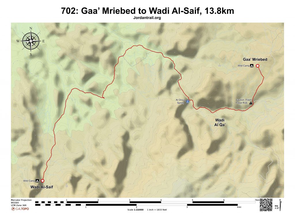
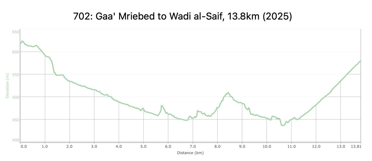
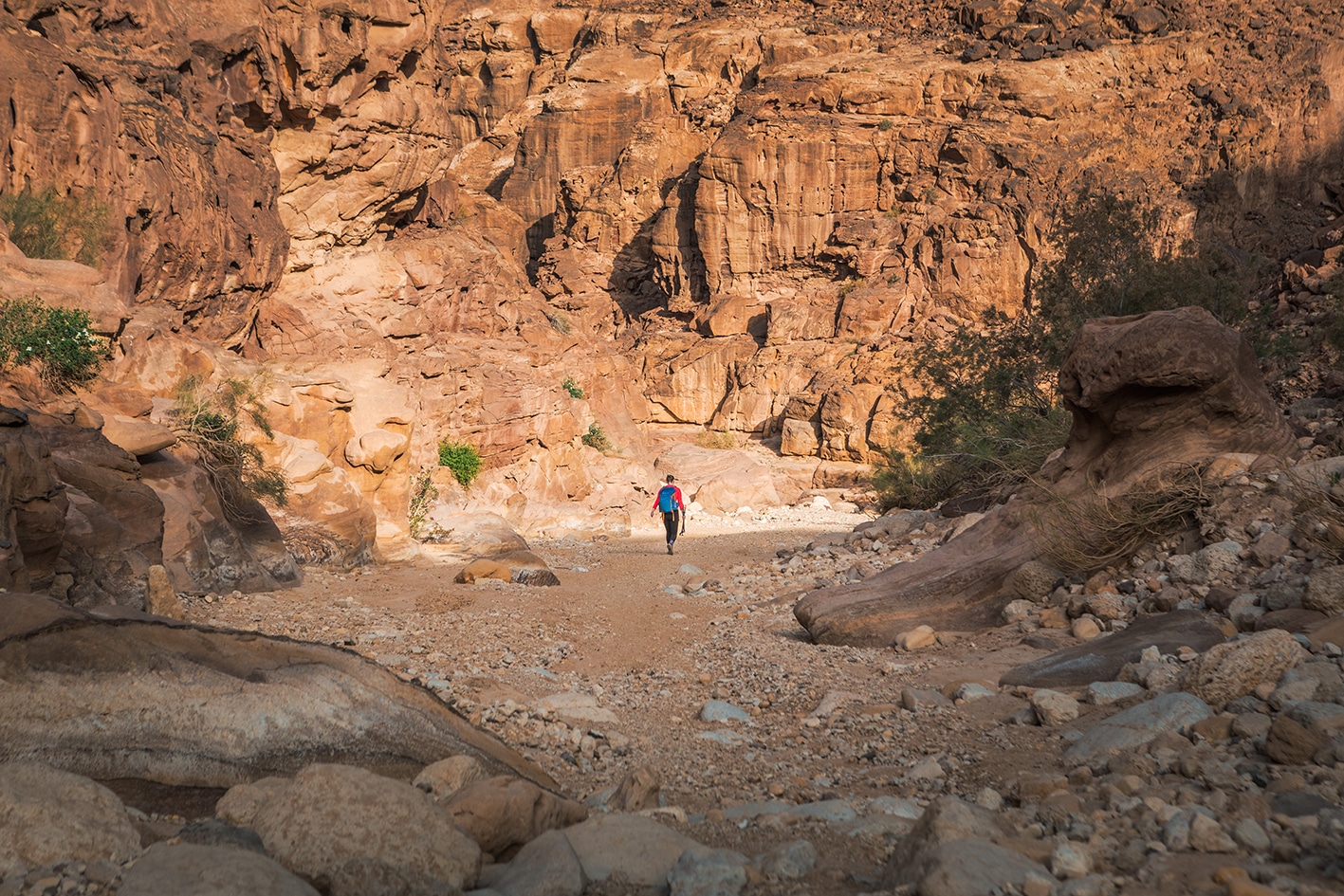
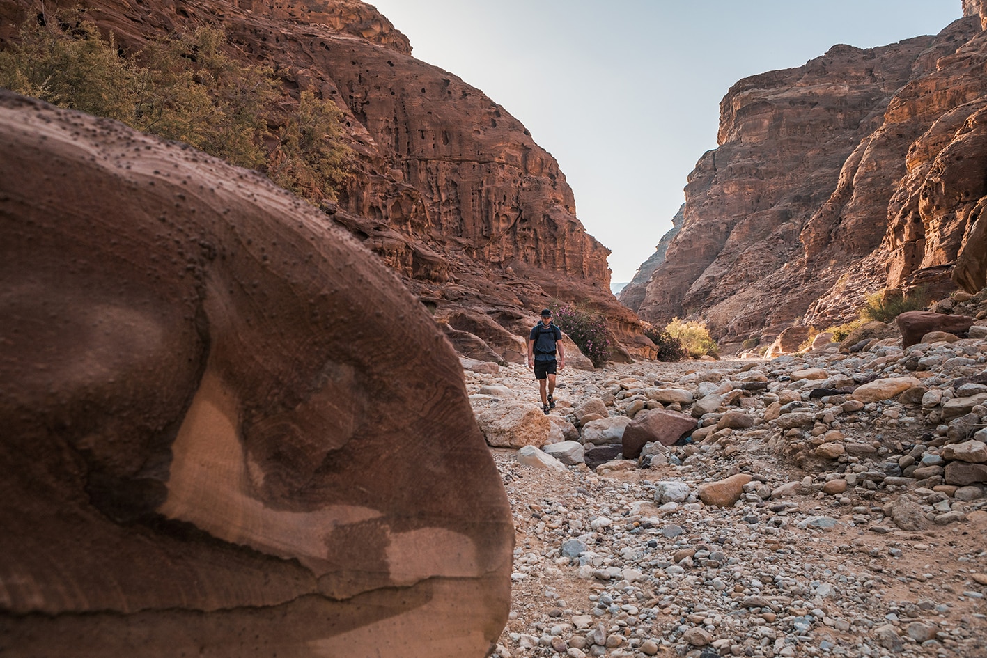
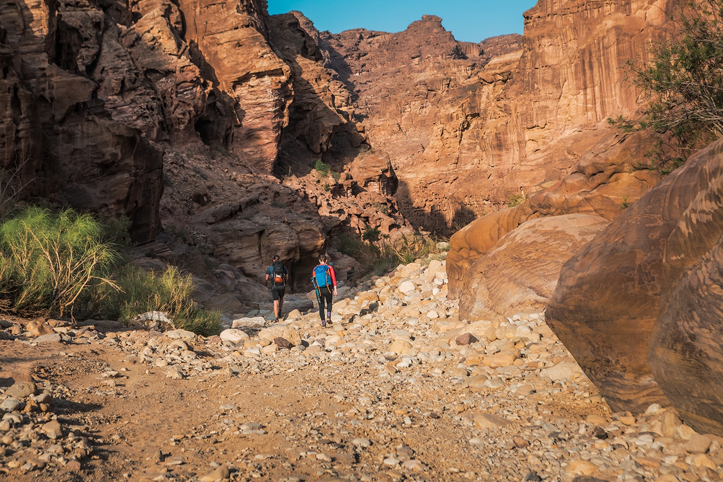
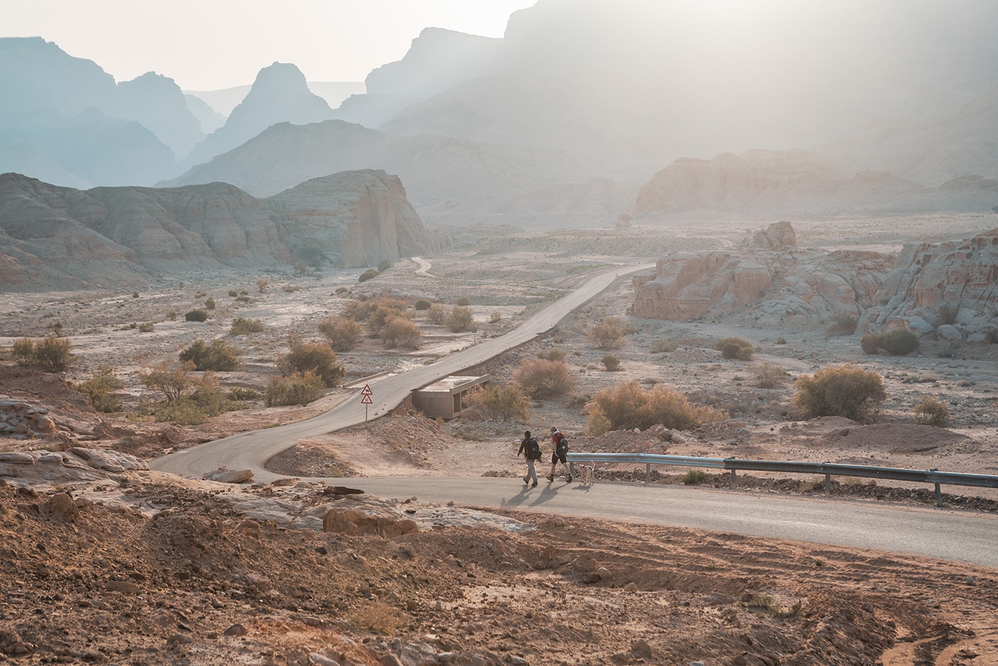
من منطقة قاع مريبض، اتجه جنوب غرباً نزولاً على الطريق المعبّد، ثم ادخل وادي أبو عروق بالانعطاف يميناً قبل جسر صغير حيث يعبر الطريق المعبّد الوادي. استمر بالنزول داخل الوادي، مروراً بصخور حجرية ملونة جميلة، ومشيًا على أرضية الوادي الصخرية ومن خلال نباتات الدفلى. عند حوالي 3 كيلومترات، يلتقي وادي أكبر من جهة اليسار، فتابع السير مستقيمًا في الوادي الرئيسي. مرّ عبر صخور كبيرة من الحجر الرملي، حتى تصل إلى نبع عين العروق الذي يغذيه الماء الجوفي ويتوفر على مدار السنة. إذا كان الماء قليلًا، احفر في الرمال الرطبة لتجد الماء. استمر في السير على طول الوادي مع اتساعه تدريجيًا.

بعد الصهريج الخرساني المربع على يمينك، انعطف يساراً متجهاً غرباً ثم جنوباً، متعرجاً عبر متاهة من المناطق الصخرية والأودية الصغيرة حتى تصل إلى مسار حمير يتجه جنوباً. استمر على هذا المسار الأفضل حتى تصل إلى وادي يدخل من الشرق بالقرب من شجرة ظل كبيرة وجدار مدرج عند النقطة 9.8 كيلومتر.

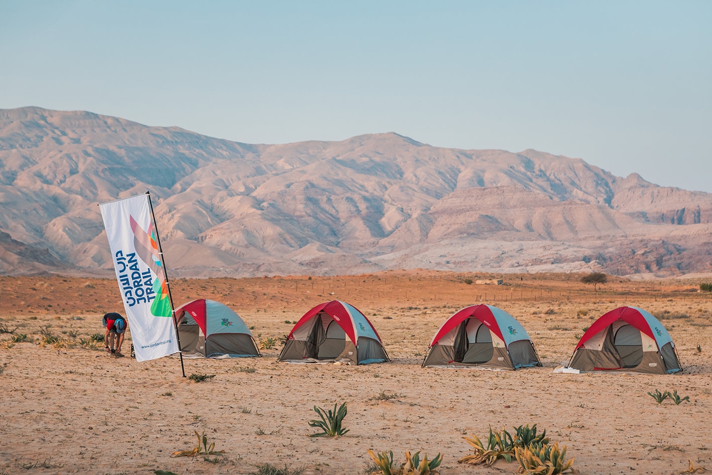
اتجه غربًا نحو مسار يؤدي إلى وادي الصيف الأوسع بكثير، حيث يقودك ممر المشي داخل الوادي في اتجاه الجنوب، متجهًا عكس مجرى الوادي (نحو المنبع). استمر في السير جنوبًا على طريق سيارات الدفع الرباعي داخل وادي الصيف حتى تصل إلى صخرة كبيرة أمام جرف عمودي ضخم من الحجر الرملي الأبيض والأحمر، حيث يشكل هذا الموقع البري لمخيم نهاية المرحلة. على قمة الصخرة توجد نقوش قديمة تعود للعصر النبطي تصور حيوانات منها الجمال والغزلان والأغنام.


وسائل النقل
  • الوصول بسيارة خاصة إلى منطقة قاع مريبض
  • الوصول بسيارة جيب فقط إلى وادي الصيف
جهات الاتصال المحلية / أماكن الإقامة
  • التخييم البري, حسين سعيدين, 962772429759+, ختم سجل الدرب وادي الصيف
  • التخييم البري, ثامر سعيدين, 962772429759+
  • التخييم البري, محمد سعيدين, 962779803200+
أهم المعالم التي يمكن مشاهدتها
  • حجر رملي ملون
  • وادي أبو العروق
  • النقوش النبطية في وادي الصيف
الطعام والماء

الطعام:

  • لايوجد على المسار

الماء:

  • المياه من عين أبو عروق وبرك المياه في الوادي بالقرب من موقع تخييم وادي قصيب (المرحلة التالية)
النصائح والسلامة العامة

النصائح:

  • معظم المشي خلال اليوم يكون في مناطق تحتوي على أحجار متفرقة ورمال وحصى في قيعان الأودية.
  • إذا كنت تسير في رحلة مشي معتمداً على نفسك، فإن التخييم بالقرب من ينابيع المياه في وادي أبو عروق ووادي قصيب في المرحلة التالية يجعل من الممكن دمج المرحلتين الطويلتين لتصبح حوالي 27 كيلومتراً. تأكد من متابعة حالة الطقس جيداً لتجنب مخاطر الفيضانات المفاجئة عند التخييم في الأودية.

السلامة العامة:

  • خطر الفيضانات المفاجئة – وادي ابو عروق.
  • الأرض غير المستقرة – تتكون الأسطح من صخور ورمال وأرضية الأودية.
  • الجفاف والإرهاق الحراري – يوجد ظل قليل جدًا على طول المرحلة، لكن هناك بعض أشجار الأكاسيا الصغيرة المتفرقة والصخور المتدلية على جوانب الأودية التي قد توفر بعض الظل.

تغطية الهاتف المحمول: هناك تغطية هاتفية محدودة في المناطق المرتفعة حول الكيلومتر8، وأيضًا في أعلى المسار عند نهاية مرحلة وادي الصيف.

The Jordan Trail is a newly established trail, and is not marked. It is therefore our strong recommendation that you hire a local guide for your safety as many sections are remote with limited water sources and at times no connectivity.
By downloading these maps/GPX you take full responsibility for their use and accuracy; Jordan Trail Association does not warrant the accuracy or completeness of the information, materials or the reliability of any maps as they provided AS IS without warranty of any kind, either express or implied, including but not limited to, fitness for a particular purpose, or non-infringement ;You acknowledge that any reliance on any such maps, shall be at your sole risk and responsibility as Hiking, backpacking, and other outdoor activities all have potential hazards involving risk of injury or death. Outdoor activities have inherent risks and you should ensure you have the skill level and abilities suitable for the activities in Jordan to partake in them and to take all precaution measures.  Check the data on Google Earth or other Apps or Programs before using them.  The Jordan Trail Association shall not be held responsible for any incidents that may occur during your participation in any activity and/or by using any of the maps/GPX.
AGREE
close-link