0
0 items
No products in the cart.

القسم 805: وادي ورقة إلى المخيم الأخير

  • مسارات المشي في المنطقة

  • اليوم الخامس: وادي ورقة إلى المخيم الأخير

  • المسافة: 26.5 كم

  • الوقت اللازم للمسير: 7-9 ساعات

  • التحدي البدني: صعب

  • صعوبة المسار: صعب

  • اجمالي الصعوبة: صعب

  • تعليم المسار: نعم

لتحميل مسار GPS، اضغط هنا.  

The Jordan Trail is a newly established trail, and is not marked. It is therefore our strong recommendation that you hire a local guide for your safety as many sections are remote with limited water sources and at times no connectivity.
By downloading these maps/GPX you take full responsibility for their use and accuracy; Jordan Trail Association does not warrant the accuracy or completeness of the information, materials or the reliability of any maps as they provided AS IS without warranty of any kind, either express or implied, including but not limited to, fitness for a particular purpose, or non-infringement ;You acknowledge that any reliance on any such maps, shall be at your sole risk and responsibility as Hiking, backpacking, and other outdoor activities all have potential hazards involving risk of injury or death. Outdoor activities have inherent risks and you should ensure you have the skill level and abilities suitable for the activities in Jordan to partake in them and to take all precaution measures.  Check the data on Google Earth or other Apps or Programs before using them.  The Jordan Trail Association shall not be held responsible for any incidents that may occur during your participation in any activity and/or by using any of the maps/GPX.
AGREE
close-link

أنقر هنا

The Jordan Trail is a newly established trail, and is not marked. It is therefore our strong recommendation that you hire a local guide for your safety as many sections are remote with limited water sources and at times no connectivity.
By downloading these maps/GPX you take full responsibility for their use and accuracy; Jordan Trail Association does not warrant the accuracy or completeness of the information, materials or the reliability of any maps as they provided AS IS without warranty of any kind, either express or implied, including but not limited to, fitness for a particular purpose, or non-infringement ;You acknowledge that any reliance on any such maps, shall be at your sole risk and responsibility as Hiking, backpacking, and other outdoor activities all have potential hazards involving risk of injury or death. Outdoor activities have inherent risks and you should ensure you have the skill level and abilities suitable for the activities in Jordan to partake in them and to take all precaution measures.  Check the data on Google Earth or other Apps or Programs before using them.  The Jordan Trail Association shall not be held responsible for any incidents that may occur during your participation in any activity and/or by using any of the maps/GPX.
AGREE
close-link
لتحميل الخريطة
أرقام مهمة

الشرطة السياحية:

الخط الساخن: 117777
واتساب: +962770992690

*في حال التواصل مع شرطة السياحة في حالة طارئة، يُرجى تحديد أنك تسير على درب الأردن، وذكر جنسيتك، موقعك الحالي، واسم ورقم الخريطة.

مكتب جمعية درب الأردن: +962 6 461 0999

(ساعات العمل: من 9:00 صباحًا حتى 5:00 مساءً، من الأحد إلى الخميس)

معلومات عامة

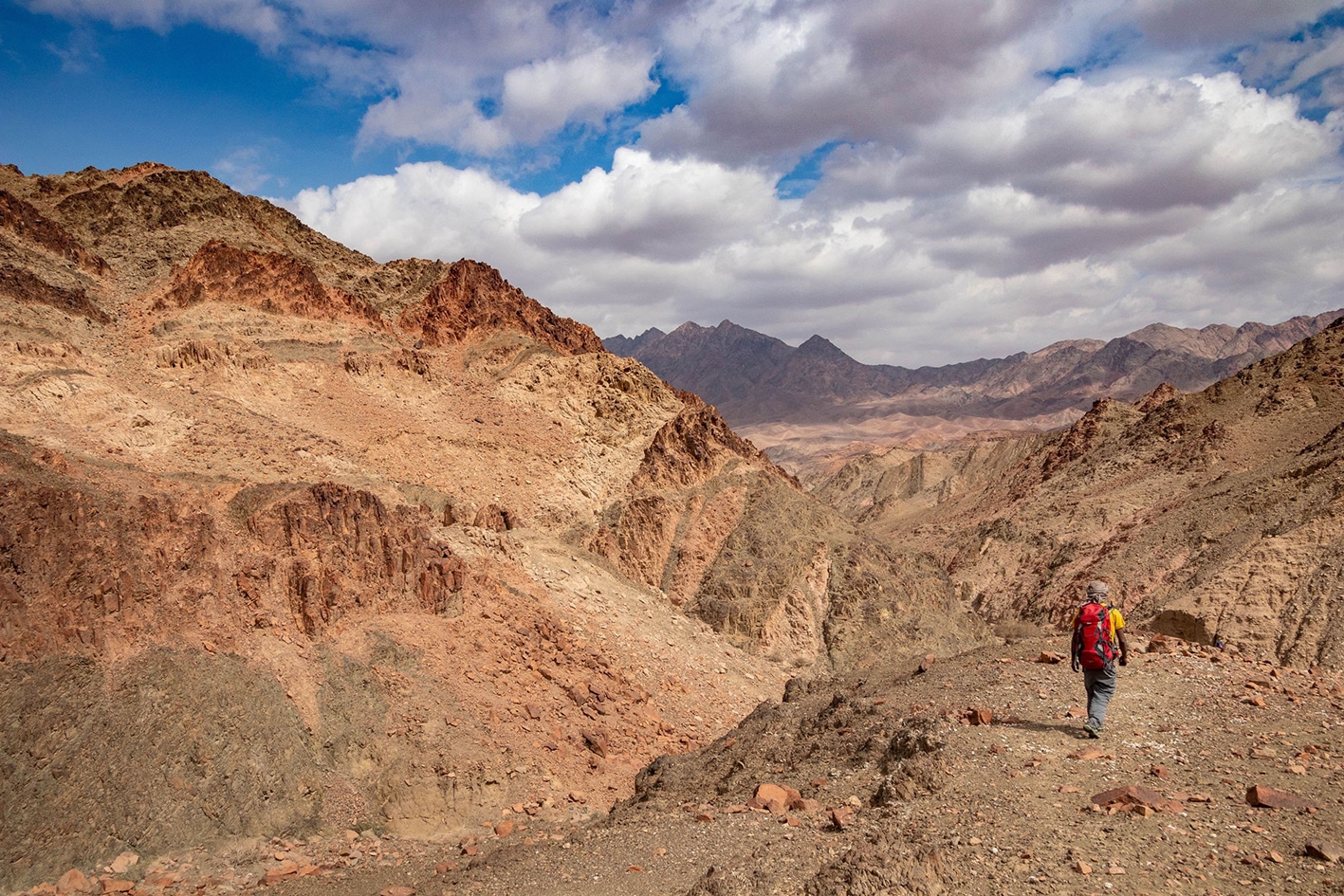
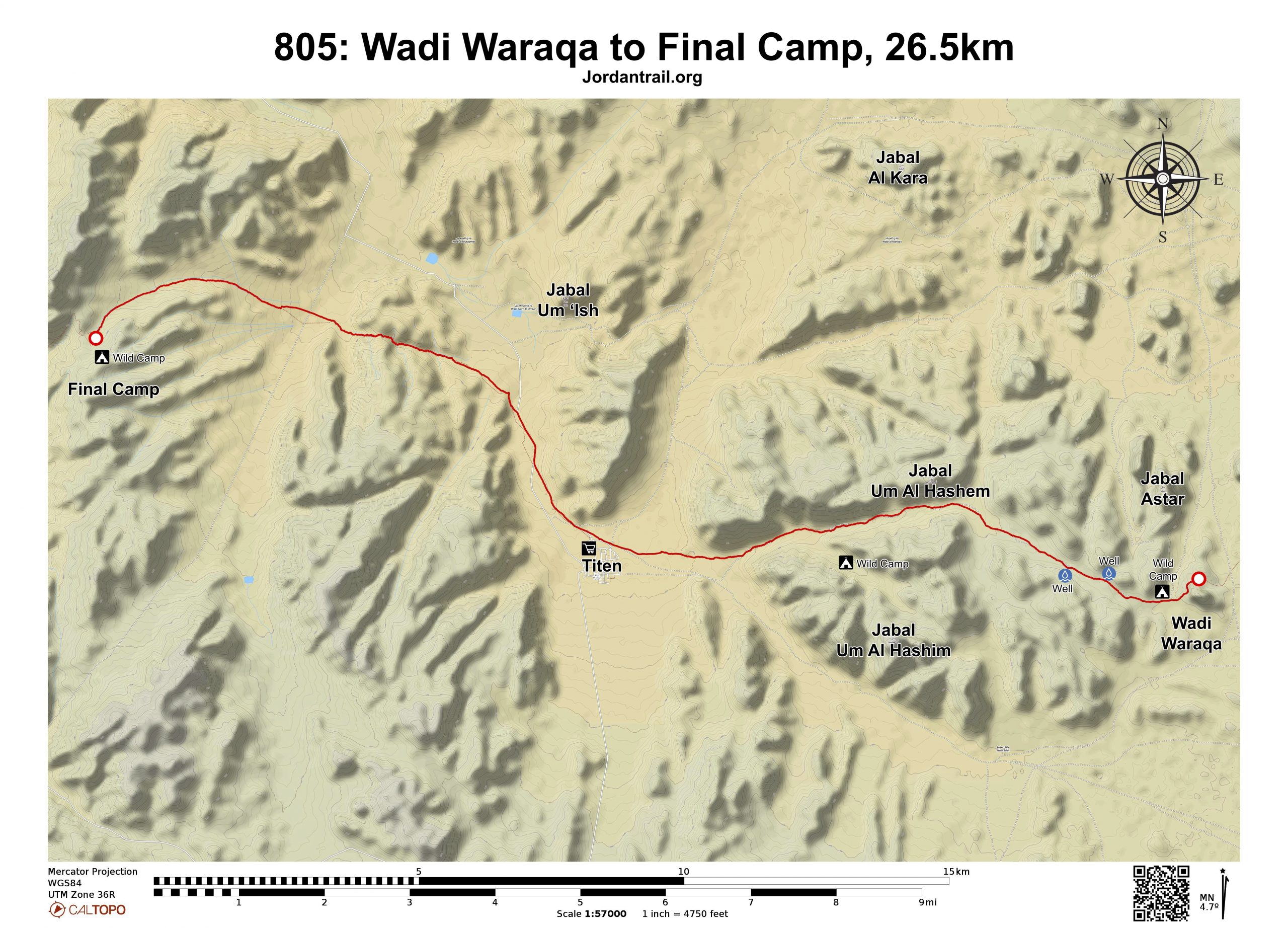
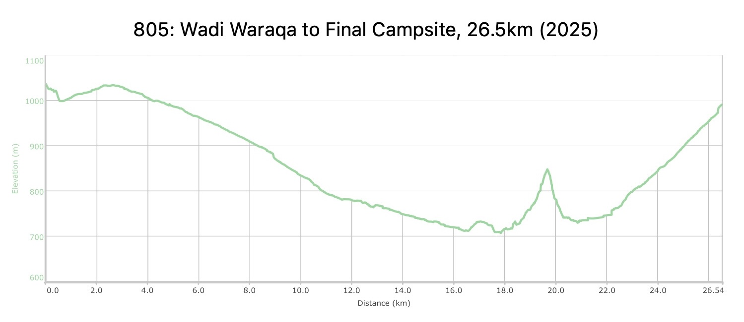
اتبع وادي ورقة غربًا، مارًا بعدة آبار جافة، ومراقبًا كيف تتلاشى جبال الرمل في وادي رم لتحل محلها صخور الجرانيت الداكنة والكوارتز الوردي المميزة لبقية المسار. توجّه مباشرة لمسافة تقارب 10 كيلومترات نزولًا تدريجيًا نحو قرية تتن، مستمتعًا بسهولة المشي وتغير التكوينات الجيولوجية إلى صخور الجرانيت والكوارتز.

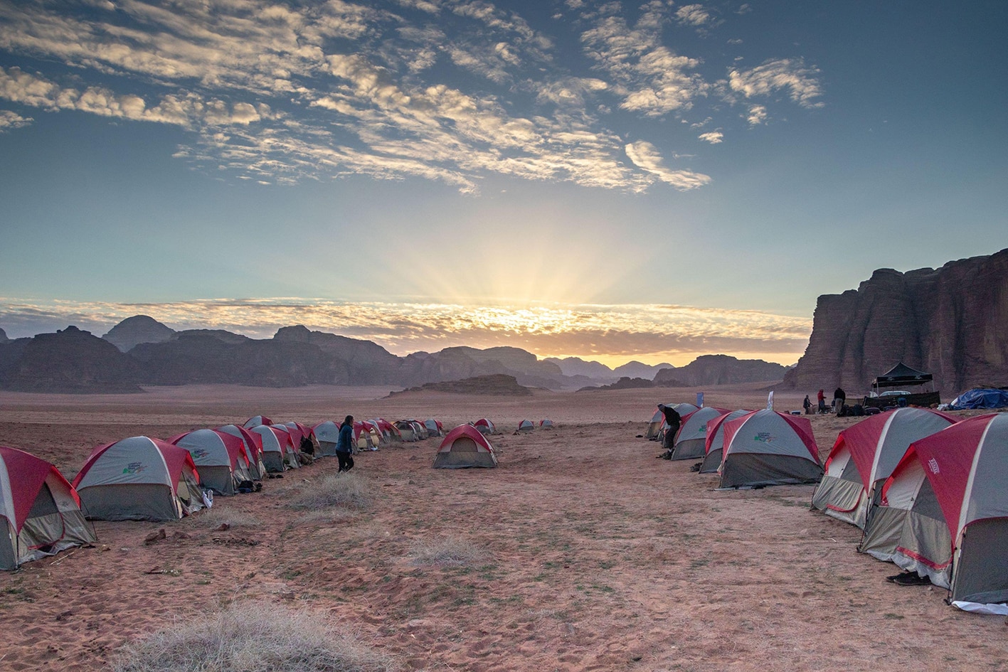
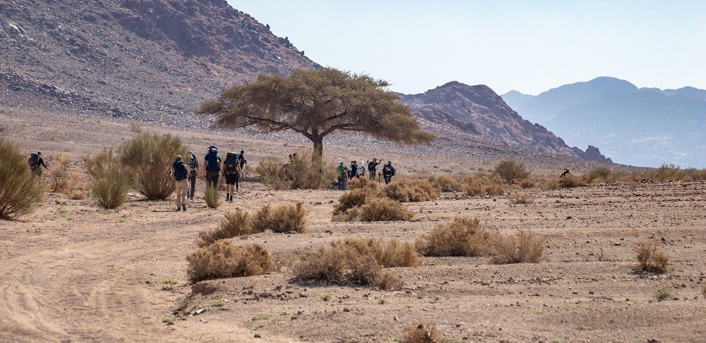
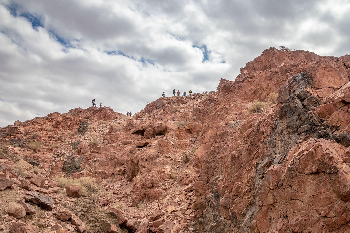
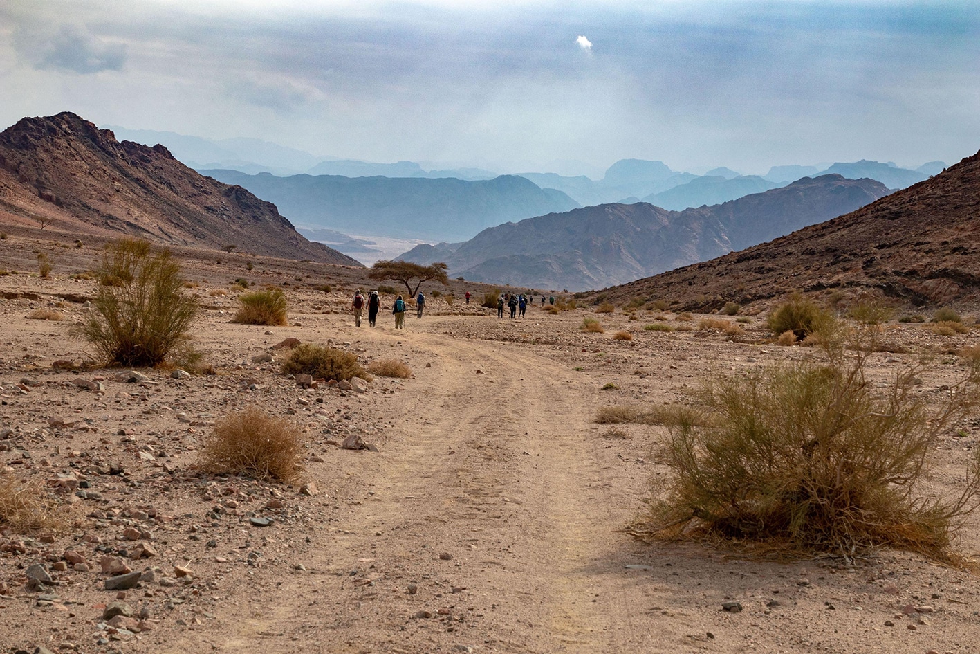
من تتن، توجه شمال غرب موازيًا للطريق المعبّد، ثم انعطف يسارًا باتجاه الغرب لدخول وادٍ تحيط به أشجار الأكاسيا ومرّ بمعسكر بدوي، صاعدًا عبر ممر صخري إلى ممر يطل على وادي لبنان الواسع أدناه. المسار في هذا القسم ضعيف جدًا، لذا من الأفضل اتباع مسار GPS لإجراء بعض الانعطافات المهمة. انزل قليلاً عبر نفس الممر الصخري لمسافة قصيرة، وعبور الوادي وخطوط الكهرباء الكبيرة التي تمتد على طول الوادي. استمر بالعبور نحو الغرب على طريق حصوي جيد مخصص لسيارات الدفع الرباعي، واصعد تدريجيًا عبر وادٍ لطيف لتصل إلى المخيم النهائي، الواقع أسفل قمة الممر إلى اليسار في منطقة محمية من الرياح

وسائل النقل
  • قرية تتن يمكن الوصول إليها بالسيارة.
  • "المخيم النهائي" يمكن الوصول إليه بسيارة دفع رباعي، وسهل العثور عليه عند قمة الممر غرب وادي لبنان.
جهات الاتصال المحلية / أماكن الإقامة
  • التخييم البري, علي زلابية, 962776558752+ , ختم سجل الدرب المخيم الأخير
  • التخييم البري, محمد زلابية, 962778382082+
  • التخييم البري, راشد صباح زلابية, 962795944972+
  • التخييم البري, عبدالله مطلق زلابية, 962776335153+
  • التخييم البري, عواد مفلح زلابية, 962778775776+
  • التخييم البري, عودة محمد زلابية, 962778908338+
  • التخييم البري, خالد مفلح زلابية, 962777875264+
أهم المعالم التي يمكن مشاهدتها
  • وادي ورقة
  • قرية تتن
  • جبال العقبة
الطعام والماء

الطعام:

  • يوجد متجر صغير في قرية تتن، لكن تم الابلاغ عن إغلاقه أحيانًا.

الماء:

  • قرية تتن
  • آبار جافة في بداية وادي ورقة.
النصائح والسلامة العامة

النصائح:

  • اليوم طويل، لذلك ابدأ مبكرًا وخذ فترات راحة تحت أشجار الظل. الارتفاع الأعلى يساعد في خفض درجات الحرارة قليلاً.
  • قد تبدو قرية تتن مهجورة، لذا نأمل أن تجد الماء إذا طرقت الأبواب وكونت صداقات.
  • من الأفضل ارتداء الأحذية بدلاً من الصنادل، لأن الصخور خشنة وقد تكون حادة.
  • من الممكن تجنب التسلق بالصعود حول التلة، وهو لا يضيف مسافة كبيرة إذا كنت لا ترغب في الصعود واتباع المسار المحدد.
  • من الأفضل أن تقوم بالمشي مع دليل محلي.

السلامة العامة:

أرض غير مستقرة – توجد بعض الحصى الدقيقة المتساقطة على المسارات؛ التسلق عبر الممر صخري ويتطلب تركيزًا.

الجفاف/الإرهاق الحراري – المسار معظمه في الشمس، لكن هناك أشجار ظل كل بضعة كيلومترات.

قاعدة عسكرية – المسار يقع ضمن 15 كيلومترًا من الحدود السعودية، لكن لا توجد علامات عسكرية أو نقاط تفتيش مرئية من المسار.

تغطية الهاتف المحمول: لا يوجد تغطية لمعظم المسار، لكن هناك إشارة ضعيفة جدًا لشبكة أورانج على التلال قرب "المخيم النهائي". توجد العديد من الخيارات للتجوال على الشبكات الدولية في نفس الموقع.

The Jordan Trail is a newly established trail, and is not marked. It is therefore our strong recommendation that you hire a local guide for your safety as many sections are remote with limited water sources and at times no connectivity.
By downloading these maps/GPX you take full responsibility for their use and accuracy; Jordan Trail Association does not warrant the accuracy or completeness of the information, materials or the reliability of any maps as they provided AS IS without warranty of any kind, either express or implied, including but not limited to, fitness for a particular purpose, or non-infringement ;You acknowledge that any reliance on any such maps, shall be at your sole risk and responsibility as Hiking, backpacking, and other outdoor activities all have potential hazards involving risk of injury or death. Outdoor activities have inherent risks and you should ensure you have the skill level and abilities suitable for the activities in Jordan to partake in them and to take all precaution measures.  Check the data on Google Earth or other Apps or Programs before using them.  The Jordan Trail Association shall not be held responsible for any incidents that may occur during your participation in any activity and/or by using any of the maps/GPX.
AGREE
close-link