
0
0 items
No products in the cart.
0
0 items
No products in the cart.

المنطقة الخامسة: الكرك إلى ضانا

  • التفاصيل

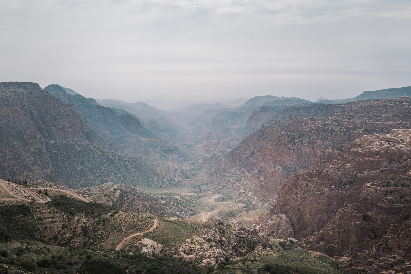
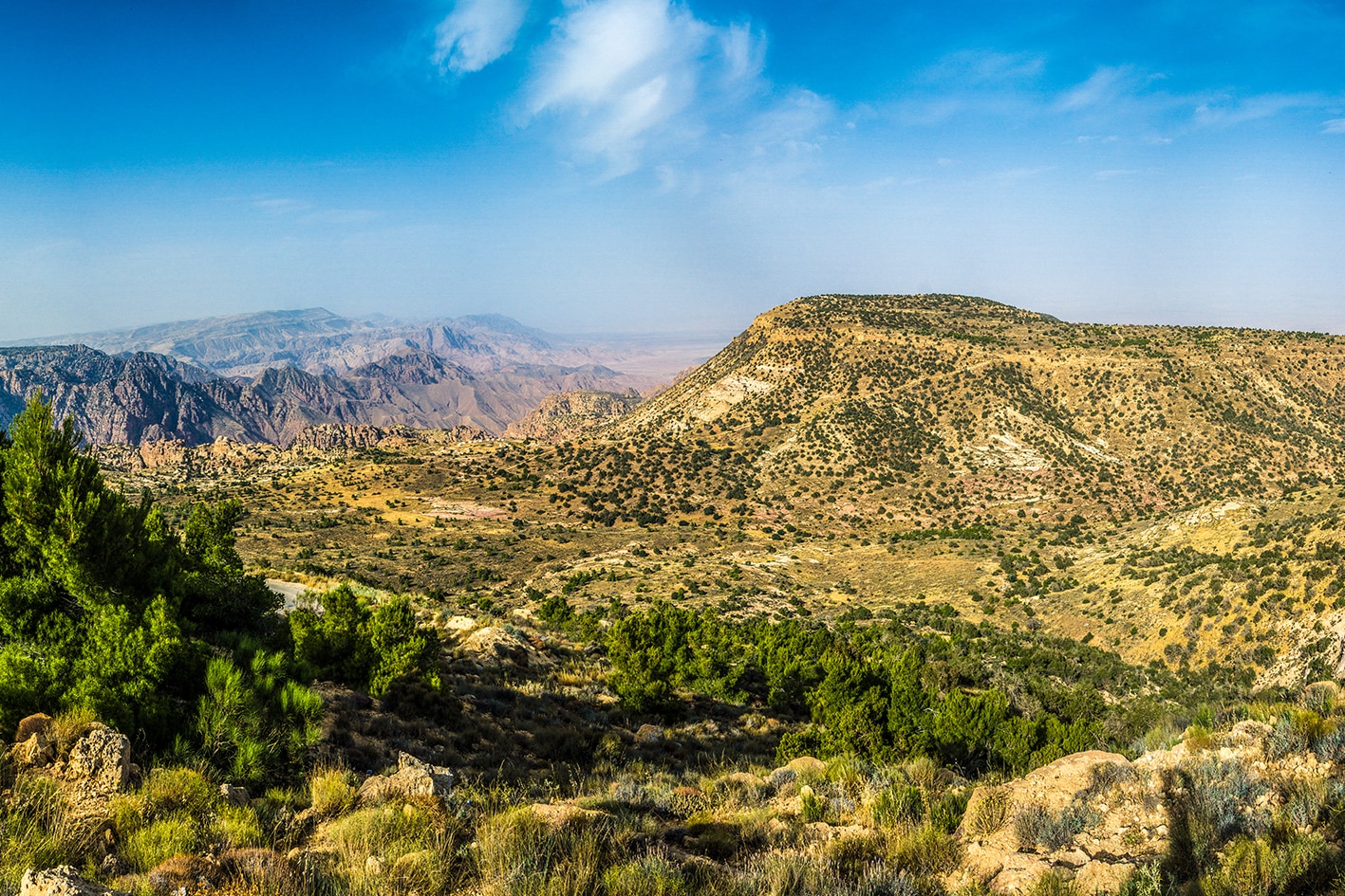
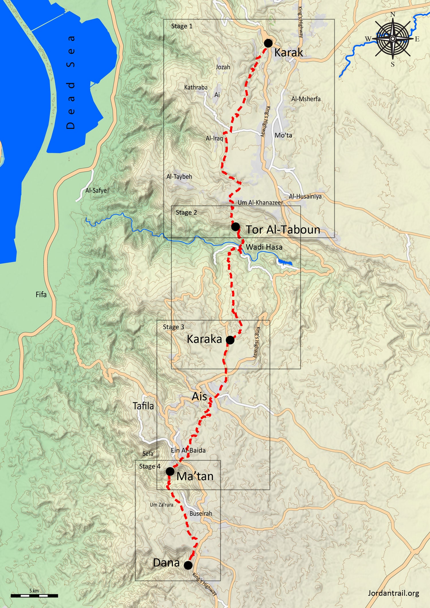
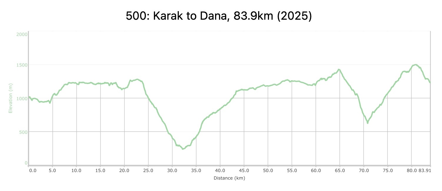
    انطلاقًا من الكرك، ينحدر المسار إلى وديان وقرى متعرجة تعود جذورها إلى عصر الصليبيين. يمر المسار بآثار خربة عينون والبساتين الخصبة قبل الوصول إلى حافة وادي الحسا الواسع. يلي ذلك هبوط بارتفاع 1,000 متر عبر طور الطابون الجيري وصولًا إلى أرضية الوادي، ثم الصعود مرة أخرى إلى الهضبة شرق الطفيلة. على طول الطريق، يصادف المتنزهون مخيمات بدوية وقرى وآثار الأدوميين في سلع ومعطن. وبعد عبور وادي اللبن، تنتهي هذه المنطقة في قرية دانا، التي تم ترميمها بشكل جميل وتقع على حافة محمية دانا للمحيط الحيوي الخلابة.

    أربعة أيام المسافة: 83.9 كم الارتفاع الصاعد: 3,453 م الإنحدار: 3,244 م اقصى ارتفاع: 1,499 م أدنى ارتفاع: 237 م

  • أبرز المواقع في هذه المنطقة:

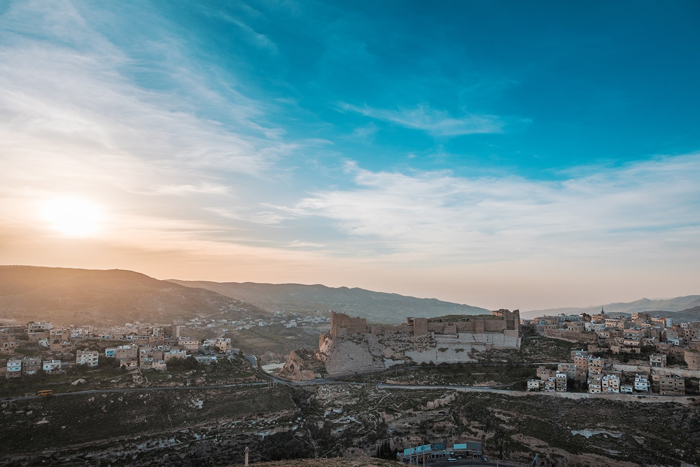
  • قلعة الكرك.

  • قرية خربة عينون في وادي ملته

  • الصخور في طور الطابون

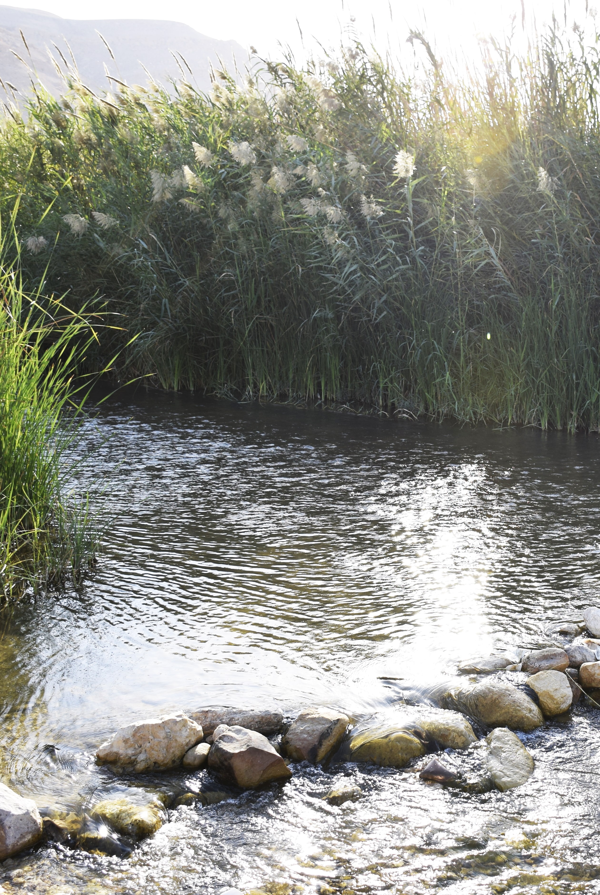
  • وادي الحسا

  • قريتا المعطن وبُصيرة، وآثار الأدوميين

  • قرية ضانا

لتحميل مسار GPS،  اضغط هنا. 

أنقر هنا

The Jordan Trail is a newly established trail, and is not marked. It is therefore our strong recommendation that you hire a local guide for your safety as many sections are remote with limited water sources and at times no connectivity.
By downloading these maps/GPX you take full responsibility for their use and accuracy; Jordan Trail Association does not warrant the accuracy or completeness of the information, materials or the reliability of any maps as they provided AS IS without warranty of any kind, either express or implied, including but not limited to, fitness for a particular purpose, or non-infringement ;You acknowledge that any reliance on any such maps, shall be at your sole risk and responsibility as Hiking, backpacking, and other outdoor activities all have potential hazards involving risk of injury or death. Outdoor activities have inherent risks and you should ensure you have the skill level and abilities suitable for the activities in Jordan to partake in them and to take all precaution measures.  Check the data on Google Earth or other Apps or Programs before using them.  The Jordan Trail Association shall not be held responsible for any incidents that may occur during your participation in any activity and/or by using any of the maps/GPX.
AGREE
close-link
لتحميل الخريطة

وسائل النقل الإقليمية

نحن لا نزال نجمع هذه المعلومات. هل لديك أي تفاصيل قد تكون مفيدة؟  شاركها معنا!

لمزيد من المعلومات حول وسائل النقل في الأردن، اضغط هنا.

الإقامة

نحن لا نزال نجمع هذه المعلومات. هل لديك أي تفاصيل قد تكون مفيدة؟  شاركها معنا!

The Jordan Trail is a newly established trail, and is not marked. It is therefore our strong recommendation that you hire a local guide for your safety as many sections are remote with limited water sources and at times no connectivity.
By downloading these maps/GPX you take full responsibility for their use and accuracy; Jordan Trail Association does not warrant the accuracy or completeness of the information, materials or the reliability of any maps as they provided AS IS without warranty of any kind, either express or implied, including but not limited to, fitness for a particular purpose, or non-infringement ;You acknowledge that any reliance on any such maps, shall be at your sole risk and responsibility as Hiking, backpacking, and other outdoor activities all have potential hazards involving risk of injury or death. Outdoor activities have inherent risks and you should ensure you have the skill level and abilities suitable for the activities in Jordan to partake in them and to take all precaution measures.  Check the data on Google Earth or other Apps or Programs before using them.  The Jordan Trail Association shall not be held responsible for any incidents that may occur during your participation in any activity and/or by using any of the maps/GPX.
AGREE
close-link

The Jordan Trail is a newly established trail, and is not marked. It is therefore our strong recommendation that you hire a local guide for your safety as many sections are remote with limited water sources and at times no connectivity.
By downloading these maps/GPX you take full responsibility for their use and accuracy; Jordan Trail Association does not warrant the accuracy or completeness of the information, materials or the reliability of any maps as they provided AS IS without warranty of any kind, either express or implied, including but not limited to, fitness for a particular purpose, or non-infringement ;You acknowledge that any reliance on any such maps, shall be at your sole risk and responsibility as Hiking, backpacking, and other outdoor activities all have potential hazards involving risk of injury or death. Outdoor activities have inherent risks and you should ensure you have the skill level and abilities suitable for the activities in Jordan to partake in them and to take all precaution measures.  Check the data on Google Earth or other Apps or Programs before using them.  The Jordan Trail Association shall not be held responsible for any incidents that may occur during your participation in any activity and/or by using any of the maps/GPX.
AGREE
close-link
AR