0
0 items
No products in the cart.

المنطقة الثامنة: وادي رم إلى البحر االأحمر

  • تفاصيل المنطقة

    متجهًا جنوبًا عبر وادي رم، يمر المسار تحت المنحدرات الشاهقة لجبل رم وجبل أم العشرين عبر المنطقة التي وصفها توماس إدوارد لورنس بـ "رم المهيب، الشاسع، الصدّاح، والإلهي". يمر بين منحدرات جبل خزّالي ونقوشه الصخرية القديمة، ويعبر جبل قطار الذي يخفي "النبع المتقطر"، ولا يزال يتعرج بين الخلفيات الفريدة والملونة لجبال الصحراء الرملية في وادي رم. ثم يتجه غربًا مرة أخرى، ليغادر جبل القدر وواديه نحو الغرب عبر وادي ورقة، مارًا بعدد من الخزانات المنتشرة على طول الطريق وصولًا إلى قرية تتن البدوية.

    من قرية تتن، يتبع المسار طرق الرعاة القديمة، متعرجًا غربًا عبر أودية صحراوية وعبر جبال جرانيتية مخططة باختراقات من صخور البازلت. عند الممر الأخير، يحصل المتنزهون فجأة على أول إطلالة لهم على البحر الأحمر وخليج العقبة، وخلفهما جبال سيناء. يقود النزول من الممر إلى أودية رملية طويلة تمتد وصولًا إلى المياه الدافئة والترحيبية للبحر الأحمر – نهاية مسار الأردن – بين الحدود مع المملكة العربية السعودية وميناء العقبة.

    ستة أيام المسافة: 112 كم

  • أبرز المواقع في هذه المنطقة:

  • وادي رم (موقع تراث عالمي)

  • قرية البدو في وادي رم

  • عين لورنس (عين شلالة) والمعبد النبطي

  • مناظر صحراوية خلابة – قبب من الحجر الرملي وجبال من الجرانيت المخطط بالبازلت، تتغير ألوانها باستمرار طوال اليوم

  • مخيمات البدو

  • قرية تتن

  • البحر الأحمر

  • منتجع البحر الأحمر في العقبة

لتحميل مسار GPS،  اضغط هنا. 
أنقر هنا

The Jordan Trail is a newly established trail, and is not marked. It is therefore our strong recommendation that you hire a local guide for your safety as many sections are remote with limited water sources and at times no connectivity.
By downloading these maps/GPX you take full responsibility for their use and accuracy; Jordan Trail Association does not warrant the accuracy or completeness of the information, materials or the reliability of any maps as they provided AS IS without warranty of any kind, either express or implied, including but not limited to, fitness for a particular purpose, or non-infringement ;You acknowledge that any reliance on any such maps, shall be at your sole risk and responsibility as Hiking, backpacking, and other outdoor activities all have potential hazards involving risk of injury or death. Outdoor activities have inherent risks and you should ensure you have the skill level and abilities suitable for the activities in Jordan to partake in them and to take all precaution measures.  Check the data on Google Earth or other Apps or Programs before using them.  The Jordan Trail Association shall not be held responsible for any incidents that may occur during your participation in any activity and/or by using any of the maps/GPX.
AGREE
close-link
لتحميل الخريطة

وسائل النقل الإقليمية

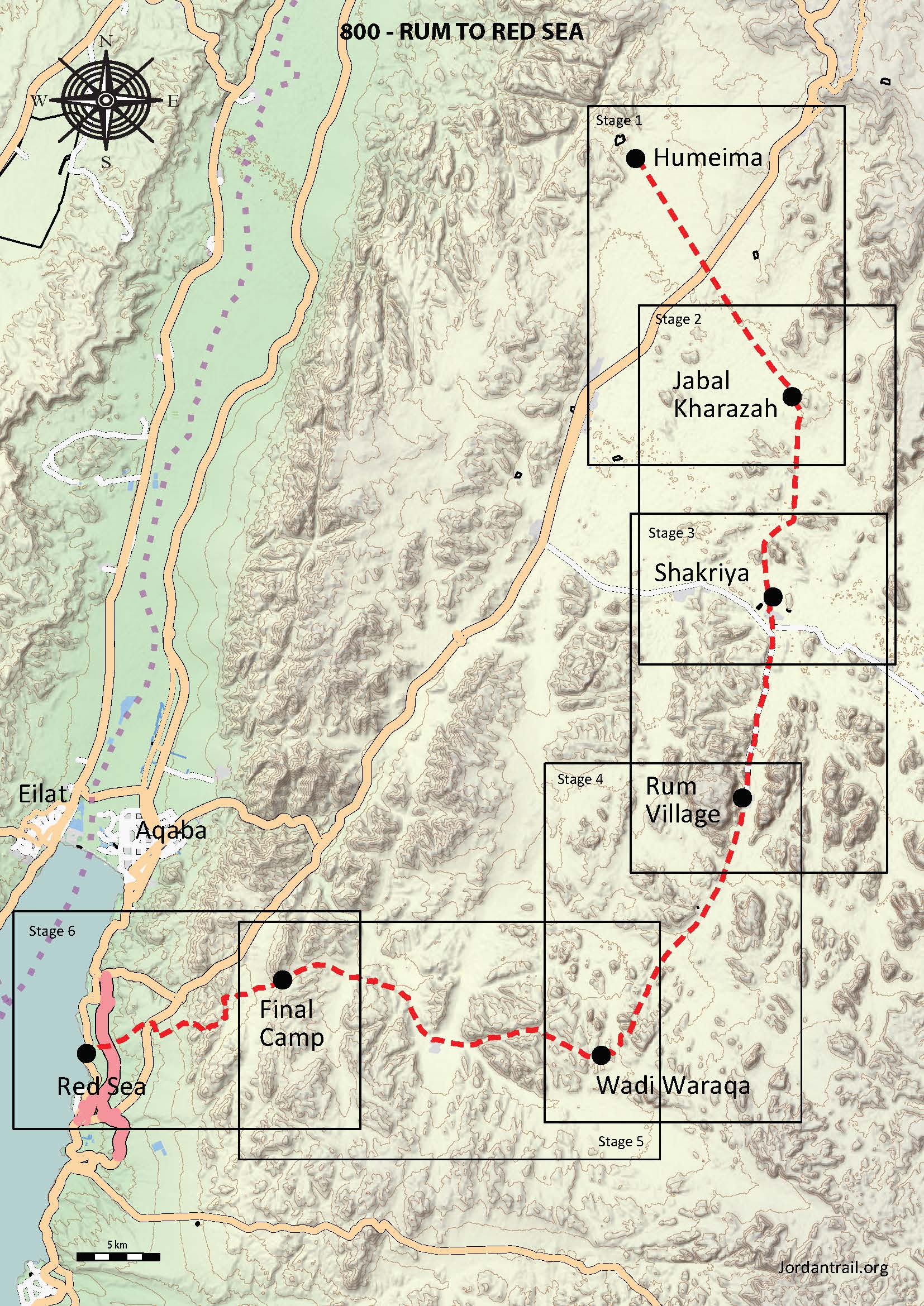
باستثناء وادي رم ومدينة العقبة، لا يمكن الوصول إلى هذه المنطقة عبر وسائل النقل العام – للوصول إلى نقاط على طول المسار، سيتعين عليك القيادة بنفسك أو استئجار سيارة أجرة أو، على الأرجح، سائق بدوي بمركبة دفع رباعي.

بالنسبة لوجهة سياحية رئيسية، فإن وادي رم يعتبر صعب الوصول نسبيًا. إذا لم تكن تقود بنفسك، فسيتعين عليك العثور على واحدة من الحافلات القليلة التي تصل إليه يوميًا، أو ركوب حافلة تسير على طول الطريق الصحراوي ثم المشي أو محاولة استئجار سيارة أجرة لإكمال بقية الطريق.

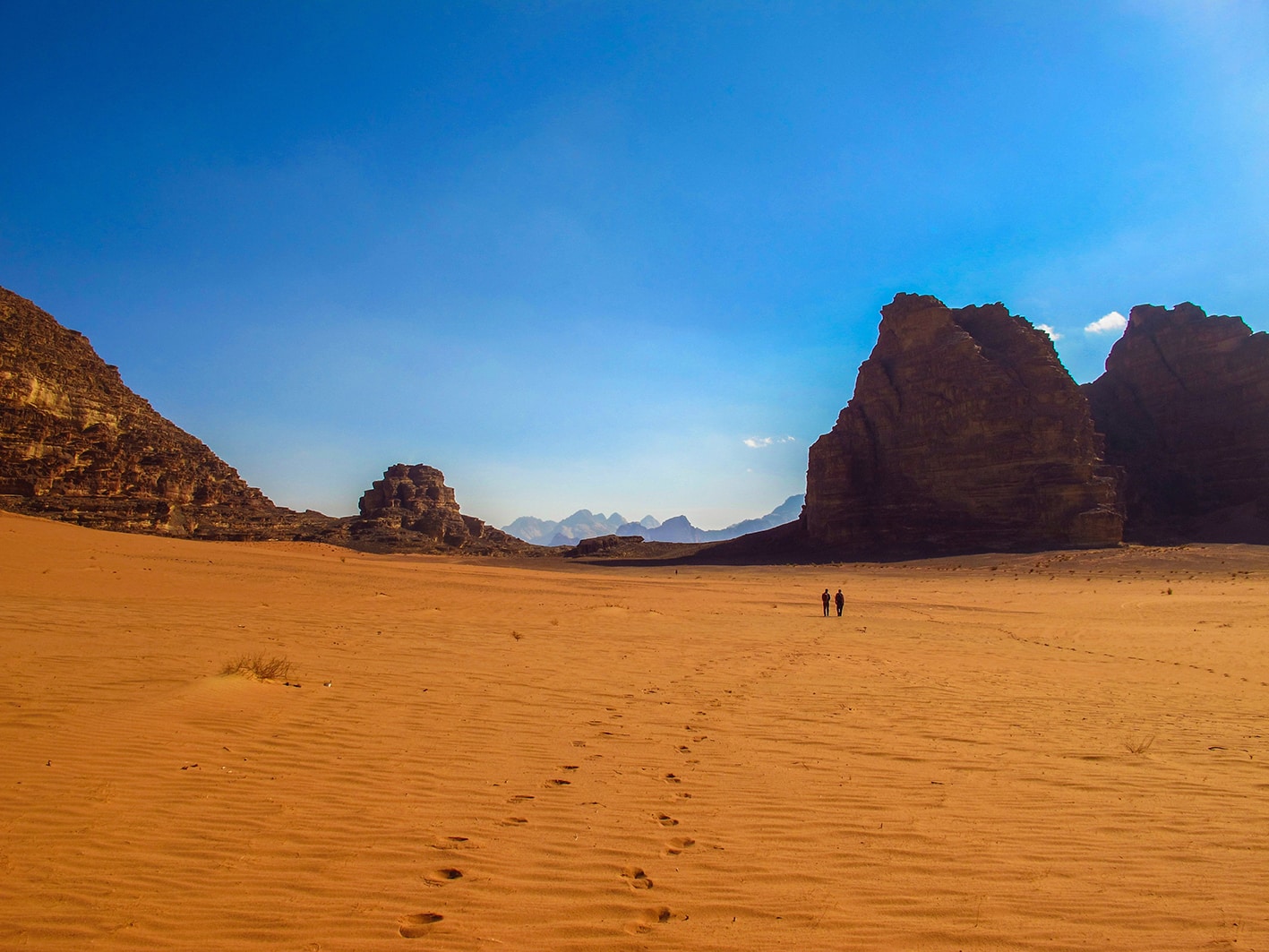
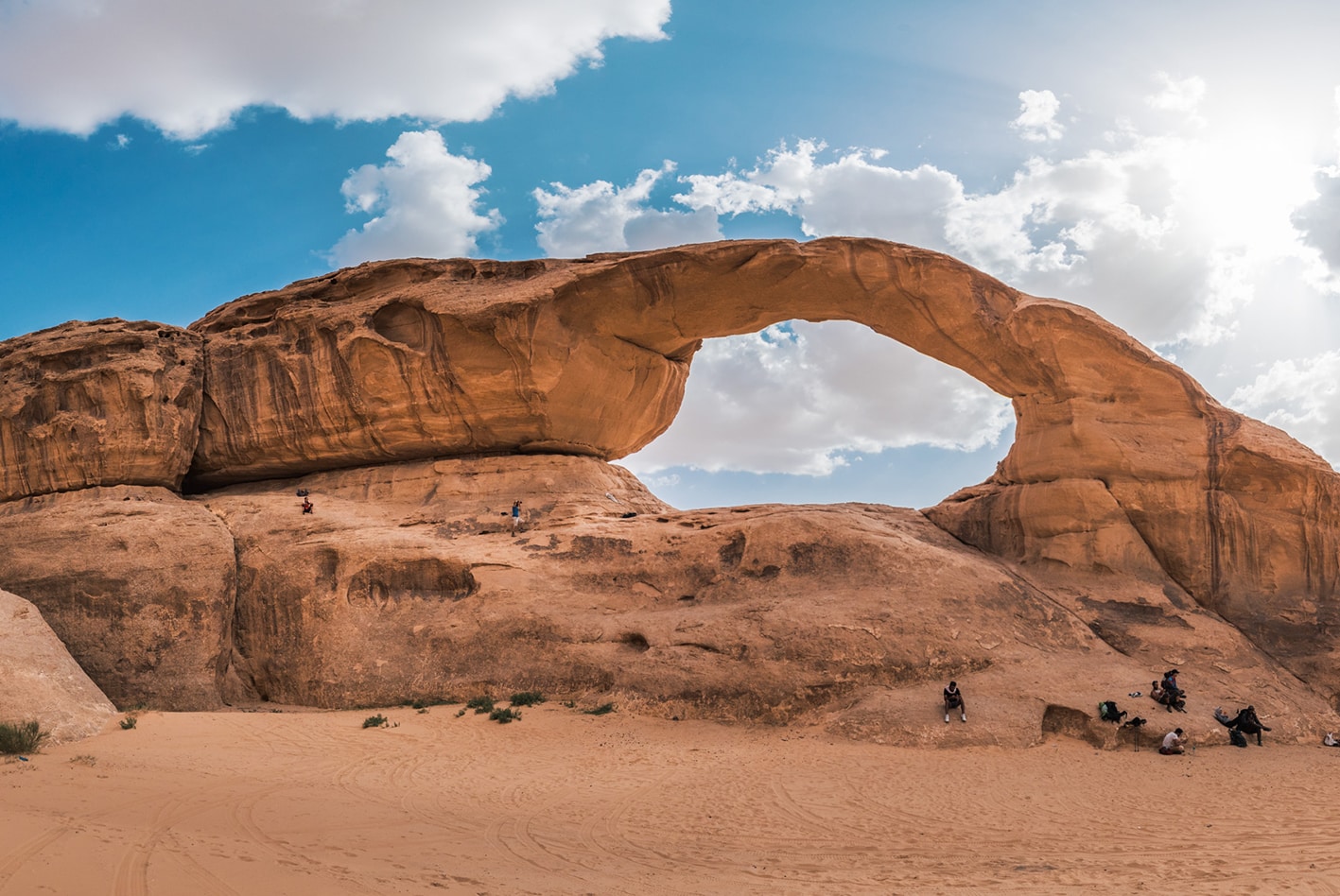
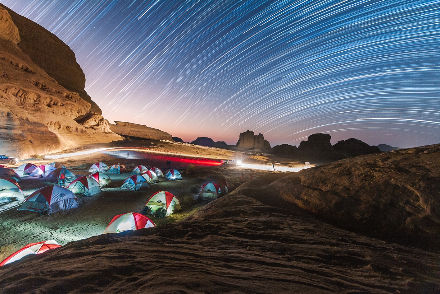
قرية رم، التي تقع على بعد حوالي 10 كم في نهاية طريق مسدود بعد مركز الزوار، تحتوي على عدد قليل من المتاجر و"البيت الاستراحة" (مطعم رخيص وخيار للإقامة)؛ تنطلق جولات الجيب التي تأخذك إلى مخيم صحراوي من مركز الزوار. كلا الموقعين يقعان على مسار درب الأردن.

كما هو مذكور في Jordan Jubilee، وهو المصدر الأكثر شمولاً وتحديثاً للمسافرين، هناك حافلة سياحية يومية (تنظمها الفنادق) تتحرك في الصباح الباكر من البتراء إلى وادي رم ثم تعود مرة أخرى؛ كما أن هناك حافلة فاخرة تابعة لشركة جت تنطلق مرة واحدة في الأسبوع من عمّان إلى وادي رم ليلة الخميس. ونظراً لعدم موثوقية المواصلات بشكل عام في المناطق النائية، ينبغي على المسافرين عدم الاعتماد على هذه الحافلات عند مغادرة وادي رم، وإنما التخطيط لاستئجار وسيلة نقل خاصة.

إذا كان إيجاد وسيلة نقل عام تصل بك مباشرة إلى وادي رم أمراً صعباً، فإن خيارك الآخر هو ركوب أي حافلة عامة (وليست تابعة لشركة جت أو حافلة سياحية) تسير على طول طريق الصحراء السريع (على سبيل المثال، بين عمّان والعقبة) والنزول عند تقاطع الراشدية. من هناك، يجب أن تجد وسيلة نقل خاصة أو تمشي على طول الطريق المتجه شرقاً إلى وادي رم والديسي

العقبة، باعتبارها مدينة كبرى، يسهل الوصول إليها بالحافلة من أي مكان تتوفر فيه الحافلات؛ كما أن التنقل داخل المدينة سهل ورخيص من خلال سيارات الأجرة الخضراء المحلية.

لا توجد حافلة عامة تصل إلى نقطة النهاية الجنوبية للمسار على طول شاطئ البحر الأحمر؛ ستحتاج إلى سيارة أجرة من العقبة للذهاب أو العودة.

لمزيد من المعلومات حول وسائل النقل في الأردن، اضغط هنا.

الإقامة

العقبة هي مدينة سياحية كبيرة وتحتوي على العديد من الفنادق. كما أن براري وادي رم مليئة بمخيمات سياحية، والتي عادةً ما تنقل الزوار من مركز الزوار إلى المخيم عبر جولة جيب ذات مناظر خلابة. لا يزال المتنزهون المستقلون نوعًا غير معروف إلى حد كبير؛ لكن إذا مشيت إلى أحد هذه المخيمات، قد تتمكن من المبيت هناك إذا توفرت غرف، أو حتى دفع أجرة النقل إلى مخيم آخر. في كل من العقبة ووادي رم، بالطبع، تختلف خيارات الإقامة الليلية بشكل واسع من حيث التكلفة ومستوى الفخامة والجودة.


تحتوي قرية رم أيضًا على "بيت الاستراحة"، وهو مطعم صغير يقدم خدمة التخييم في فنائه الخلفي مقابل 2 دينار أردني لاستخدام خيمتك الخاصة، و3 دنانير لاستخدام خيمة من عندهم. يشمل هذا السعر الاستحمام، والذي قد يكون به ماء ساخن أو لا.


ما لم تقم بانحراف عن المسار للإقامة في أحد المخيمات السياحية في وادي رم، لا توجد أماكن إقامة في هذه المنطقة – فالتخييم البري هو الخيار الوحيد.

The Jordan Trail is a newly established trail, and is not marked. It is therefore our strong recommendation that you hire a local guide for your safety as many sections are remote with limited water sources and at times no connectivity.
By downloading these maps/GPX you take full responsibility for their use and accuracy; Jordan Trail Association does not warrant the accuracy or completeness of the information, materials or the reliability of any maps as they provided AS IS without warranty of any kind, either express or implied, including but not limited to, fitness for a particular purpose, or non-infringement ;You acknowledge that any reliance on any such maps, shall be at your sole risk and responsibility as Hiking, backpacking, and other outdoor activities all have potential hazards involving risk of injury or death. Outdoor activities have inherent risks and you should ensure you have the skill level and abilities suitable for the activities in Jordan to partake in them and to take all precaution measures.  Check the data on Google Earth or other Apps or Programs before using them.  The Jordan Trail Association shall not be held responsible for any incidents that may occur during your participation in any activity and/or by using any of the maps/GPX.
AGREE
close-link