To download the Jordan Trail GPS tracks, اضغط هنا.
The Jordan Trail is a newly established trail, and is not marked. It is therefore our strong recommendation that you hire a local guide for your safety as many sections are remote with limited water sources and at times no connectivity.
By downloading these maps/GPX you take full responsibility for their use and accuracy; Jordan Trail Association does not warrant the accuracy or completeness of the information, materials or the reliability of any maps as they provided AS IS without warranty of any kind, either express or implied, including but not limited to, fitness for a particular purpose, or non-infringement ;You acknowledge that any reliance on any such maps, shall be at your sole risk and responsibility as Hiking, backpacking, and other outdoor activities all have potential hazards involving risk of injury or death. Outdoor activities have inherent risks and you should ensure you have the skill level and abilities suitable for the activities in Jordan to partake in them and to take all precaution measures. Check the data on Google Earth or other Apps or Programs before using them. The Jordan Trail Association shall not be held responsible for any incidents that may occur during your participation in any activity and/or by using any of the maps/GPX.
*في حال التواصل مع شرطة السياحة في حالة طارئة، يُرجى تحديد أنك تسير على درب الأردن، وذكر جنسيتك، موقعك الحالي، واسم ورقم الخريطة.
مكتب جمعية درب الأردن: +962 6 461 0999
(ساعات العمل: من 9:00 صباحًا حتى 5:00 مساءً، من الأحد إلى الخميس)
معلومات عامة
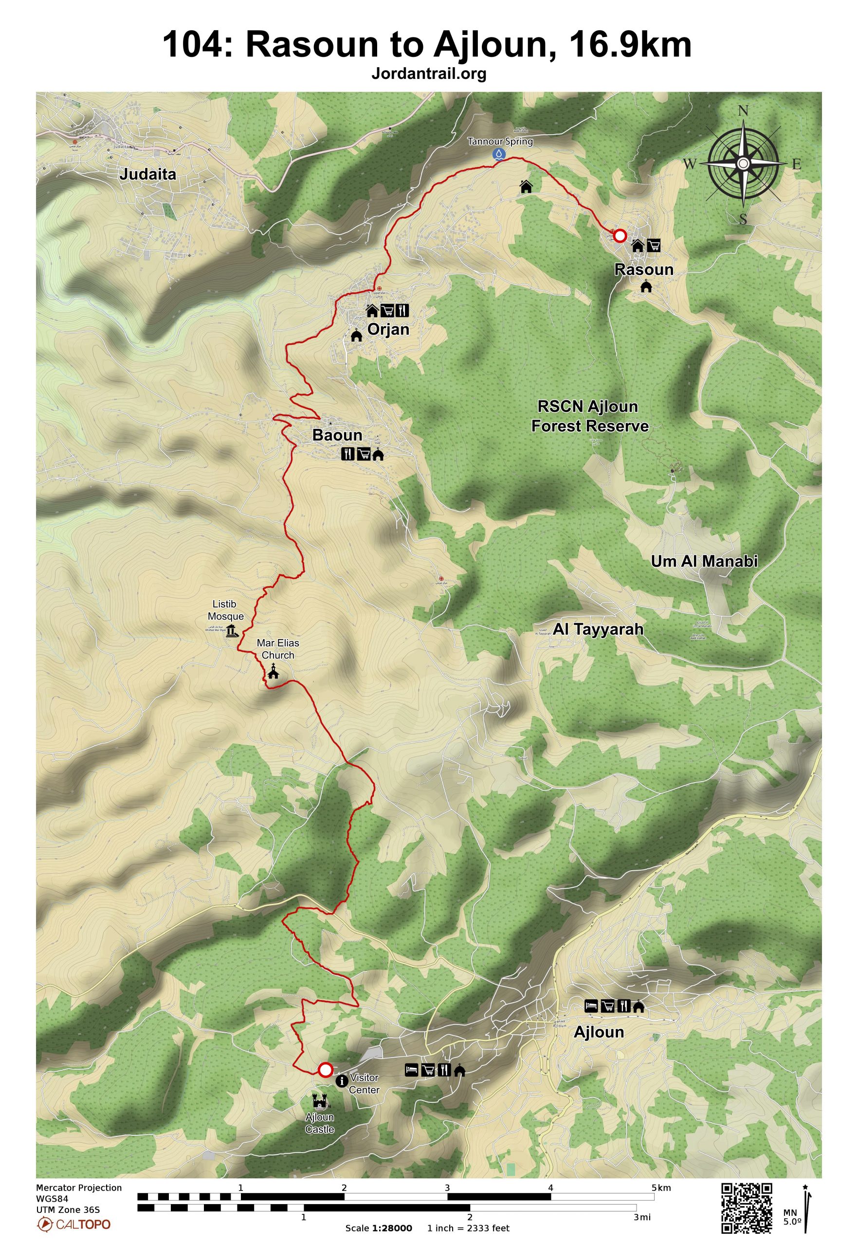
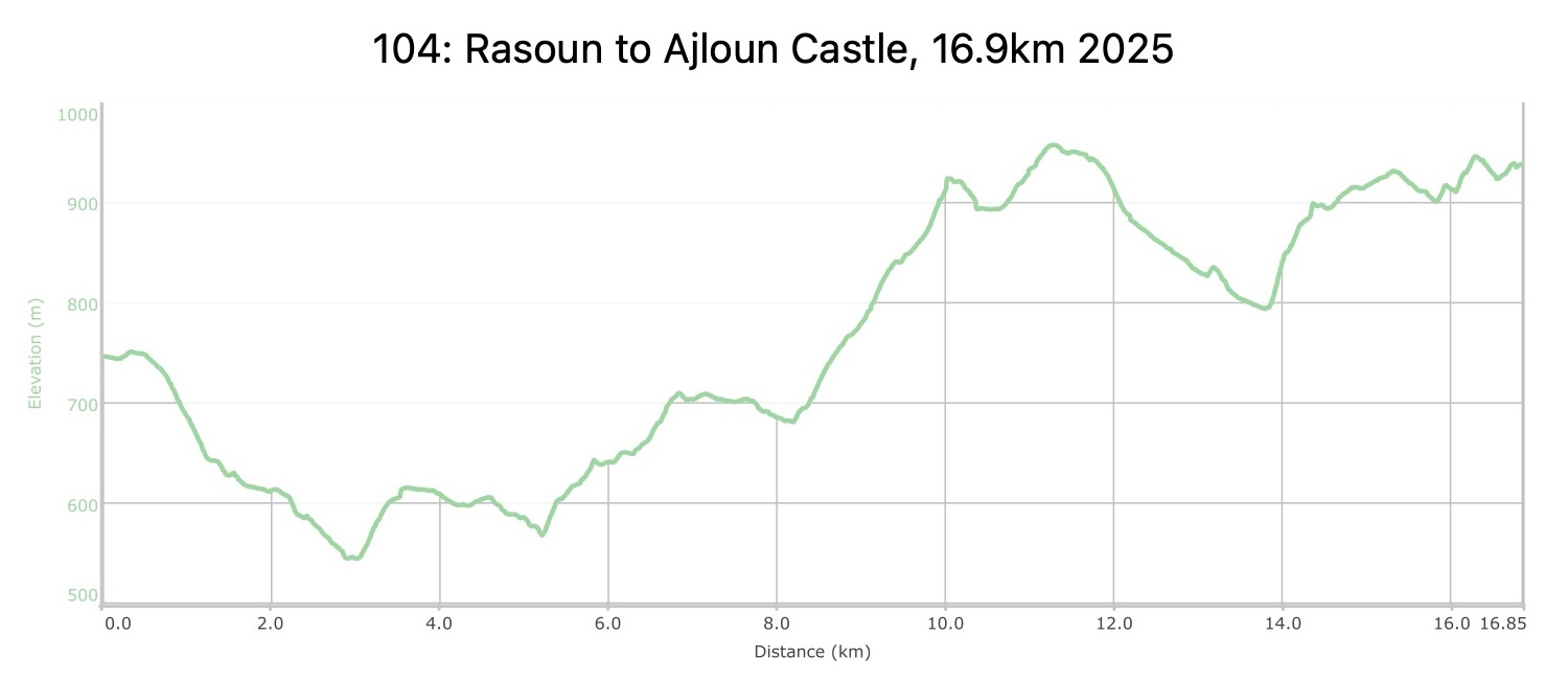
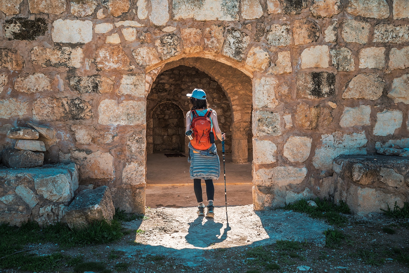
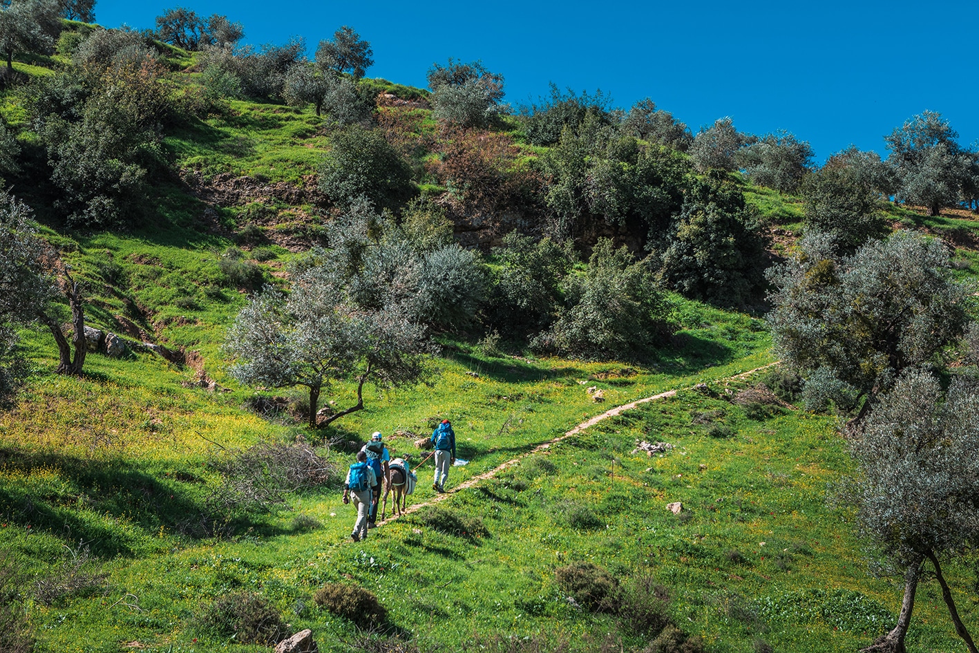
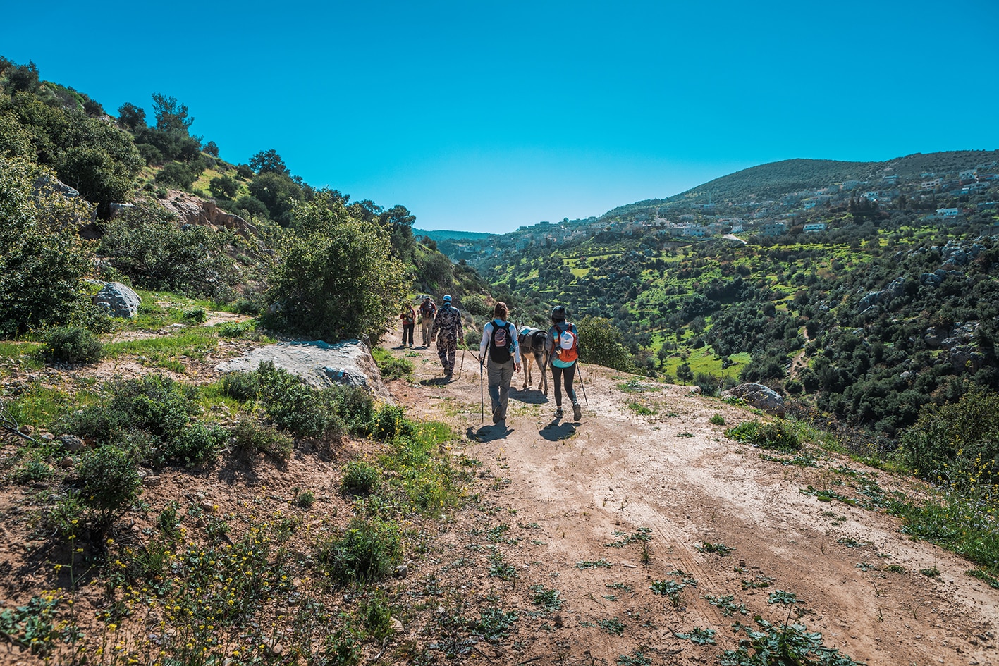
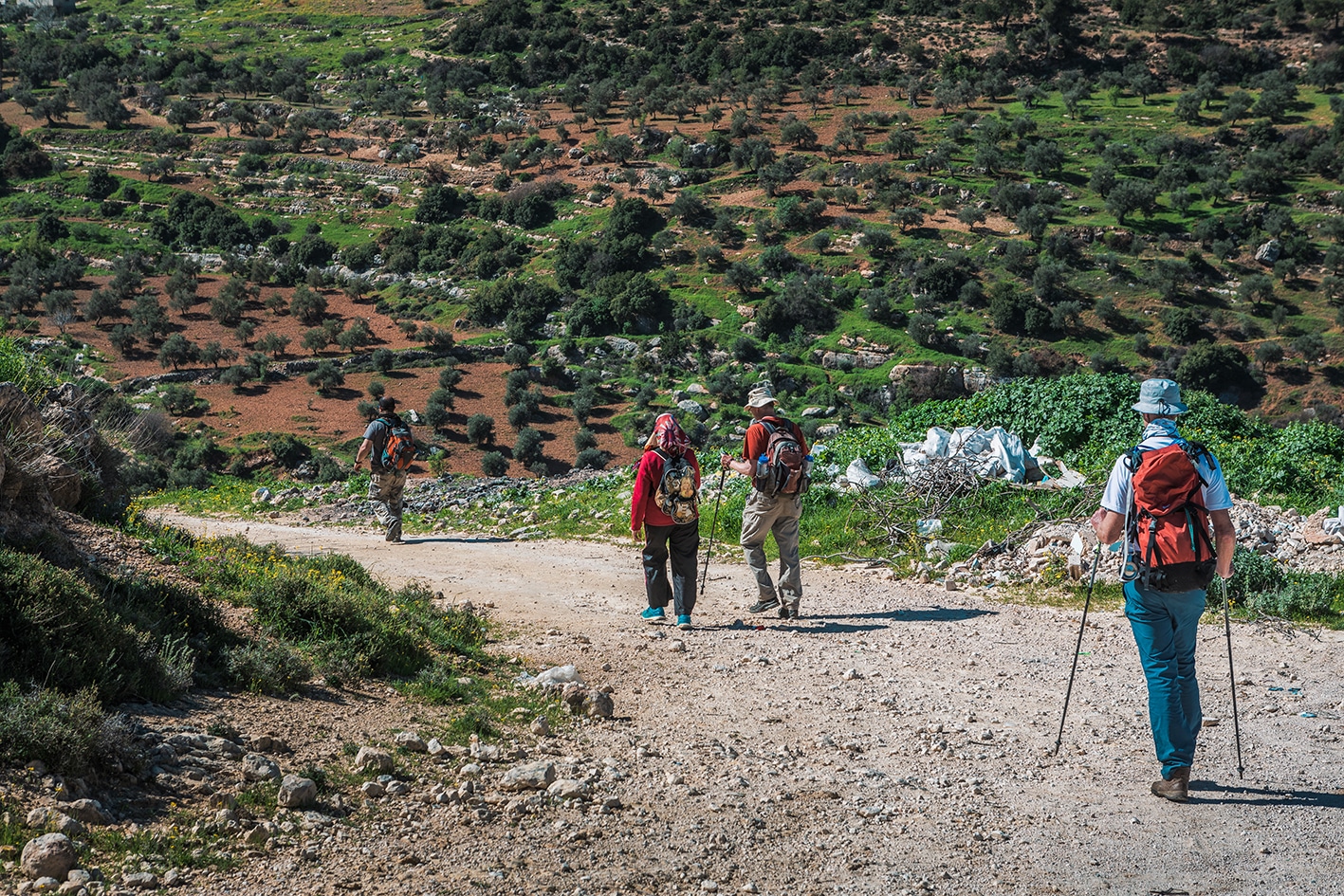
من السهل عموماً السير على الأقدام اليوم، وغالباً ما يكون المشي سهلاً على الممرات الريفية عبر قرى العيون الريفية مع فرص لتناول وجبة غداء مرتبة مسبقاً في أحد بيوت الضيافة في العيون. كما يقع بيت الصابون وبيت الخط التابع للمركز الملكي للثقافة والفنون بالقرب من بيت الخط العربي في زيارة ممتعة. ثم يتعرج المشي فوق التلال شبه الحرجية المرتفعة بشكل متزايد مروراً باثار كنيسة مار إلياس القديمة وصولاً إلى قلعة عجلون الإسلامية على قمة تلها المهيمن مع مركز للزوار ومقاهي وفنادق (متواضعة حالياً) في البلدة الواقعة أسفلها.
: مواصلات النقل العامة بين القرىلا توجد جداول زمنية محددة، حيث تغادر الحافلات عند امتلائها، وتعتمد العديد من الطرق على خدمات السيارات الخاصة فقط. التكلفة من باعون إلى عجلون تتراوح بين 5 و7 دينار أردني، ومن راسون إلى عجلون بين 7 و10 دينار أردني.
جهات الاتصال المحلية / أماكن الإقامة
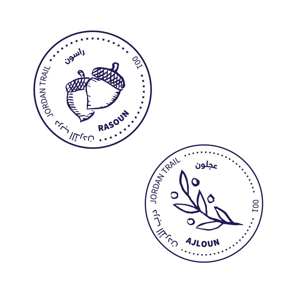
فندق عجلون: 96226420524+, خليل العريفج 962795656233+, يامن العريفج 962792922579+, ختم سجل الدرب عجلون
توجد في قرى راسون، وعرجان، وباعون محلات صغيرة أو بقالات لتلبية احتياجات الزوّار.
كافيه في قلعة عجلون
يوجد مطعم في فندق عجلون يقع على بُعد خطوات من القلعة، يُقدِّم وجبات للزوّار في موقع مميز بالقرب من المعلم التاريخي.
الماء:
تتوفر في قرى راسون, عرجان, وباعون
دورات مياه مار إلياس (قد ترغب في استخدامها للوضوء أو التنقية).
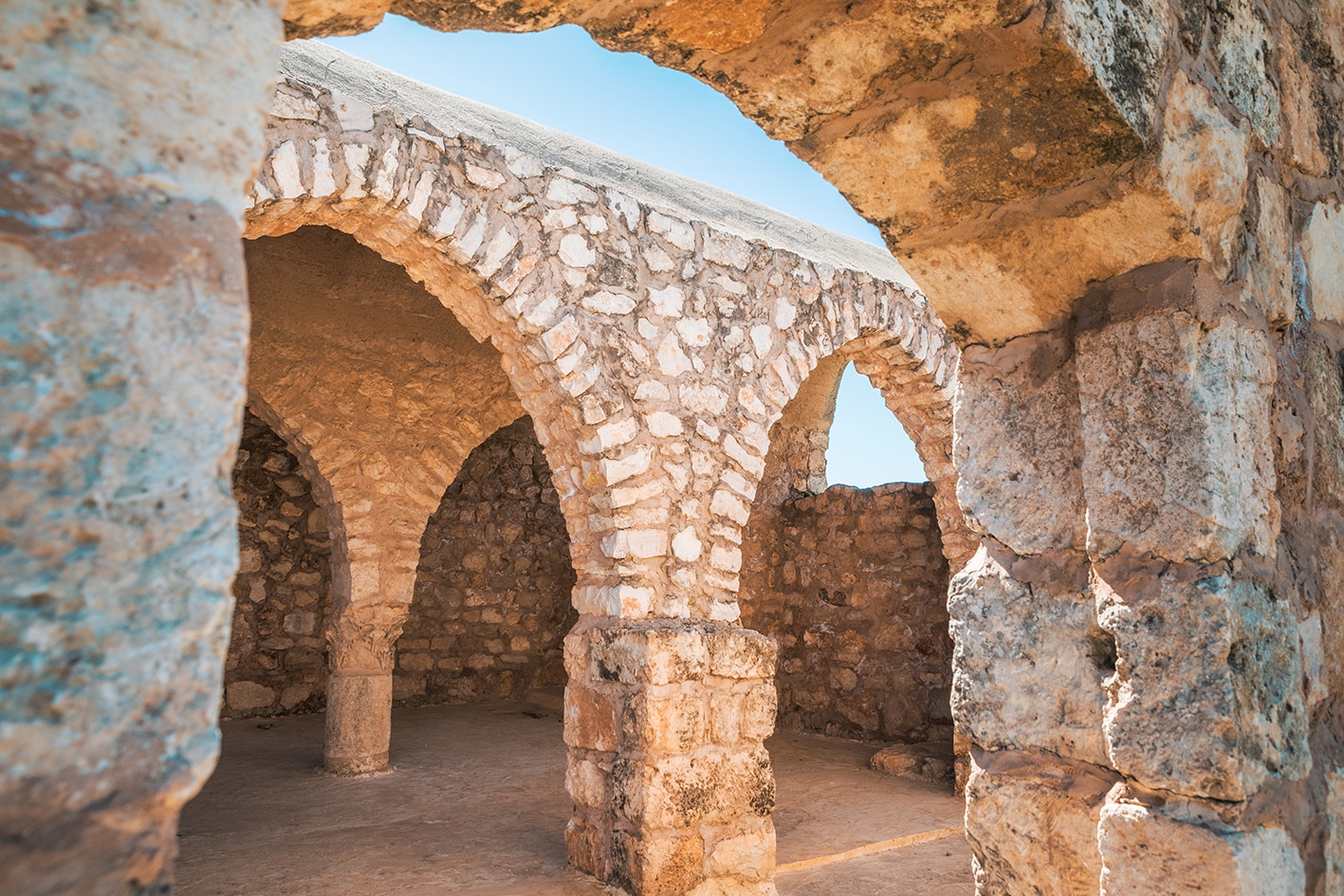
قلعة عجلون الأثرية
النصائح والسلامة العامة
النصائح:
استمتع بيومٍ رائع مليء بالإطلالات الخلابة، والقرى الودودة، وتنوّع المواقع التاريخية الساحرة.
المسار محدد بعلامات ويُستخدم بشكل متكرر.
السلامة العامة:
أرضية غير ثابتة – توجد فقط بضع مقاطع قصيرة جدًا عند الصعود أو النزول على الممر، حيث تكون الأرضية غير مستقرة قليلًا.
الحيوانات – قد يصادف المتنزهون كلاب الرعاة أثناء المسير.
The Jordan Trail is a newly established trail, and is not marked. It is therefore our strong recommendation that you hire a local guide for your safety as many sections are remote with limited water sources and at times no connectivity.
By downloading these maps/GPX you take full responsibility for their use and accuracy; Jordan Trail Association does not warrant the accuracy or completeness of the information, materials or the reliability of any maps as they provided AS IS without warranty of any kind, either express or implied, including but not limited to, fitness for a particular purpose, or non-infringement ;You acknowledge that any reliance on any such maps, shall be at your sole risk and responsibility as Hiking, backpacking, and other outdoor activities all have potential hazards involving risk of injury or death. Outdoor activities have inherent risks and you should ensure you have the skill level and abilities suitable for the activities in Jordan to partake in them and to take all precaution measures. Check the data on Google Earth or other Apps or Programs before using them. The Jordan Trail Association shall not be held responsible for any incidents that may occur during your participation in any activity and/or by using any of the maps/GPX.