0
0 items
No products in the cart.

القسم 403: وادي موجب إلى مجدلين

  • مسارات المشي في المنطقة

  • اليوم الثالث: وادي موجب إلى مجدلين

  • المسافة: 20.1 كم

  • الوقت اللازم للمسير: 7 ساعات

  • التحدي البدني: صعب جدًا

  • صعوبة المسار: صعب جدًا

  • اجمالي الصعوبة: صعب جدًا

  • تعليم المسار: نعم

لتحميل مسار GPS، اضغط هنا.  

The Jordan Trail is a newly established trail, and is not marked. It is therefore our strong recommendation that you hire a local guide for your safety as many sections are remote with limited water sources and at times no connectivity.
By downloading these maps/GPX you take full responsibility for their use and accuracy; Jordan Trail Association does not warrant the accuracy or completeness of the information, materials or the reliability of any maps as they provided AS IS without warranty of any kind, either express or implied, including but not limited to, fitness for a particular purpose, or non-infringement ;You acknowledge that any reliance on any such maps, shall be at your sole risk and responsibility as Hiking, backpacking, and other outdoor activities all have potential hazards involving risk of injury or death. Outdoor activities have inherent risks and you should ensure you have the skill level and abilities suitable for the activities in Jordan to partake in them and to take all precaution measures.  Check the data on Google Earth or other Apps or Programs before using them.  The Jordan Trail Association shall not be held responsible for any incidents that may occur during your participation in any activity and/or by using any of the maps/GPX.
AGREE
close-link

أنقر هنا

The Jordan Trail is a newly established trail, and is not marked. It is therefore our strong recommendation that you hire a local guide for your safety as many sections are remote with limited water sources and at times no connectivity.
By downloading these maps/GPX you take full responsibility for their use and accuracy; Jordan Trail Association does not warrant the accuracy or completeness of the information, materials or the reliability of any maps as they provided AS IS without warranty of any kind, either express or implied, including but not limited to, fitness for a particular purpose, or non-infringement ;You acknowledge that any reliance on any such maps, shall be at your sole risk and responsibility as Hiking, backpacking, and other outdoor activities all have potential hazards involving risk of injury or death. Outdoor activities have inherent risks and you should ensure you have the skill level and abilities suitable for the activities in Jordan to partake in them and to take all precaution measures.  Check the data on Google Earth or other Apps or Programs before using them.  The Jordan Trail Association shall not be held responsible for any incidents that may occur during your participation in any activity and/or by using any of the maps/GPX.
AGREE
close-link
لتحميل الخريطة
أرقام مهمة

الشرطة السياحية:

الخط الساخن: 117777
واتساب: +962770992690

*في حال التواصل مع شرطة السياحة في حالة طارئة، يُرجى تحديد أنك تسير على درب الأردن، وذكر جنسيتك، موقعك الحالي، واسم ورقم الخريطة.

مكتب جمعية درب الأردن: +962 6 461 0999

(ساعات العمل: من 9:00 صباحًا حتى 5:00 مساءً، من الأحد إلى الخميس)

معلومات عامة

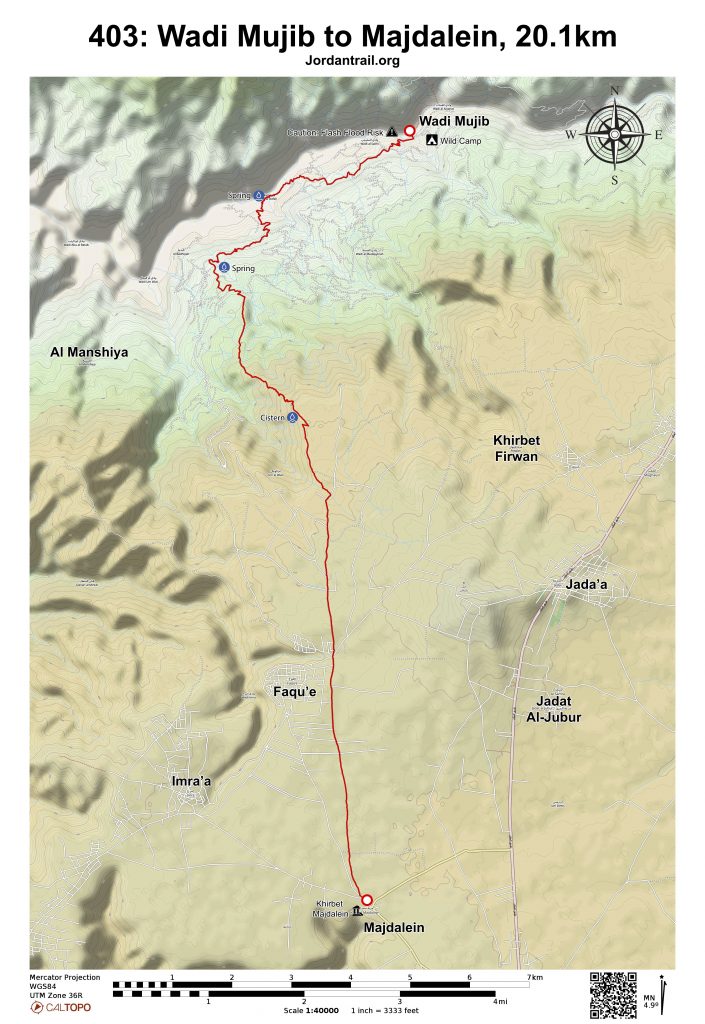
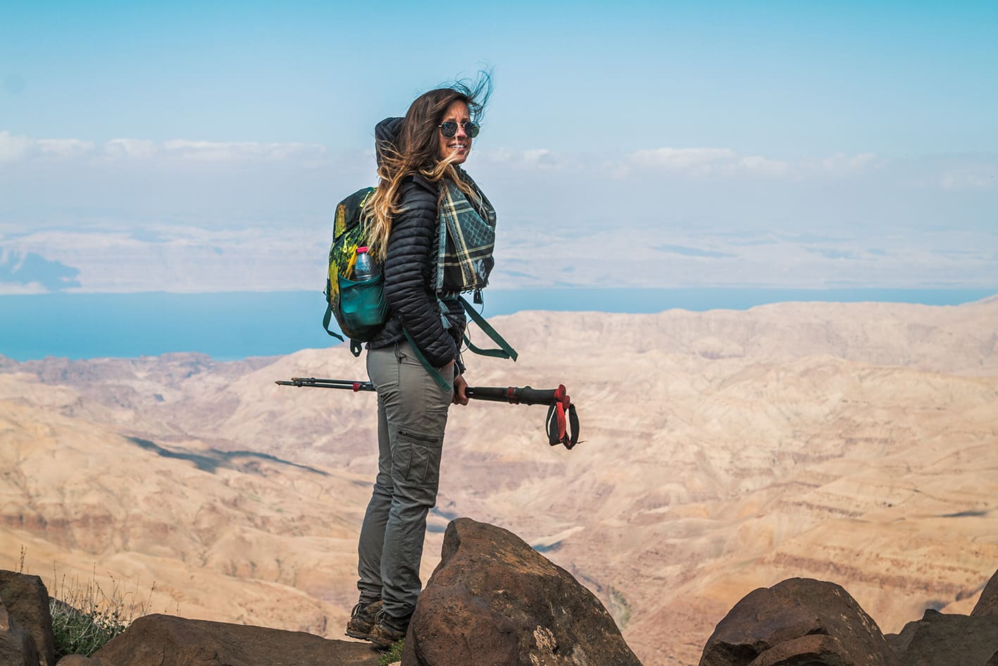
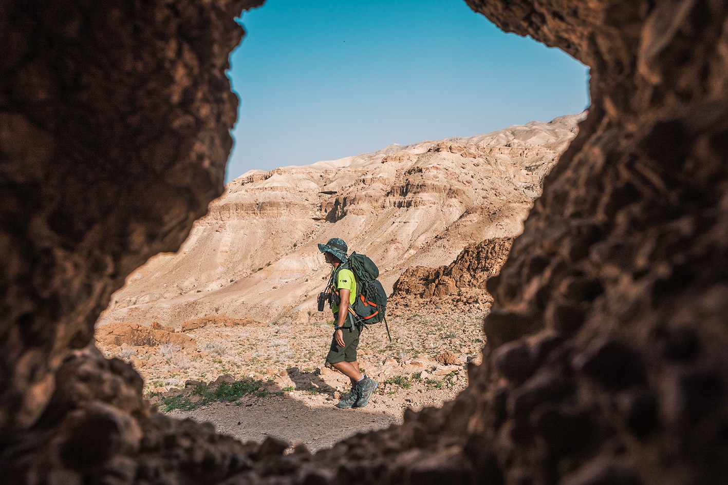
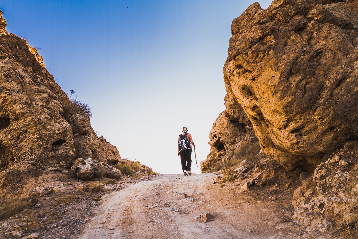
تباين في تضاريس اليوم، حيث يبدأ المسار مرة أخرى بصعود طويل وسط مناظر طبيعية قاحلة رائعة. يتبع مسار جيد الجانب الجنوبي للوادي ببطء، متجهاً جنوب شرق نحو حافة جبلية، ثم يصعد بين مناظر خلابة إلى حافة الأخدود. بعد ذلك، يسلك طريق صغير باتجاه الجنوب عبر الهضبة الخصبة العالية، ليصل في النهاية إلى طريق روماني قديم محاط بالصخور، يمر بالقرب من بلدة فقوع الصغيرة وقرية مجدلين القديمة المهجورة الواقعة على حافة وادي ابن حماد، حيث تطل مناظر رائعة.

وسائل النقل
  • لا توجد حافلات مباشرة إلى القرى الواقعة على المسار، لذا يُمكن أخذ حافلة إلى مادبا ومن هناك استخدام وسيلة نقل خاصة للوصول إلى المسار.
  • يمكن الوصول إلى وادي الموجب عبر مجموعة متنوعة من الطرق الترابية باستخدام سيارات الدفع الرباعي.
جهات الاتصال المحلية / أماكن الإقامة
  • التخييم البري, كرم خريسه, 962798372030+
  • التخييم البري, محمد بشابشه, 962791534734+
أهم المعالم التي يمكن مشاهدتها
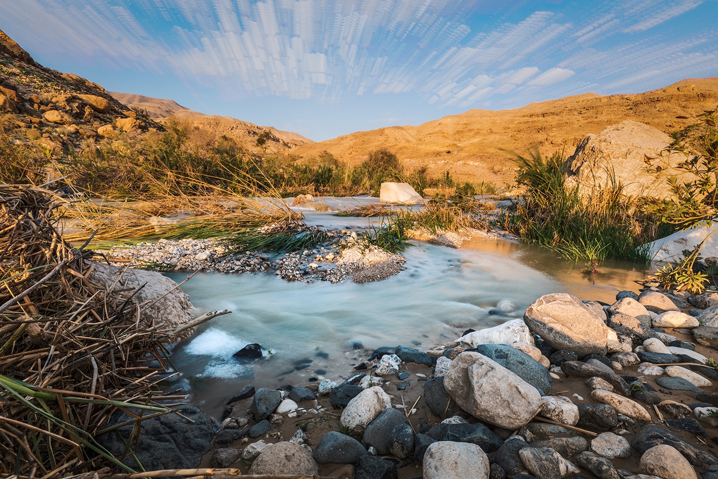
  • وادي موجب.
  • المقابر.
  • مبانٍ مهدّمة على طول الطريق.
  • بلدة فَقوع وإطلالات خلّابة من فوق التلة.
  • آثار قرية مجدلين.
الطعام والماء

الطعام:

  • محال تجارية صغيرة في فقوع

الماء:

  • المياه: مجرى وادي الموجب (يتطلب تنقية قبل الشرب).
  • قرية فقوع
  • لا يتوفر ماء حاليًا مباشرة عند آثار قرية مجدلين في نهاية المرحلة، لكنك ستمر بعد الوصول إلى الطريق بعدة بيوت يمكن أن تقدم المساعدة.
النصائح والسلامة العامة

النصائح:

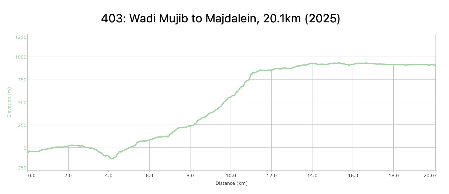
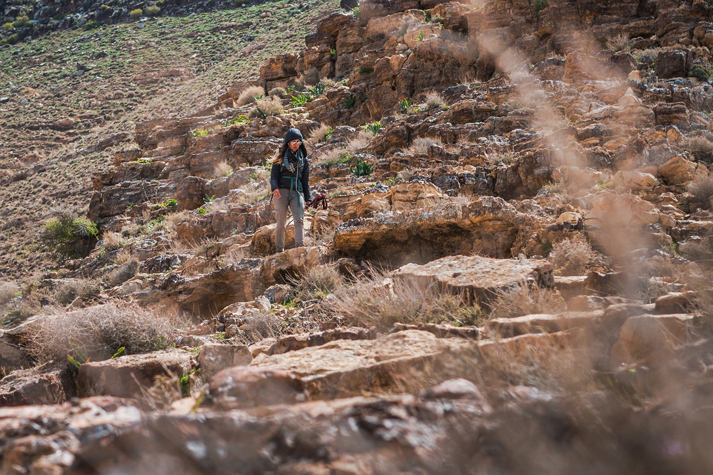
  • كن مستعدًا نفسيًا لأطول صعود على درب الأردن حتى الآن، بارتفاع يقارب 1200 متر خارج وادي الموجب. يصبح المسار أكثر انحدارًا كلما تقدمت، ويُعد على الأرجح الأكثر تحديًا في كامل الدرب. الأرضية أثناء الصعود أفضل مما تبدو من الأسفل. إذا واجهت صعوبة في تتبع المسار، واصل السير على امتداد التلال. بالقرب من القمة، يصبح الميل الحاد ممكنا للصعود باتباع الحافة الصخرية التي تشبه سلالم حجرية متينة لمعظم الطريق. وعند الاقتراب من الأعلى، قد يبدو المسار مستحيلاً، لكن ستجد طريقًا واسعًا وممهدًا يلتف يسارًا عبر طبقة البازلت على حافة الوادي. قد يكون هذا الجزء صعبًا لمن يعانون من خوف شديد من المرتفعات، لكنه ممكنا لمعظم الناس. إذا كنت متجهًا شمالًا نزولًا، فكن حذرًا جدًا!
  • سطح المسار قاسٍ على الأقدام، خصوصًا بعد عدة أيام من السير في طرق وعرة.
  • احذر من فيضانات وادي موجب إذا كان هناك توقعات لهطول الأمطار.
  • يمكنك التفكير في التخييم بعد 3 كم من بداية المرحلة، قرب خروجك من وادي الموجب، لتقليل طول اليوم وجعل الصعود يبدأ أبكر.

السلامة العامة:

  • الحواف المكشوفة: كما ورد في النصائح أعلاه – تظهر فقط عند القمة في مقطع قصير.
  • مخاطر السيول: في قاع وادي الموجب، خصوصًا عند منطقة العبور التي تقع أسفل منطقة الصخور المتساقطة والنبع.
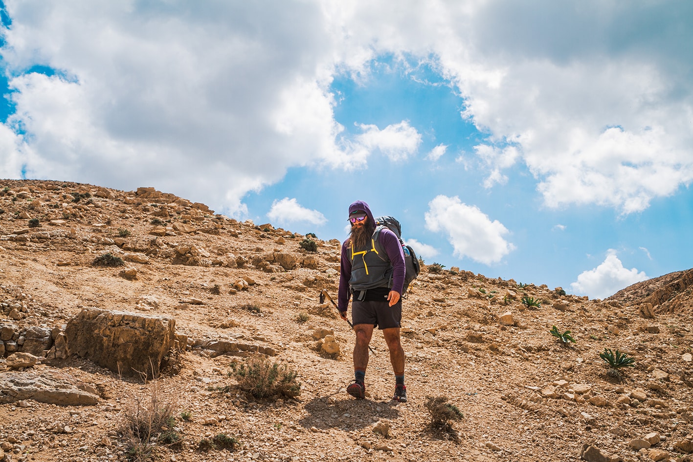
  • الأرضية غير المستقرة: يحتوي الصعود على بعض المقاطع ذات الأرضية غير المستقرة، لكنها قابلة للمشاة باستخدام أحذية مناسبة وعصي المشي. الصعود عادة أسهل من النزول.
  • الجفاف/الإرهاق الحراري: الظل محدود بعد مغادرة المنطقة القريبة من وادي الموجب، لذا يُنصح بالانطلاق باكرًا لتجنب التسلق تحت شمس الظهيرة الحارقة.

تغطية الهاتف المحمول: الخدمة متوفرة في معظم أجزاء المرحلة، لكنها ضعيفة في قاع وادي الموجب وبعض المقاطع. شركة أورانج توفر تغطية أفضل من زين في هذه المنطقة.

وسائل النقل الإقليمية

نحن لا نزال نجمع هذه المعلومات. هل لديك أي تفاصيل قد تكون مفيدة؟  شاركها معنا!

لمزيد من المعلومات حول وسائل النقل في الأردن، اضغط هنا.

The Jordan Trail is a newly established trail, and is not marked. It is therefore our strong recommendation that you hire a local guide for your safety as many sections are remote with limited water sources and at times no connectivity.
By downloading these maps/GPX you take full responsibility for their use and accuracy; Jordan Trail Association does not warrant the accuracy or completeness of the information, materials or the reliability of any maps as they provided AS IS without warranty of any kind, either express or implied, including but not limited to, fitness for a particular purpose, or non-infringement ;You acknowledge that any reliance on any such maps, shall be at your sole risk and responsibility as Hiking, backpacking, and other outdoor activities all have potential hazards involving risk of injury or death. Outdoor activities have inherent risks and you should ensure you have the skill level and abilities suitable for the activities in Jordan to partake in them and to take all precaution measures.  Check the data on Google Earth or other Apps or Programs before using them.  The Jordan Trail Association shall not be held responsible for any incidents that may occur during your participation in any activity and/or by using any of the maps/GPX.
AGREE
close-link