Search
Close this search box.

القسم 102: زقلاب إلى بيت إيدس

  • مسار المشي في المنطقة

  • اليوم الثاني: زقلاب إلى بيت إيدس

  • المسافة: 21.9 كيلومتر

  • الوقت: 8 ساعات

  • التحديات الجسدية: صعب

  • تحديات المسار: صعب

  • التحديات الكلية: صعب

  • التحديد على المسار: نعم

To download the Jordan Trail GPS tracks, click here

The Jordan Trail is a newly established trail, and is not marked. It is therefore our strong recommendation that you hire a local guide for your safety as many sections are remote with limited water sources and at times no connectivity.
By downloading these maps/GPX you take full responsibility for their use and accuracy; Jordan Trail Association does not warrant the accuracy or completeness of the information, materials or the reliability of any maps as they provided AS IS without warranty of any kind, either express or implied, including but not limited to, fitness for a particular purpose, or non-infringement ;You acknowledge that any reliance on any such maps, shall be at your sole risk and responsibility as Hiking, backpacking, and other outdoor activities all have potential hazards involving risk of injury or death. Outdoor activities have inherent risks and you should ensure you have the skill level and abilities suitable for the activities in Jordan to partake in them and to take all precaution measures.  Check the data on Google Earth or other Apps or Programs before using them.  The Jordan Trail Association shall not be held responsible for any incidents that may occur during your participation in any activity and/or by using any of the maps/GPX.
AGREE
close-link
أنقر هنا

The Jordan Trail is a newly established trail, and is not marked. It is therefore our strong recommendation that you hire a local guide for your safety as many sections are remote with limited water sources and at times no connectivity.
By downloading these maps/GPX you take full responsibility for their use and accuracy; Jordan Trail Association does not warrant the accuracy or completeness of the information, materials or the reliability of any maps as they provided AS IS without warranty of any kind, either express or implied, including but not limited to, fitness for a particular purpose, or non-infringement ;You acknowledge that any reliance on any such maps, shall be at your sole risk and responsibility as Hiking, backpacking, and other outdoor activities all have potential hazards involving risk of injury or death. Outdoor activities have inherent risks and you should ensure you have the skill level and abilities suitable for the activities in Jordan to partake in them and to take all precaution measures.  Check the data on Google Earth or other Apps or Programs before using them.  The Jordan Trail Association shall not be held responsible for any incidents that may occur during your participation in any activity and/or by using any of the maps/GPX.
AGREE
close-link
لتحميل الخريطة
أرقام مهمة

الشرطة السياحية:

الخط الساخن: 117777
واتساب: +962770992690

*في حال التواصل مع شرطة السياحة في حالة طارئة، يُرجى تحديد أنك تسير على درب الأردن، وذكر جنسيتك، موقعك الحالي، واسم ورقم الخريطة.

مكتب جمعية درب الأردن: +962 6 461 0999

(ساعات العمل: من 9:00 صباحًا حتى 5:00 مساءً، من الأحد إلى الخميس)

معلومات عامة

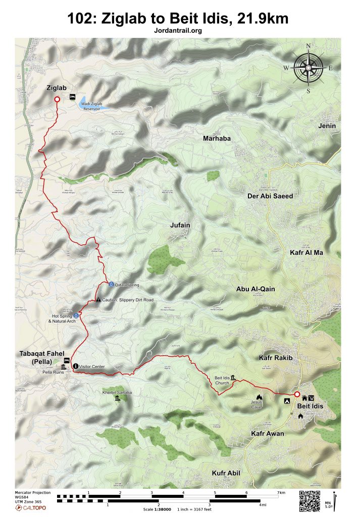
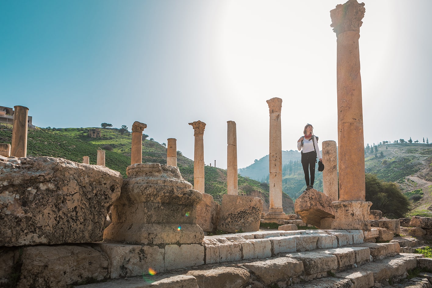
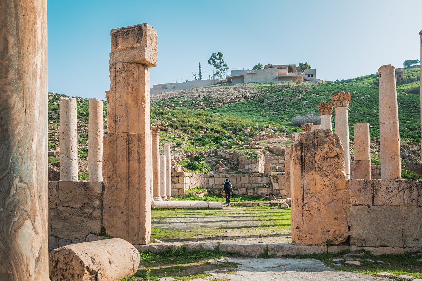
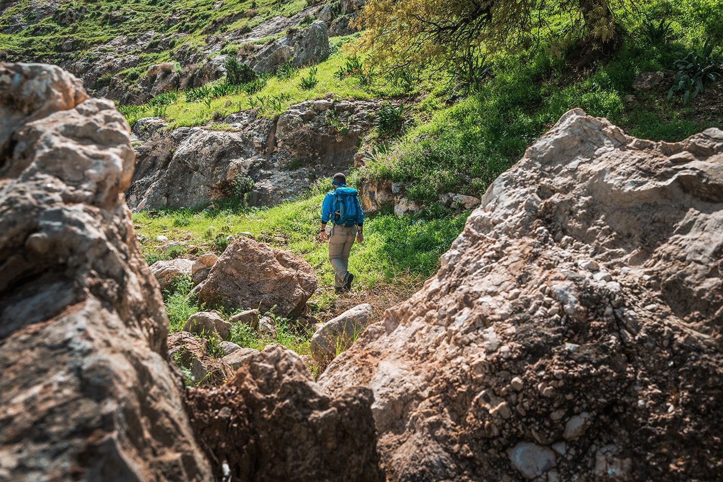
يتجه المسار جنوبًا من بوابة شرحبيل بن حسنة، مرتفعًا تدريجيًا حول التلال الواقعة فوق السهل الزراعي الذي يقل عن مستوى سطح البحر في غور الأردن، حيث ينخفض المسار لفترة قصيرة عبر الحقول قبل أن يصعد مرة أخرى إلى التلال. يتابع الطريق جنوبًا، حيث تعبر المسارات وطرق السير قمم التلال، ثم ينحدر مسار جيد إلى الجنوب الغربي نحو الينابيع الساخنة والقوس الطبيعي، ومنها يؤدي طريق ريفي إلى آثار بيلا اليونانية والرومانية، مع بيت الضيافة على التل أعلاها، وفندق الريف وبيوت الضيافة في قرية طبقة فحل أدناه. نواصل السير على جانب وادي يُدعى وادي الجرّيم خلف الآثار، لنخرج بين أشجار الصنوبر إلى المروج المرتفعة. ونواصل متابعة خط الوادي، الذي يُسمى الآن وادي سير، حيث تمر بأطلال كنيسة بيزنطية ثم تصل إلى "كهف المسيح" قبل التوجه إلى قرية بيت إيدس.

وسائل النقل
  • خدمة الحافلات من إربد إلى بيت إيدس
  • سائقون خاصون (مركبات صغيرة) بين القرى – اطلب من أحدهم سائقًا إلى منطقة معينة وقم بالتفاوض على السعر.
جهات الاتصال المحلية / أماكن الإقامة
  • بيت الضيافة: جمعية المسامير الذهبية, فادي مقدادي, 962772114138+
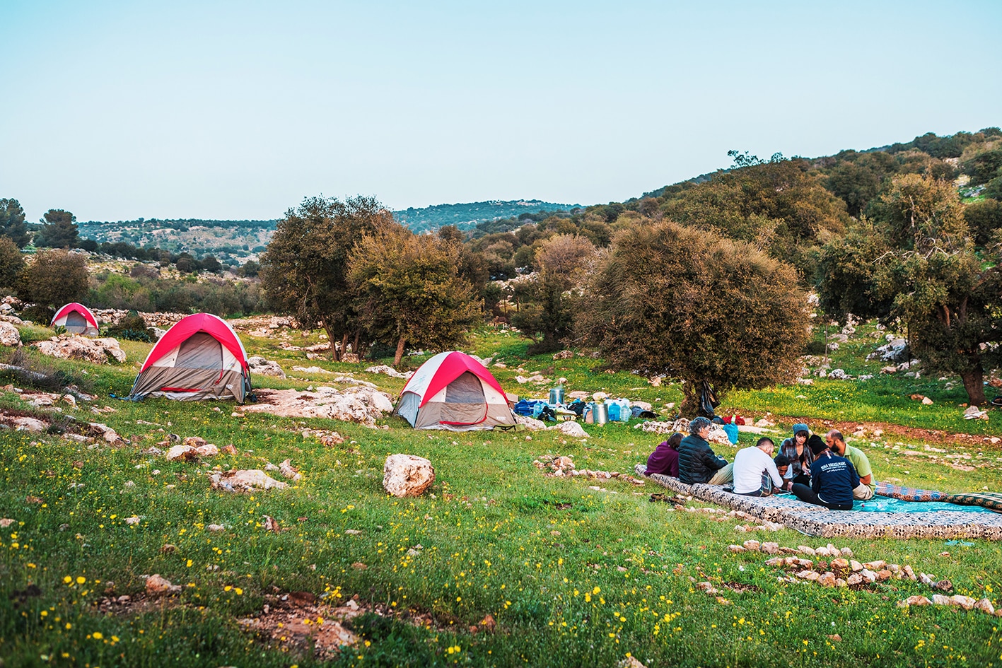
  • التخييم البري: يحيى مبارك, 962787443710+
  • فندق بيلا الريفي, محمد جواهرة, 962797055901+ www.pellacountrysidehotel.com
  • بيت الضيافة: بيت الفنان, 962776667660+ barakadestinations.com
  • بيت الضيافة: محمد الدويكات, 962772293291+ JT Pass Stamp Rasoun
أهم المعالم التي يمكن مشاهدتها
  • وادي الأردن
  • القوس الصخري الطبيعي
  • الينابيع الحارة
  • آثار بيلا
  • "كهف المسيح" أو "كهف معصرة الزيتون"
  • آثار كنيسة بيت إيدس
الطعام والماء

الطعام:

  • طبقة فحل - متاجر (خارج المسار).
  • بيت إيدس - متاجر.

الماء:

  • نبعة قطرة (يُفضل تنقية المياه قبل الشرب).
  • لم يتم التأكد من توفر مياه في مركز زوار بيلا. تقع قرية طبقة فحل بالقرب من الموقع لكنها خارج المسار.
  • تتواجد منازل متفرقة على طول الطريق طوال اليوم.
  • بيت إيدس
النصائح والسلامة العامة

النصائح:

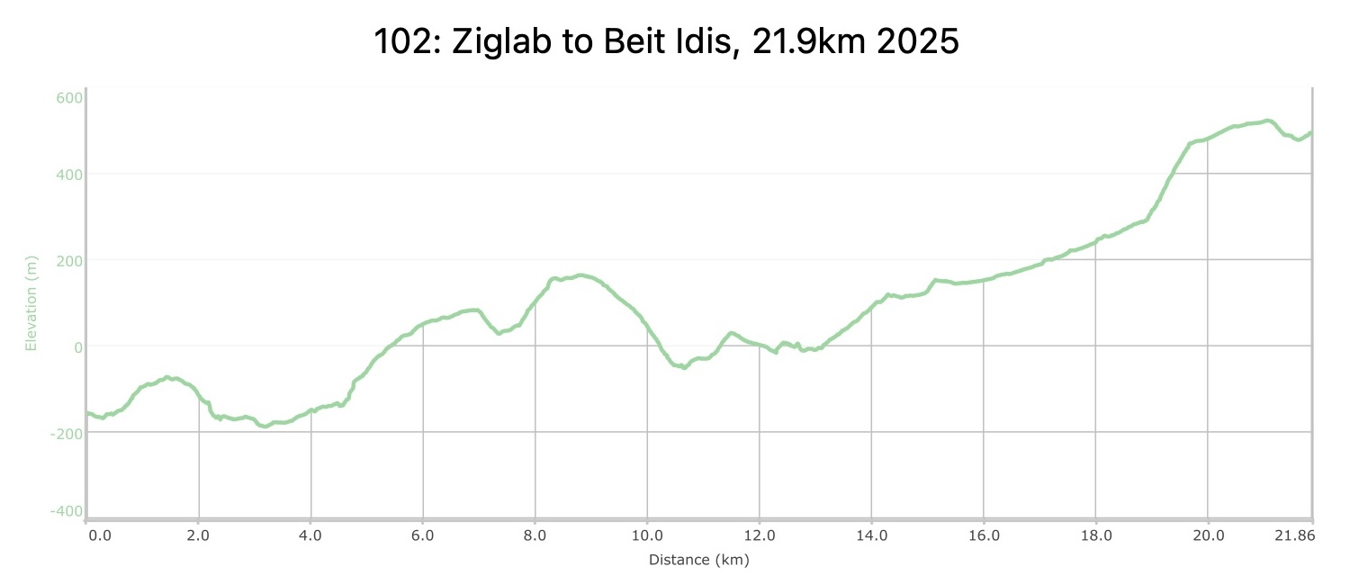
  • كن مستعدًا لمسافة طويلة تتضمن صعودًا حادًا في بدايتها، يتبعها لاحقًا صعود طويل من منطقة بيلا للخروج من غور الأردن.
  • المسار محدد بعلامات ويُستخدم بشكل متكرر.

السلامة العامة:

  • حواف مكشوفة – توجد بعض المقاطع القصيرة بعد عين أم قيس وبعد بيلا.
  • مخاطر السيول – عبور الأودية وبعض الأجزاء الضيقة من وادي سير، لكنها بشكل عام ليست خطيرة جداً.
  • الحيوانات – انتبه لوجود كلاب الرعاة.
  • الجفاف / الإنهاك الحراري – يُعتبر مشكلة في المناطق المنخفضة، لكنه ليس بنفس شدة اليوم السابق، إذ تكون الأجزاء الأكثر حرارة من المسار على ارتفاع أعلى. بعد منطقة بيلا، يمكن العثور على المزيد من الظلال من أشجار البلوط الكبيرة.
  • قاعدة عسكرية – يُرجى تجنّب الاقتراب من المنطقة العسكرية الواقعة قبل بيلا مباشرة، وابقَ على المسار المحدد بعلامات الطريق.

The Jordan Trail is a newly established trail, and is not marked. It is therefore our strong recommendation that you hire a local guide for your safety as many sections are remote with limited water sources and at times no connectivity.
By downloading these maps/GPX you take full responsibility for their use and accuracy; Jordan Trail Association does not warrant the accuracy or completeness of the information, materials or the reliability of any maps as they provided AS IS without warranty of any kind, either express or implied, including but not limited to, fitness for a particular purpose, or non-infringement ;You acknowledge that any reliance on any such maps, shall be at your sole risk and responsibility as Hiking, backpacking, and other outdoor activities all have potential hazards involving risk of injury or death. Outdoor activities have inherent risks and you should ensure you have the skill level and abilities suitable for the activities in Jordan to partake in them and to take all precaution measures.  Check the data on Google Earth or other Apps or Programs before using them.  The Jordan Trail Association shall not be held responsible for any incidents that may occur during your participation in any activity and/or by using any of the maps/GPX.
AGREE
close-link