Search
Close this search box.

القسم 201: عجلون إلى خريبة السوق

  • مسارات المشي في المنطقة

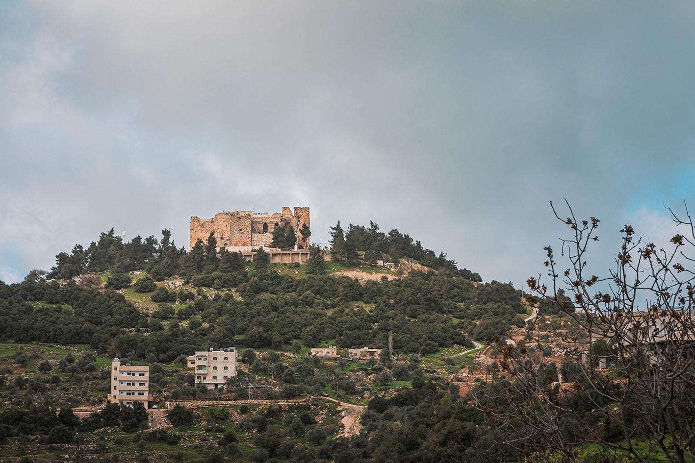
  • اليوم الأول: قلعة عجلون إلى خريبة السوق

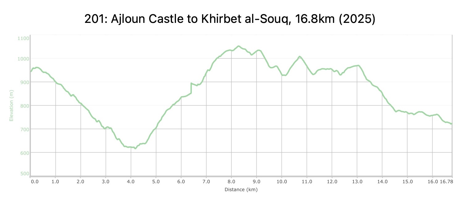
  • المسافة: 16.8 كيلومتر

  • الوقت: 5-6 ساعات

  • التحديات الجسدية: صعب

  • تحديات المسار: متوسط

  • التحديات الكلية: متوسط

  • التحديد على المسار: نعم

لتحميل مسار GPS، اضغط هنا.

The Jordan Trail is a newly established trail, and is not marked. It is therefore our strong recommendation that you hire a local guide for your safety as many sections are remote with limited water sources and at times no connectivity.
By downloading these maps/GPX you take full responsibility for their use and accuracy; Jordan Trail Association does not warrant the accuracy or completeness of the information, materials or the reliability of any maps as they provided AS IS without warranty of any kind, either express or implied, including but not limited to, fitness for a particular purpose, or non-infringement ;You acknowledge that any reliance on any such maps, shall be at your sole risk and responsibility as Hiking, backpacking, and other outdoor activities all have potential hazards involving risk of injury or death. Outdoor activities have inherent risks and you should ensure you have the skill level and abilities suitable for the activities in Jordan to partake in them and to take all precaution measures.  Check the data on Google Earth or other Apps or Programs before using them.  The Jordan Trail Association shall not be held responsible for any incidents that may occur during your participation in any activity and/or by using any of the maps/GPX.
AGREE
close-link

أنقر هنا

The Jordan Trail is a newly established trail, and is not marked. It is therefore our strong recommendation that you hire a local guide for your safety as many sections are remote with limited water sources and at times no connectivity.
By downloading these maps/GPX you take full responsibility for their use and accuracy; Jordan Trail Association does not warrant the accuracy or completeness of the information, materials or the reliability of any maps as they provided AS IS without warranty of any kind, either express or implied, including but not limited to, fitness for a particular purpose, or non-infringement ;You acknowledge that any reliance on any such maps, shall be at your sole risk and responsibility as Hiking, backpacking, and other outdoor activities all have potential hazards involving risk of injury or death. Outdoor activities have inherent risks and you should ensure you have the skill level and abilities suitable for the activities in Jordan to partake in them and to take all precaution measures.  Check the data on Google Earth or other Apps or Programs before using them.  The Jordan Trail Association shall not be held responsible for any incidents that may occur during your participation in any activity and/or by using any of the maps/GPX.
AGREE
close-link
لتحميل الخريطة
أرقام مهمة

الشرطة السياحية:

الخط الساخن: 117777
واتساب: +962770992690

*في حال التواصل مع شرطة السياحة في حالة طارئة، يُرجى تحديد أنك تسير على درب الأردن، وذكر جنسيتك، موقعك الحالي، واسم ورقم الخريطة.

مكتب جمعية درب الأردن: +962 6 461 0999

(ساعات العمل: من 9:00 صباحًا حتى 5:00 مساءً، من الأحد إلى الخميس)

معلومات عامة

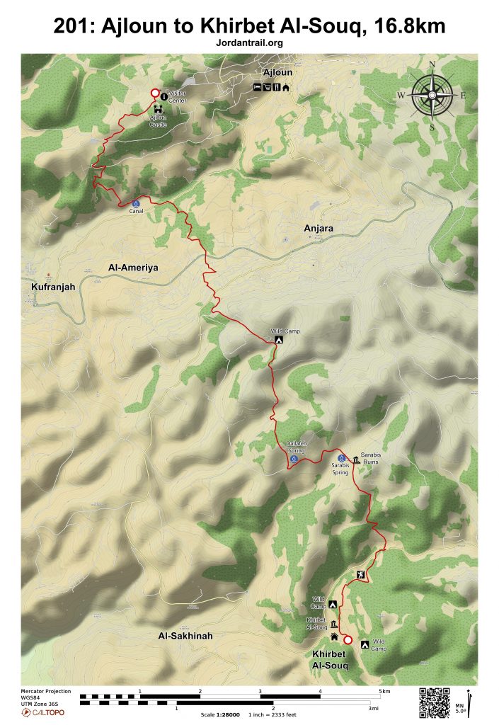
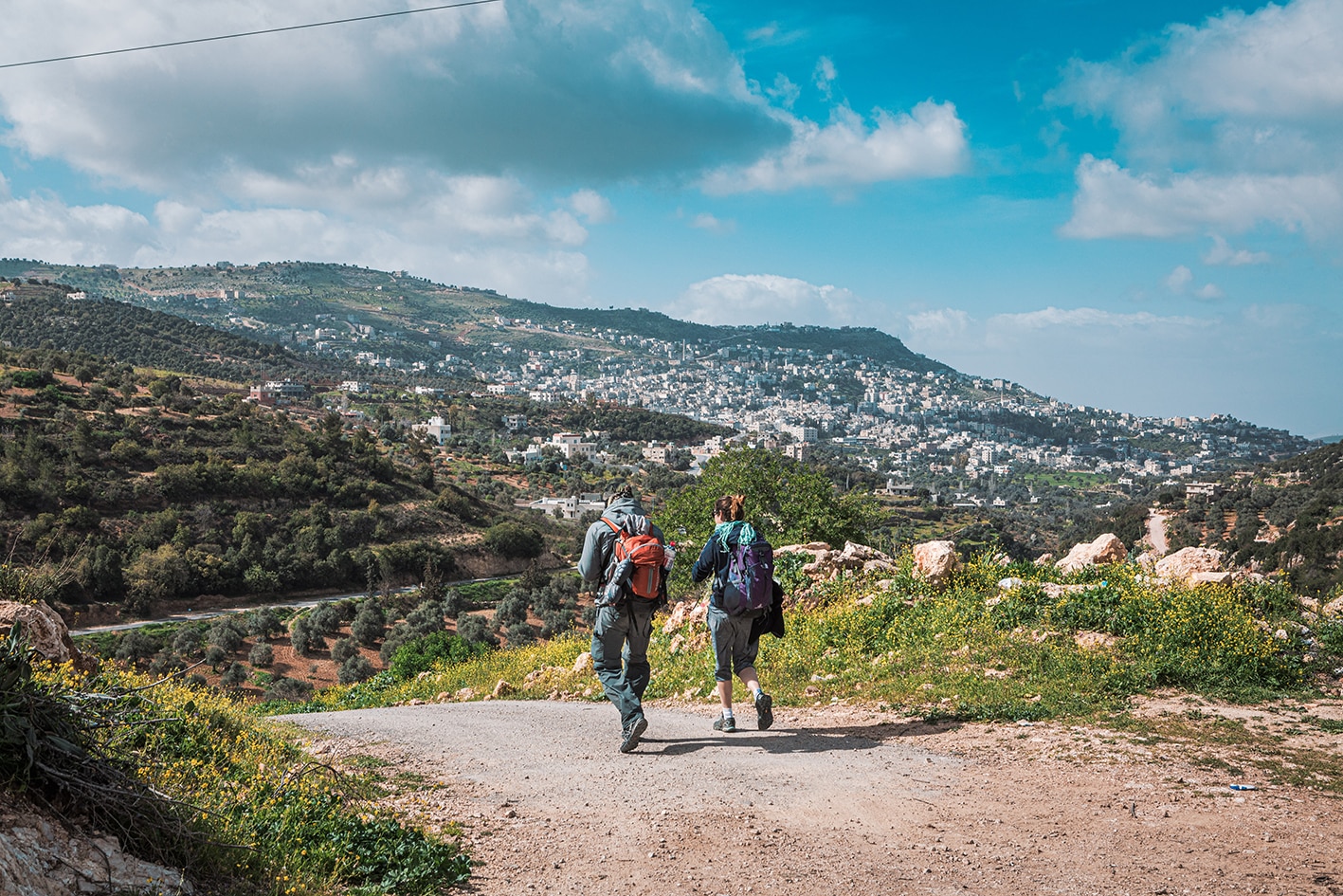
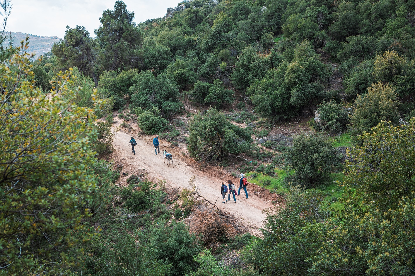
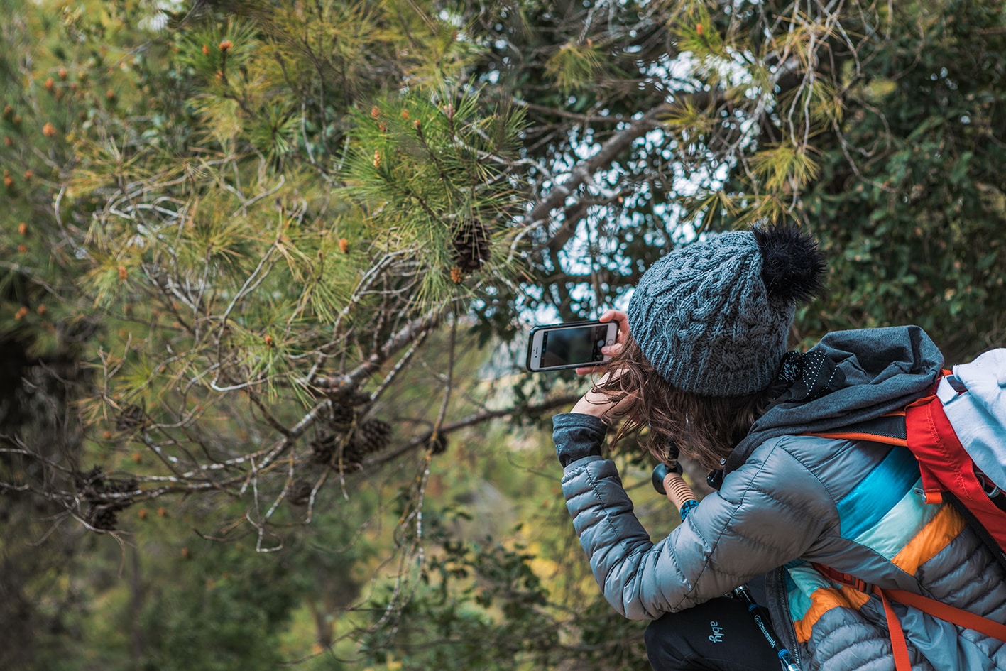
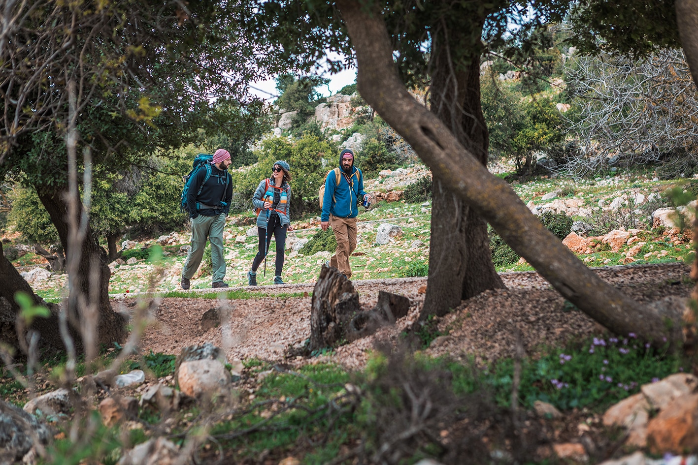
تبدأ الرحلة بإطلالات جميلة ومشياً ممتعاً نحو الجنوب على تلة مغطاة بأشجار الصنوبر المتناثرة نحو بداية وادي الطواحين. بعد عبور الوادي، تصعد الممرات الضيقة مجدداً مروراً ببساتين الزيتون، متجنبةً بلدتي عنجرة وكفرنجة، قبل أن تلتف حول الطرف الغربي للتلال المطلة على الوادي. تستمر الطرق الريفية الهادئة مروراً بالقرية المهجورة القديمة سرابيس ونافورتها، ثم تعبر المزيد من التلال المتموجة وصولاً إلى وادي محمود الجميل، الذي يشتهر بجرفه الشهير المناسب لتسلق الرياضات الصعبة. يتبع المسار الرائع حافة الجرف ليدور حول الوادي التالي وصولاً إلى خربة السوق، حيث تتوفر بيوت ضيافة للراحة والإقامة.

وسائل النقل

عجلون - حافلات من عمان (محطة الحافلات الشمالية) إلى عجلون، ثم من عجلون يمكن ركوب حافلة أو تاكسي إلى قلعة عجلون. لا توجد جداول زمنية محددة للحافلات، حيث تغادر عند اكتمال عدد الركاب.

عنجرة - تمر حافلات محلية بين عجلون وعنجرة.

خريبة السوق - تتوفر خدمة حافلات من عنجرة إلى راجب، حيث تصل إلى السخنة على بعد ٣ كيلومترات من خريبة السوق.

  • من خريبة السوق إلى جرش مسافة 15 كيلومتر. يمكنك الانطلاق عبر طريق راجب، ثم الاستعانة بسيارة من الطريق الرئيسي والبحث عن تاكسي خدمات (تكلفته 1 دينار للسخنة، و10 دنانير لجرش).
جهات الاتصال المحلية / أماكن الإقامة


  • بيت الضيافة: عيسى الزغول, 962799831041+ , JT Pass Stamp Khirbet Al-Souq
أهم المعالم التي يمكن مشاهدتها
  • قلعة عجلون الأثرية (رسم الدخول: ٣ دنانير أردنية للشخص).
  • مقام النبي خضر بالقرب من مدخل قلعة عجلون.
  • نبع ماء دلافة (مياه عذبة).
  • نبع ماء سرابيس (مياه عذبة).
  • آثار قرية ساربيس.
  • جرف محمود (مسارات تسلق مزودة بمسامير وقبور أثرية).
  • خريبة السوق. 
  • فستق بري.
الطعام والماء
الطعام:
  • تتوفر وجبات الطعام بالقرب من قلعة عجلون داخل مدينة عجلون، وفي عنجرة، وكذلك في خريبة السوق.
  • في خربة السوق، يوجد متجر صغير يبيع الوجبات الخفيفة والمياه فقط، ويمتلكه حابس زغور.

الماء:

  • يوجد على المسار ينبوعان يتدفقان دائمًا (يُفضل تنقية المياه قبل الشرب): عين حنيش وعين سارابيس.
النصائح والسلامة العامة

النصائح:

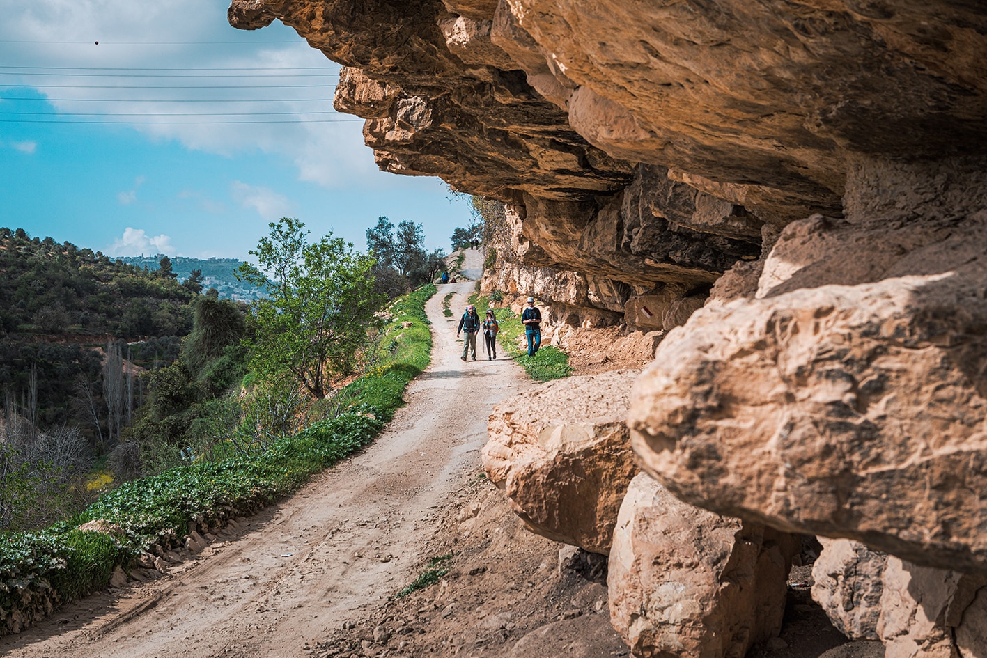
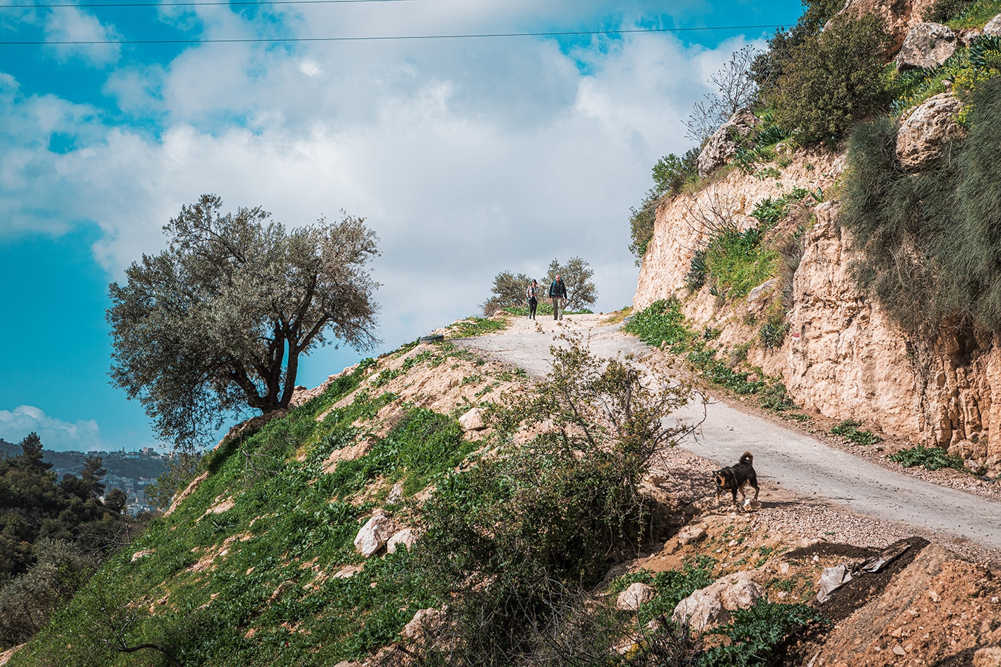
  • اليوم يسير بشكل مريح في الغالب، مع وجود بعض المقاطع الوعرة في بداية الطريق، بينما يكون باقي المسار على الطرق المعبدة.
  • قد يتم تحويل بعض مقاطع هذا اليوم، لذا يُنصح بالتحقق من جمعية درب الأردن للحصول على أفضل مسار للنزول من قلعة عجلون.
  • توفر الظل على طول المسار.
  • يمكن الوصول إلى معظم أجزاء المسار بالسيارة.
  • يتوفر موقف سيارات عند نقطة البداية (قلعة عجلون الأثرية ) وكذلك في نقطة النهاية (خربة السوق).
  • تتوفر دورات المياه أيضًا في نقاط البداية والنهاية عند قلعة عجلون، وكذلك في بيوت الضيافة التابعة لمقدمي الخدمة.
  • تتوفر خدمة الشبكة للهاتف المحمول على طول الطريق بالكامل.
  • تتوفر أجهزة الصراف الآلي في وسط مدينة عجلون.
  • موقع جيد للتخييم مع إطلالة جميلة في منطقة "أم الخشاب".

السلامة العامة:

  • أرضية غير مستقرة – المسار غير واضح جيدًا عند النزول من قلعة عجلون؛ قد يتم تحويل هذا الجزء من المسار.
  • الحيوانات – يُنصح بالحذر من كلاب الرعاة.
جهات الاتصال المحلية

أبو جوهر (عجلون) 6420525-02/ 079779254

عيسى زغول (خريبة السوق) - 0799831041

The Jordan Trail is a newly established trail, and is not marked. It is therefore our strong recommendation that you hire a local guide for your safety as many sections are remote with limited water sources and at times no connectivity.
By downloading these maps/GPX you take full responsibility for their use and accuracy; Jordan Trail Association does not warrant the accuracy or completeness of the information, materials or the reliability of any maps as they provided AS IS without warranty of any kind, either express or implied, including but not limited to, fitness for a particular purpose, or non-infringement ;You acknowledge that any reliance on any such maps, shall be at your sole risk and responsibility as Hiking, backpacking, and other outdoor activities all have potential hazards involving risk of injury or death. Outdoor activities have inherent risks and you should ensure you have the skill level and abilities suitable for the activities in Jordan to partake in them and to take all precaution measures.  Check the data on Google Earth or other Apps or Programs before using them.  The Jordan Trail Association shall not be held responsible for any incidents that may occur during your participation in any activity and/or by using any of the maps/GPX.
AGREE
close-link