





0
0 items
No products in the cart.
0
0 items
No products in the cart.

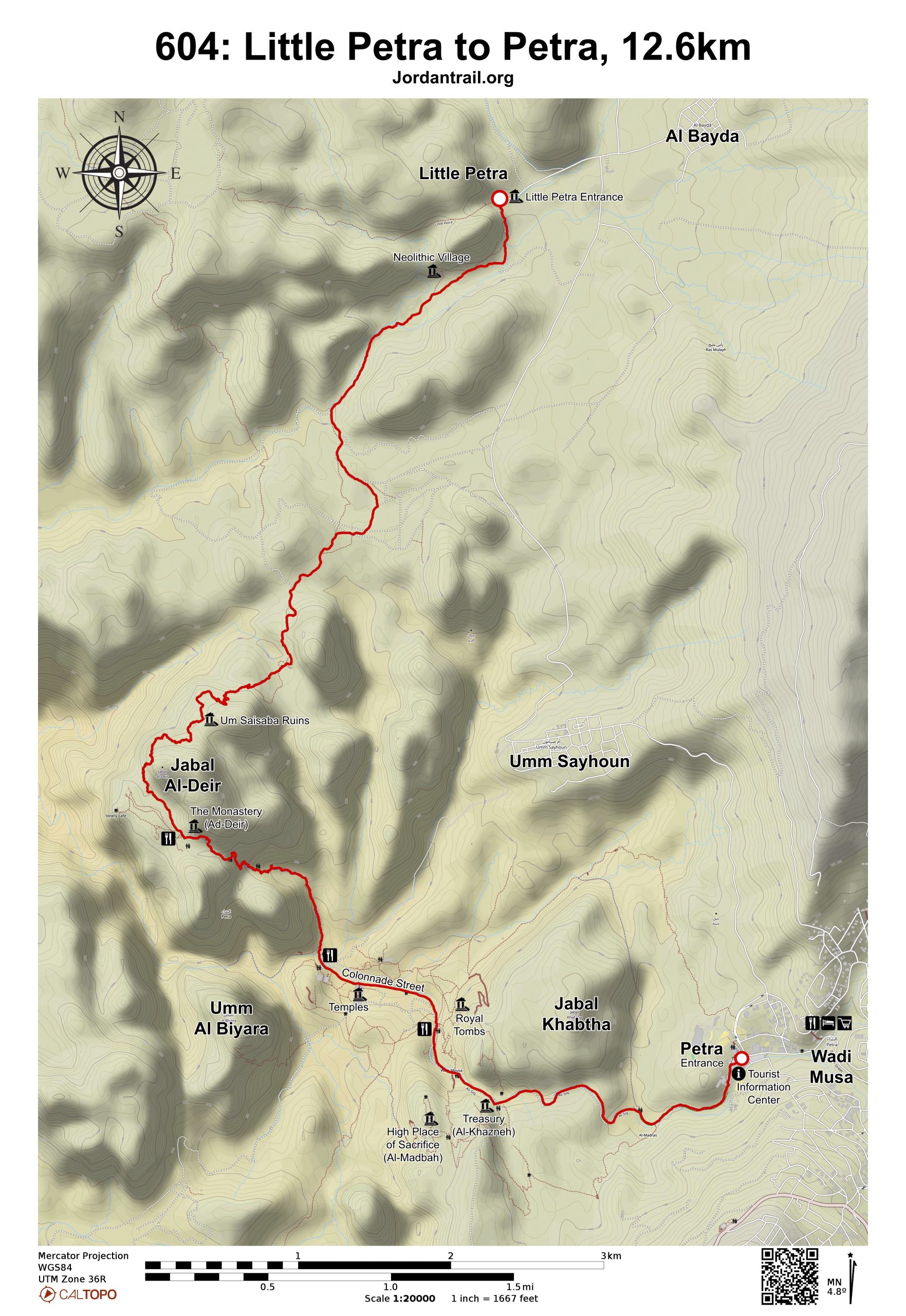
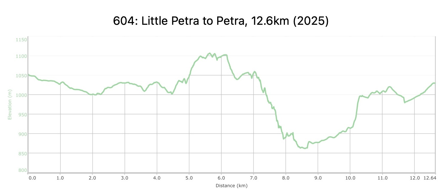
القسم 604: البترا الصغيرة إلى البترا

  • مسارات المشي في المنطقة

  • اليوم الرابع: البترا الصغيرة إلى البترا

  • المسافة: 12.6 كم

  • الوقت اللازم للمسير: 3-4 ساعات

  • التحدي البدني: متوسط

  • صعوبة المسار: سهل

  • اجمالي الصعوبة: سهل

  • تعليم المسار: No

لتحميل مسار GPS، اضغط هنا.  

The Jordan Trail is a newly established trail, and is not marked. It is therefore our strong recommendation that you hire a local guide for your safety as many sections are remote with limited water sources and at times no connectivity.
By downloading these maps/GPX you take full responsibility for their use and accuracy; Jordan Trail Association does not warrant the accuracy or completeness of the information, materials or the reliability of any maps as they provided AS IS without warranty of any kind, either express or implied, including but not limited to, fitness for a particular purpose, or non-infringement ;You acknowledge that any reliance on any such maps, shall be at your sole risk and responsibility as Hiking, backpacking, and other outdoor activities all have potential hazards involving risk of injury or death. Outdoor activities have inherent risks and you should ensure you have the skill level and abilities suitable for the activities in Jordan to partake in them and to take all precaution measures.  Check the data on Google Earth or other Apps or Programs before using them.  The Jordan Trail Association shall not be held responsible for any incidents that may occur during your participation in any activity and/or by using any of the maps/GPX.
AGREE
close-link

The Jordan Trail is a newly established trail, and is not marked. It is therefore our strong recommendation that you hire a local guide for your safety as many sections are remote with limited water sources and at times no connectivity.
By downloading these maps/GPX you take full responsibility for their use and accuracy; Jordan Trail Association does not warrant the accuracy or completeness of the information, materials or the reliability of any maps as they provided AS IS without warranty of any kind, either express or implied, including but not limited to, fitness for a particular purpose, or non-infringement ;You acknowledge that any reliance on any such maps, shall be at your sole risk and responsibility as Hiking, backpacking, and other outdoor activities all have potential hazards involving risk of injury or death. Outdoor activities have inherent risks and you should ensure you have the skill level and abilities suitable for the activities in Jordan to partake in them and to take all precaution measures.  Check the data on Google Earth or other Apps or Programs before using them.  The Jordan Trail Association shall not be held responsible for any incidents that may occur during your participation in any activity and/or by using any of the maps/GPX.
AGREE
close-link
اضغط هنا لتحميل الخريطة
أرقام مهمة

الشرطة السياحية:

الخط الساخن: 117777
واتساب: +962770992690

*في حال التواصل مع شرطة السياحة في حالة طارئة، يُرجى تحديد أنك تسير على درب الأردن، وذكر جنسيتك، موقعك الحالي، واسم ورقم الخريطة.

مكتب جمعية درب الأردن: +962 6 461 0999

(ساعات العمل: من 9:00 صباحًا حتى 5:00 مساءً، من الأحد إلى الخميس)

معلومات عامة

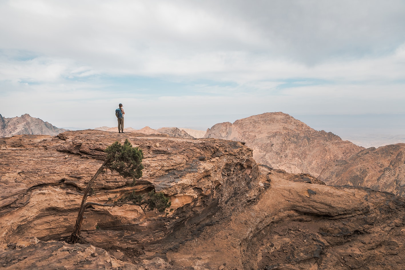
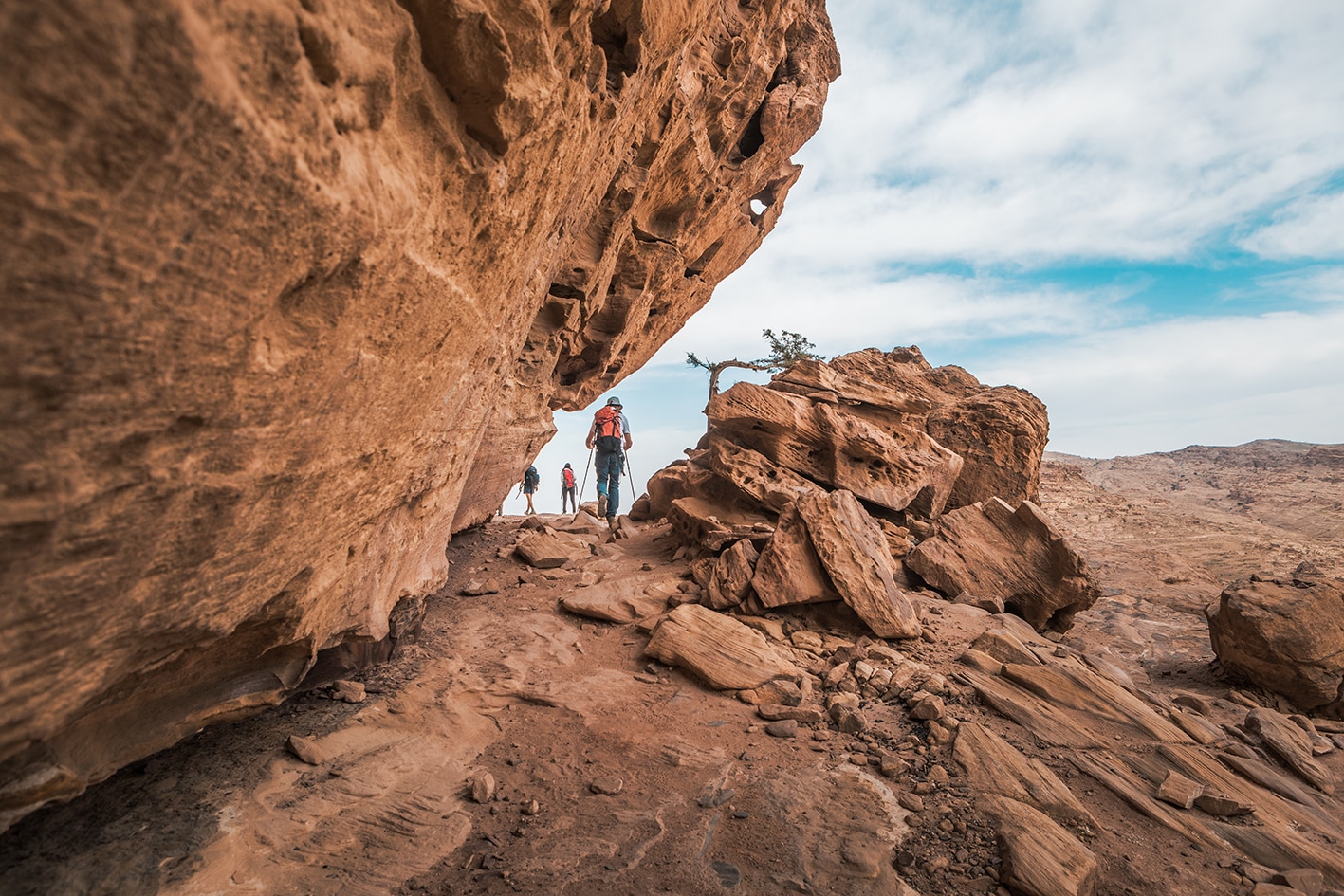
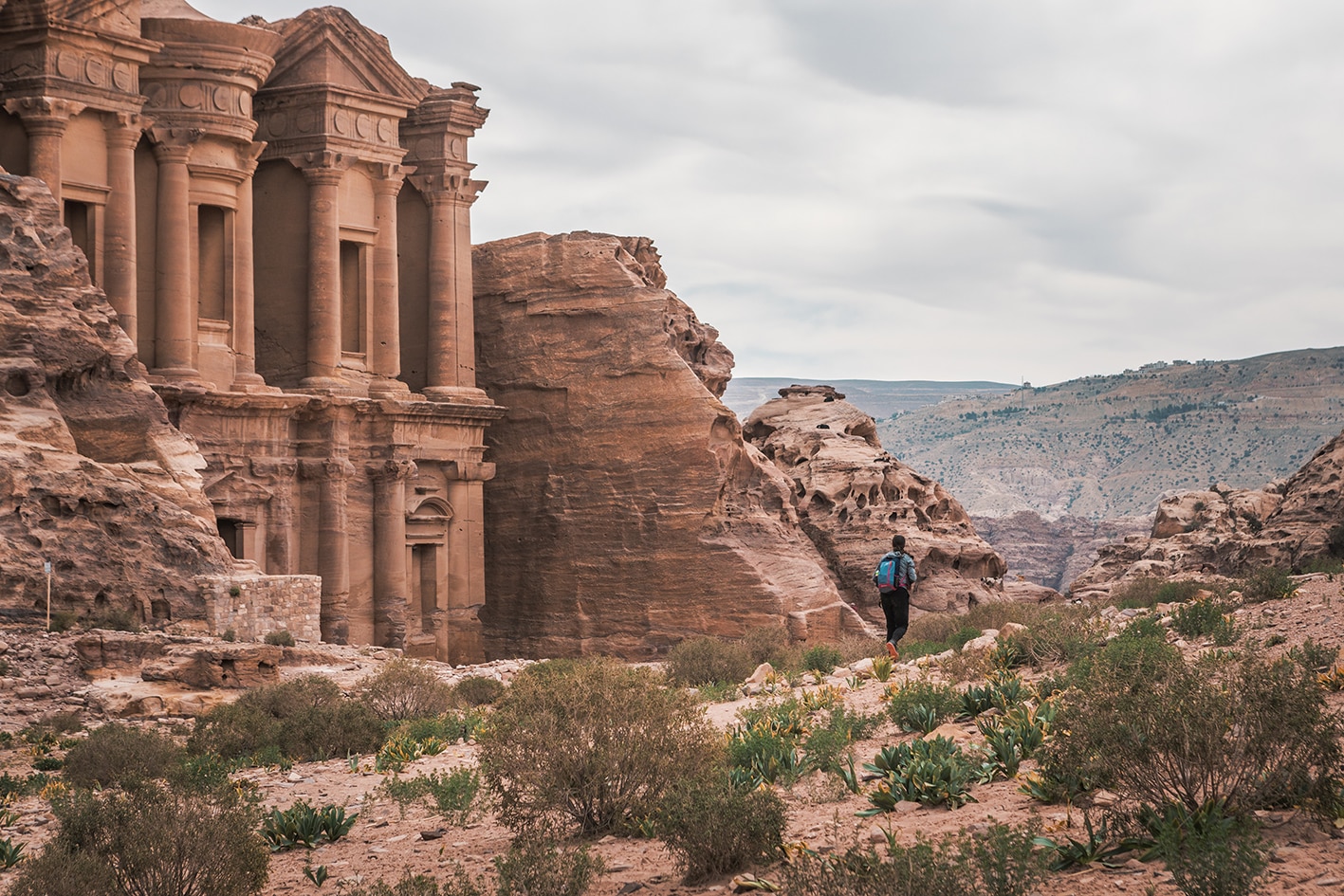
بيترا عبر “الباب الخلفي”! تتجه المسارات الجيدة بشكل مريح نحو أسفل وادي غراب وسط جبال من الحجر الرملي التي تحرس مداخل بيترا. تتبع هذه الطريق مسارًا نبطيًا يخرج من الوادي ويلتف حول الجبل الأخير على شرفة صخرية طبيعية قام برنامج بيترا الأثري بتطويرها لضمان سلامة المشاة. ومع ذلك، لا تزال الطريق تضيق قليلاً قبل الوصول إلى هضبة مخفية مرتفعة فوق الخانق الرائع لوادي السياغ. فور تجاوز هذا المكان، تظهر “الدير” منحوتة في جدار الصخر بشكل مفاجئ (مقهى بدوي). ثم تأخذك درجات نبطية للأسفل إلى مدينة بيترا القديمة، حيث يمر المسار من خلالها قبل الخروج بجانب “الخزنة” الشهيرة، ومن ثم عبر “سيق بيترا” المشهور إلى المحلات والمقاهي والفنادق في وادي موسى.

ملاحظات مهمه:

الدخول إلى البتراء يتطلب تصريحًا، والذي يمكن شراؤه الآن من مكتب التذاكر الجديد في صغيرة البتراء بدون الحاجة أولًا لزيارة مكتب التذاكر الرئيسي في وادي موسى.

يمكن مشاهدة مكتب التذاكر الجديد عبر خاصية جوجل مابس ستريت فيو الجديدة من خلال الرابط التالي: [https://maps.app.goo.gl/4cVgojuUh3vqsFPt5](https://maps.app.goo.gl/4cVgojuUh3vqsFPt5)
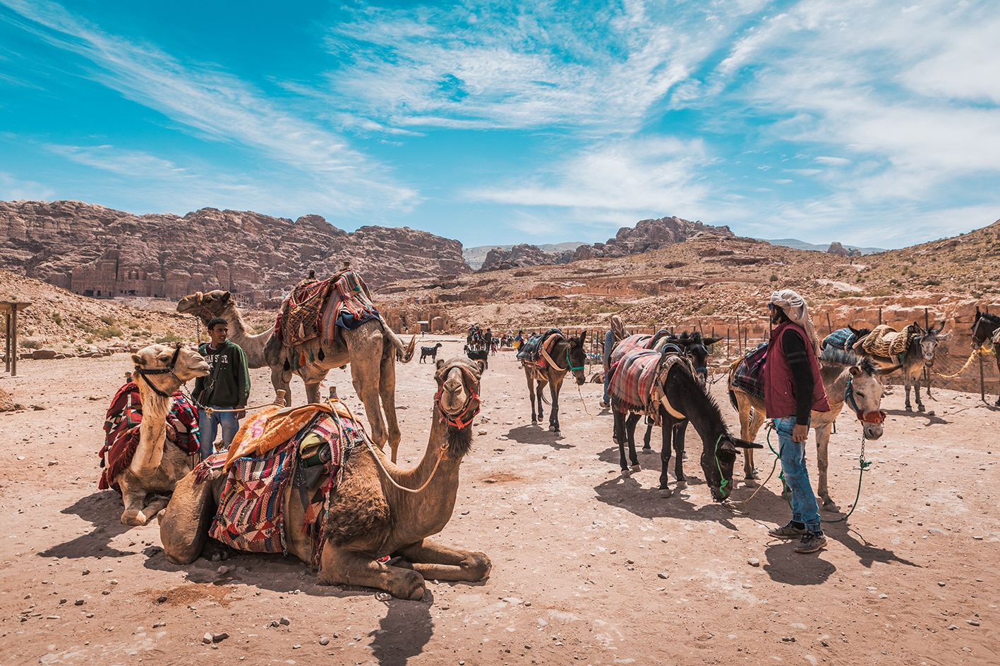
وسائل النقل

يمكن مشاهدة مكتب التذاكر الجديد عبر خاصية جوجل مابس ستريت فيو الجديدة من خلال الرابط التالي: (https://maps.app.goo.gl/4cVgojuUh3vqsFPt5) يمكن مشاهدة مكتب التذاكر الجديد عبر خاصية Google Maps Street View الجديدة هنا: (https://maps.app.goo.gl/4cVgojuUh3vqsFPt5)
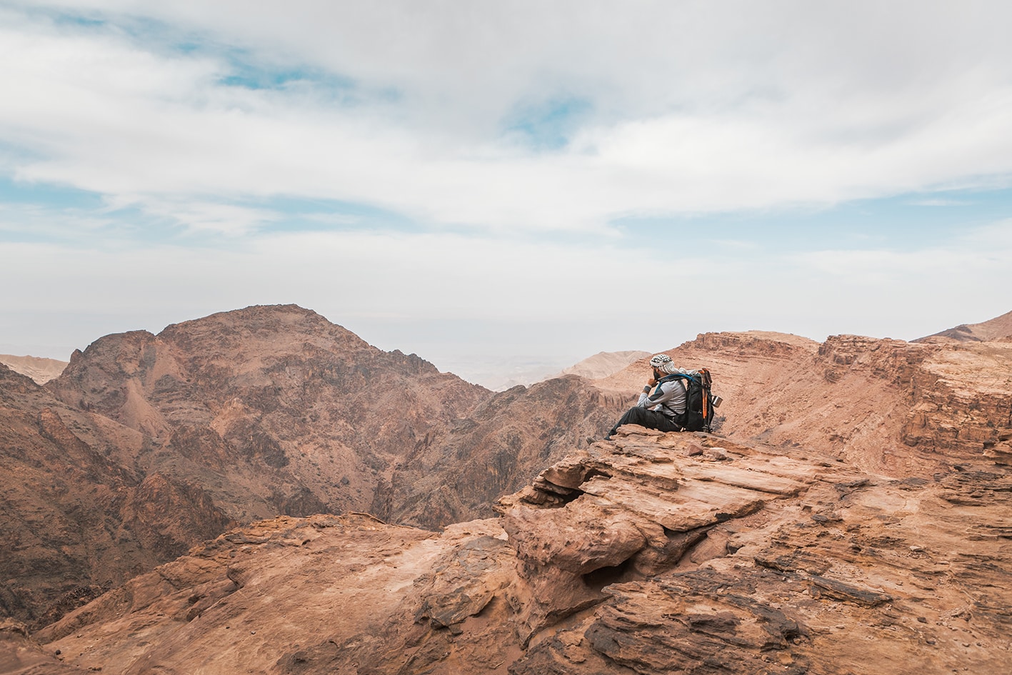
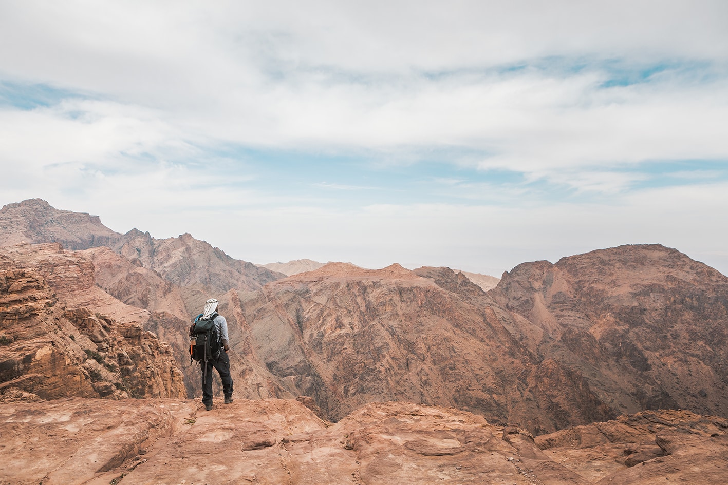
جهات الاتصال المحلية / أماكن الإقامة
  • التخييم البري, عبدالله عمارين, 962775945592+ ختم سجل الدرب البترا الصغيرة
  • فنادق البترا عبر Booking.com
  • فندق, فندق نومادز, للحجز, 032157171
  • بيت الضيافة, البترا شجرة التين, فادي هلالات, 962779092675+
أهم المعالم التي يمكن مشاهدتها

البترا

  • طريق خلفي غير عادي عبر البترا
  • دير
  • قصر البنت
  • شارع الأعمدة
الطعام والماء

الطعام:

  • مطاعم في البترا و وادي موسى

الماء:

  • البترا الصغيرة
  • البترا و وادي موسى
النصائح والسلامة العامة

النصائح:

  • الدخول إلى البترا يتطلب شراء تذاكر، ولكن يمكن شراء هذه التذاكر فقط عند المدخل الرئيسي؛ مما يعني أنه للدخول قانونياً من هذا الطريق الخلفي عبر الدير، يجب عليك (أو على شخص آخر) شراء التذاكر مسبقاً. تحقق مع مرشد محلي أو معسكر بدوي بالقرب من البترا الصغيرة. تكلفة التذاكر هي 50/55/60 دينار لليوم الواحد/اليومين/الثلاثة ولا يمكن شراؤها مسبقاً. يمكنك استكشاف خيارات شراء التذكرة الموحدة (جوردان باس) مسبقاً والدخول إلى البترا من خلال الرابط التالي ((http://www.jordanpass.jo/Contents/How_it_Works.aspx))، لكن ضع في اعتبارك أن صلاحية جواز الدرب تكون لمدة أسبوعين فقط بعد أول مسح لها.
  • المسارات معبدة جيدًا طوال الطريق.
  • إذا كان لدى الشخص خوف شديد من المرتفعات، قد يجد بعض الأقسام تحدياً. مع ذلك، الطريق ثابت جداً طوال المسار وغير زلق في المناطق المكشوفة قليلاً.
  • هناك قسم واحد مكشوف قبل الدير – مسار ضيق فوق منحدر. تم مؤخراً توسيع هذا الطريق وتثبيته.
  • طريق وادي مدثيم لا يمر بجانب الخزنة الشهيرة في البترا؛ الوصول إلى الخزنة يكون في المرحلة التالية عند الدخول من طريق وادي موسى. من مركز البترا، يمكنك الوصول إلى الخزنة بسهولة إذا رغبت بذلك.
  • المياه، الوجبات الخفيفة، والحمامات متوفرة في البترا الصغيرة. وادي موسى هي مدينة متكاملة الخدمات بها فنادق، متاجر، أجهزة صراف آلي، وغيرها.

السلامة العامة:

  • حواف مكشوفة – حوالي 6.3 كم، جزء من الطريق مكشوف قليلاً فوق جانب التلة أسفله.
  • مخاطر الفيضانات المفاجئة – وادي المظلم (الطريق البديل).
  • الجفاف/الإرهاق الحراري – معظم الطريق تحت أشعة الشمس، لكن توجد مناطق استراحة بانتظام في ظل التشكيلات الصخرية العالية في أنحاء البترا

The Jordan Trail is a newly established trail, and is not marked. It is therefore our strong recommendation that you hire a local guide for your safety as many sections are remote with limited water sources and at times no connectivity.
By downloading these maps/GPX you take full responsibility for their use and accuracy; Jordan Trail Association does not warrant the accuracy or completeness of the information, materials or the reliability of any maps as they provided AS IS without warranty of any kind, either express or implied, including but not limited to, fitness for a particular purpose, or non-infringement ;You acknowledge that any reliance on any such maps, shall be at your sole risk and responsibility as Hiking, backpacking, and other outdoor activities all have potential hazards involving risk of injury or death. Outdoor activities have inherent risks and you should ensure you have the skill level and abilities suitable for the activities in Jordan to partake in them and to take all precaution measures.  Check the data on Google Earth or other Apps or Programs before using them.  The Jordan Trail Association shall not be held responsible for any incidents that may occur during your participation in any activity and/or by using any of the maps/GPX.
AGREE
close-link

The Jordan Trail is a newly established trail, and is not marked. It is therefore our strong recommendation that you hire a local guide for your safety as many sections are remote with limited water sources and at times no connectivity.
By downloading these maps/GPX you take full responsibility for their use and accuracy; Jordan Trail Association does not warrant the accuracy or completeness of the information, materials or the reliability of any maps as they provided AS IS without warranty of any kind, either express or implied, including but not limited to, fitness for a particular purpose, or non-infringement ;You acknowledge that any reliance on any such maps, shall be at your sole risk and responsibility as Hiking, backpacking, and other outdoor activities all have potential hazards involving risk of injury or death. Outdoor activities have inherent risks and you should ensure you have the skill level and abilities suitable for the activities in Jordan to partake in them and to take all precaution measures.  Check the data on Google Earth or other Apps or Programs before using them.  The Jordan Trail Association shall not be held responsible for any incidents that may occur during your participation in any activity and/or by using any of the maps/GPX.
AGREE
close-link
AR