Search
Close this search box.

SECTION 604: LITTLE PETRA TO PETRA

  • HIKES IN THE REGION

  • DAY 4: LITTLE PETRA TO PETRA

  • Distance: 12.6 km

  • Time: 3 - 4 hours

  • Physical Challenge: Moderate

  • Trail Challenge: Moderate

  • Waymarked: No

To download the GPS track, click icon  

The Jordan Trail is a newly established trail, and is not marked. It is therefore our strong recommendation that you hire a local guide for your safety as many sections are remote with limited water sources and at times no connectivity.
By downloading these maps/GPX you take full responsibility for their use and accuracy; Jordan Trail Association does not warrant the accuracy or completeness of the information, materials or the reliability of any maps as they provided AS IS without warranty of any kind, either express or implied, including but not limited to, fitness for a particular purpose, or non-infringement ;You acknowledge that any reliance on any such maps, shall be at your sole risk and responsibility as Hiking, backpacking, and other outdoor activities all have potential hazards involving risk of injury or death. Outdoor activities have inherent risks and you should ensure you have the skill level and abilities suitable for the activities in Jordan to partake in them and to take all precaution measures.  Check the data on Google Earth or other Apps or Programs before using them.  The Jordan Trail Association shall not be held responsible for any incidents that may occur during your participation in any activity and/or by using any of the maps/GPX.
AGREE
close-link
Click Icon to download the map
IMPORTANT NUMBERS

Tourism Police:

Hotline: 117777
What’s App: +962 7 7099 1814

* When contacting Tourism Police for emergency identify that you are hiking the Jordan Trail, state your nationality, location and map name & number.


JTA office: +962 6 461 0999

(Working Hours: 9:00 a.m. to 5:00 p.m., Sunday- Thursday)

BASIC INFO

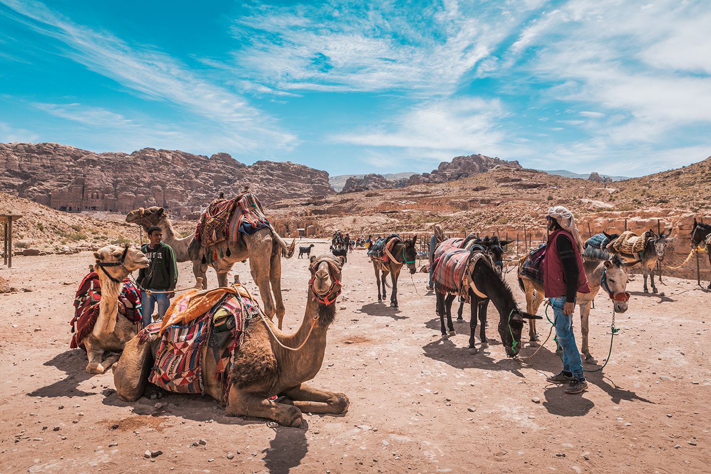
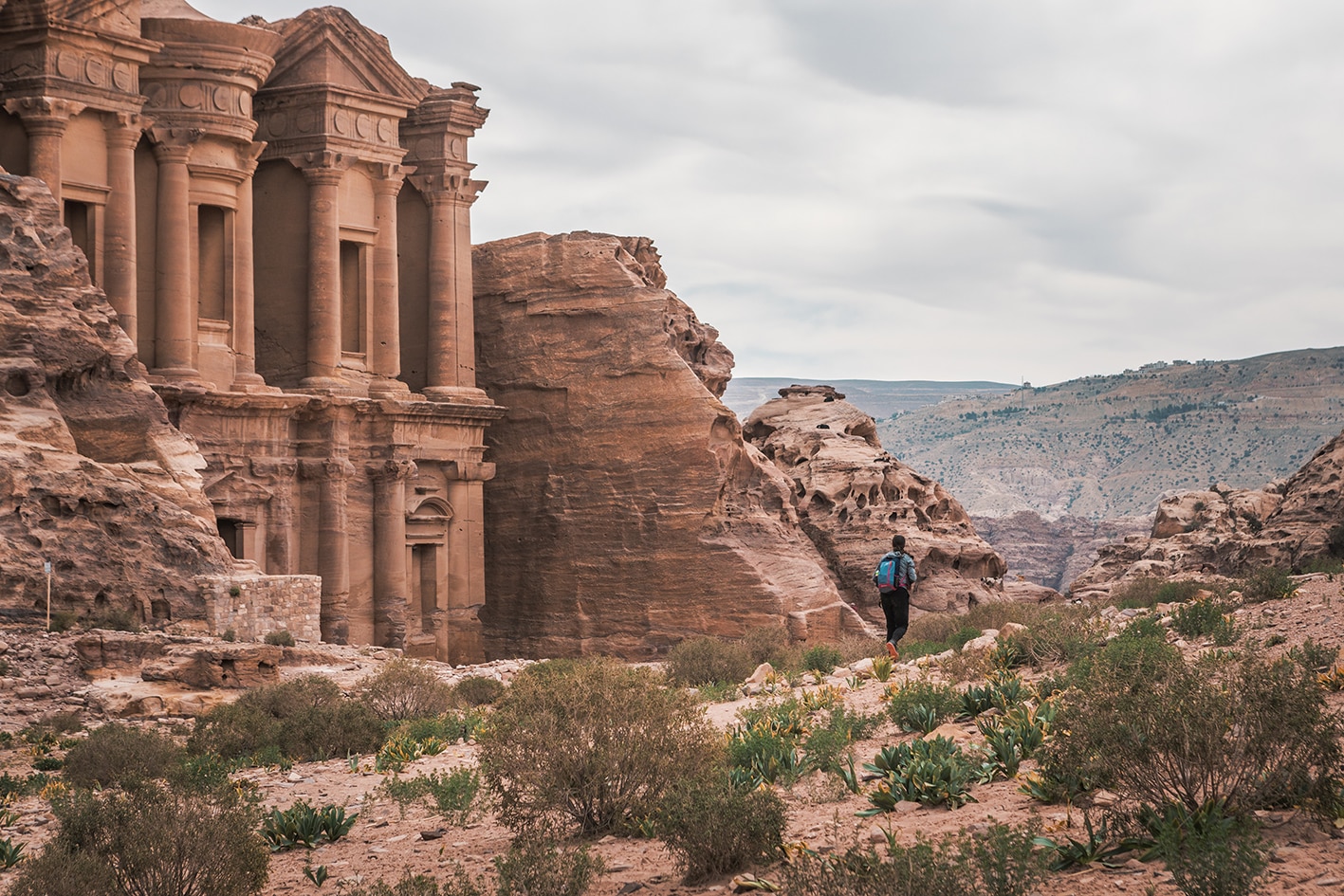
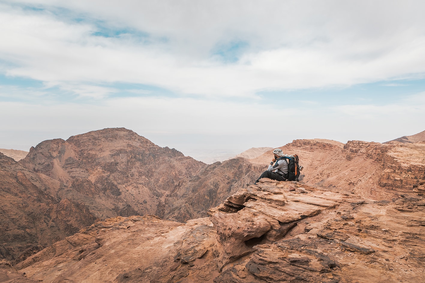
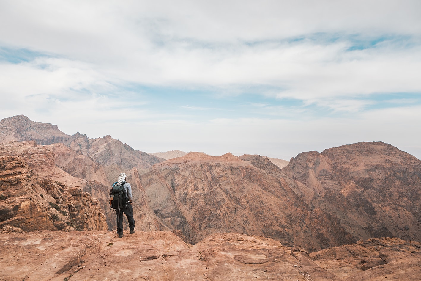
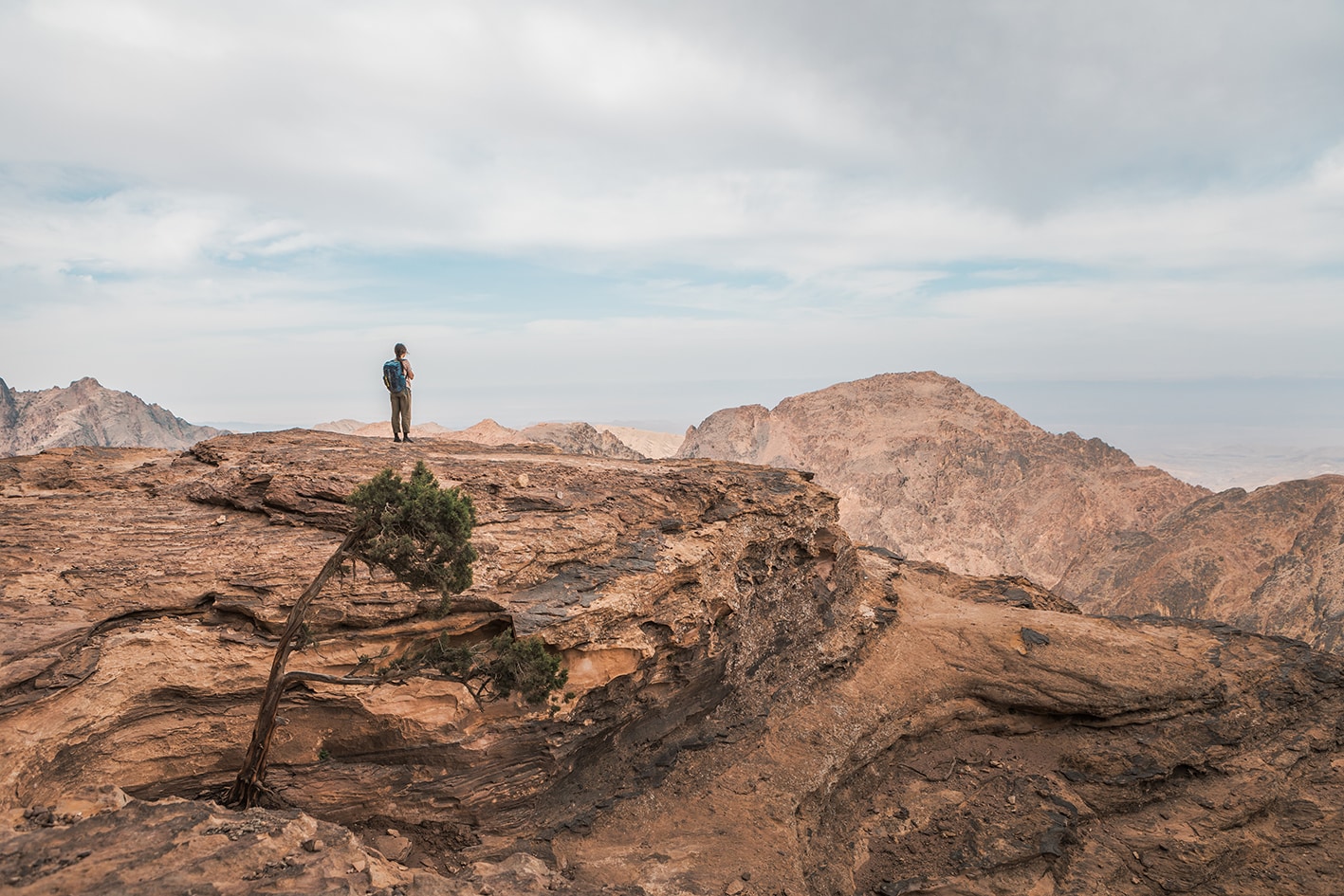
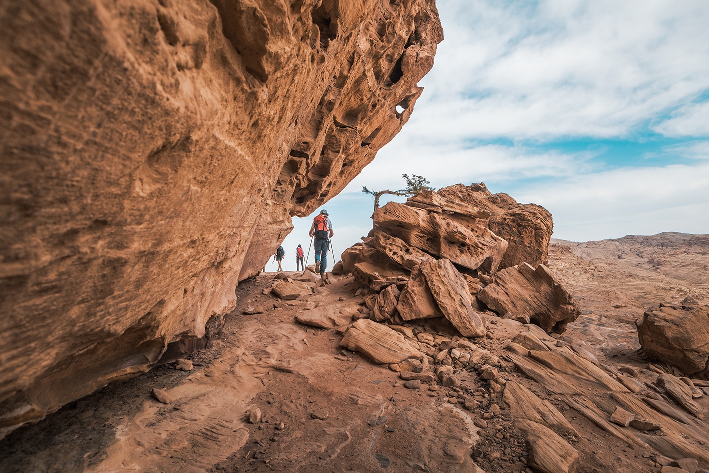
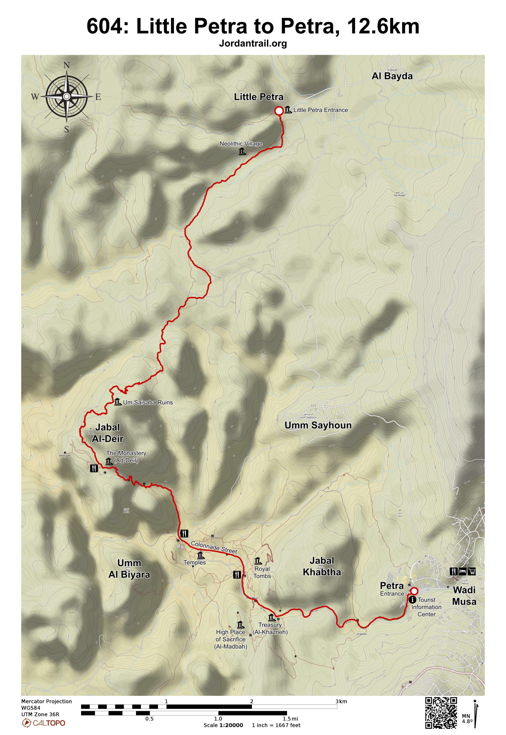
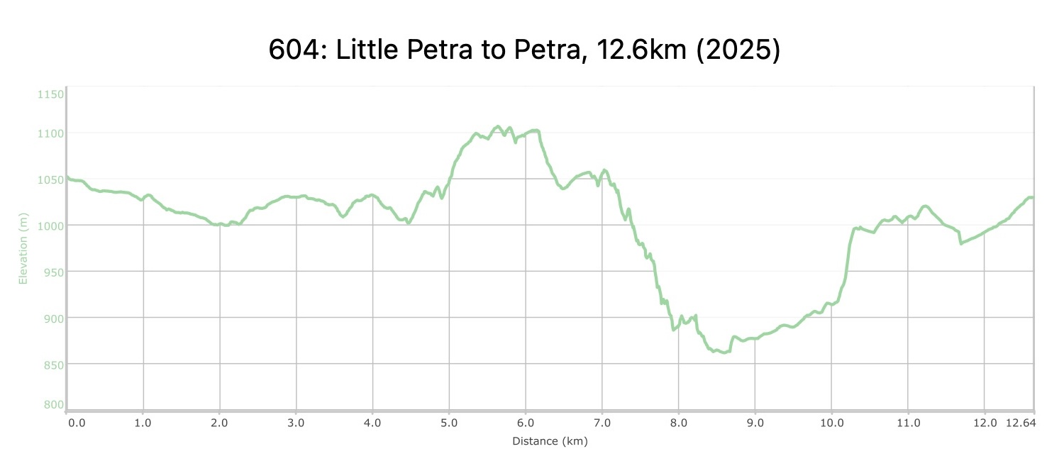
Petra via ‘The Back Door’! Good tracks go pleasantly down Wadi Ghurab amidst sandstone mountains guarding the approaches to Petra. This way follows a Nabataean route out of the valley and skirting round the final mountain on a natural rock terrace which has been ‘improved’ by the PAP for the safety of walkers. Even so, it still narrows slightly before reaching a hidden plateau high above the impressive chasm of Wadi Siyyagh. Just beyond, carved into the cliff face, ‘The Monastery’ suddenly comes into view. (Bedouin café). Nabataean steps then lead down into ancient Petra, through which the route goes before exiting past ‘The Treasury’ and though the famous ‘Petra Siq’ to the shops, cafés and hotels of Wadi Musa.


Important Note:

Entry to Petra requires a pass, which can only be purchased at the front entrance.  This route does not approach Petra through this entrance, so a pass must be purchased in advance.

TRANSTOPTATION

Regular minibuses run between Wadi Musa and Amman (from Amman’s south bus station) and Ma’an, as well as a daily (but inconsistent) bus to Wadi Rum. One JETT bus a day also runs from Amman to Wadi Musa (6:30am) and back (late afternoon – around 4pm). From the JETT website (http://www.jett.com.jo), it is possible to buy return tickets from Amman.

LOCAL CONTACTS / ACCOMMODATION
  • Wild Camping, Abdallah Ammarin, +962775945592, JT Pass Stamp Little Petra
  • Petra Hotels through Booking.com
  • Homestay, Petra Fig Tree Villa, Fadi Hilalat, +962779092675
THINGS TO SEE

Little Petra
Petra:

  • An unusual back route through Petra
  • Monastery
  • Qasr al-Bint
  • Colonnaded Street
FOOD & WATER

Food:

  • Restaurants in Petra site, Wadi Musa

Water:

  • Little Petra
  • Throughout Petra site and in Wadi Musa
TIPS & SAFETY

Tips:

  • Petra requires tickets for entry, but these can only be bought at its front entrance; this means that to legally enter by this back way via the Monastery, you (or someone else) would need to buy your tickets ahead of time. Check with a local guide or Bedouin camp near little Petra. Tickets cost 50/55/60JD for 1/2/3 days and can’t buy in advance. Explore options for Jordan pass bought in advance and entering Petra (http://www.jordanpass.jo/Contents/How_it_Works.aspx) , but keep in mind that it is only valid for two weeks after first being scanned.
  • Paths are well established all the way.
  • If someone has a severe fear of heights, there might be a few sections that are challenging. However, the path is very solid all the way and not slippery where it’s a little exposed.
  • There is one section of exposed trail just before the Monastery – a narrow path above a drop. The path has recently been widened and stabilized.
  • The Wadi Mudthim route does not pass Petra’s iconic Treasury; the approach to the Treasury is on the next stage entering from the road to Wadi Musa. From the center of Petra, you can still easily reach the Treasury if you wish.
  • Water, snacks, and bathrooms are available at Little Petra. Wadi Musa is a full service city with hotels, shops, ATMs, etc.

Safety Info:

  • Exposed edges – Around 6.3 km, a part of the path is a little exposed above hillside below.
  • Flash flood dangers – Wadi Mudthlim (alternate route)
  • Dehydration/heat exhaustion – Most of the route is in the sun, but rest areas exist regularly in the shade of the high rock formations throughout Petra.

The Jordan Trail is a newly established trail, and is not marked. It is therefore our strong recommendation that you hire a local guide for your safety as many sections are remote with limited water sources and at times no connectivity.
By downloading these maps/GPX you take full responsibility for their use and accuracy; Jordan Trail Association does not warrant the accuracy or completeness of the information, materials or the reliability of any maps as they provided AS IS without warranty of any kind, either express or implied, including but not limited to, fitness for a particular purpose, or non-infringement ;You acknowledge that any reliance on any such maps, shall be at your sole risk and responsibility as Hiking, backpacking, and other outdoor activities all have potential hazards involving risk of injury or death. Outdoor activities have inherent risks and you should ensure you have the skill level and abilities suitable for the activities in Jordan to partake in them and to take all precaution measures.  Check the data on Google Earth or other Apps or Programs before using them.  The Jordan Trail Association shall not be held responsible for any incidents that may occur during your participation in any activity and/or by using any of the maps/GPX.
AGREE
close-link