Search
Close this search box.

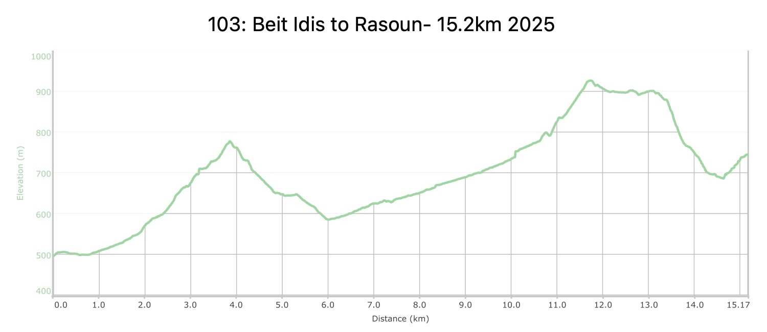
القسم 103: بيت إيدس إلى راسون

  • مسار المشي في المنطقة

  • اليوم الثالث: بيت إيدس إلى راسون

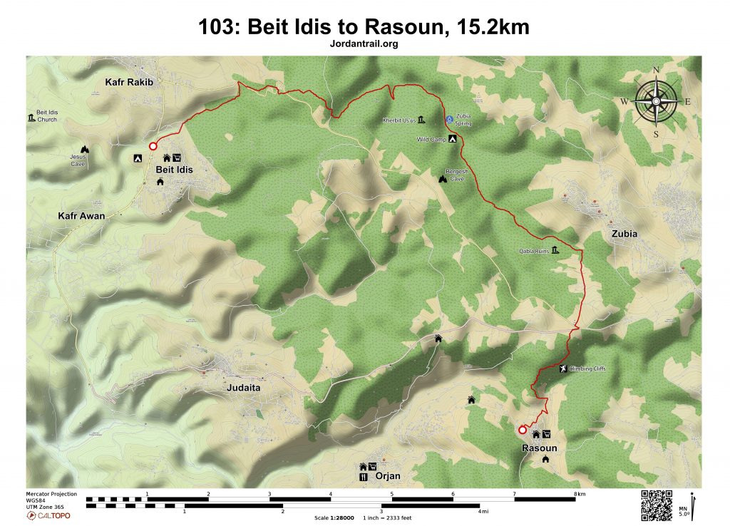
  • المسافة: 15.2 كيلومتر

  • الوقت: 4-6 ساعات

  • التحديات الجسدية: متوسط

  • تحديات المسار: صعب

  • التحديات الكلية: متوسط

  • التحديد على المسار: نعم

To download the Jordan Trail GPS tracks, اضغط هنا.

The Jordan Trail is a newly established trail, and is not marked. It is therefore our strong recommendation that you hire a local guide for your safety as many sections are remote with limited water sources and at times no connectivity.
By downloading these maps/GPX you take full responsibility for their use and accuracy; Jordan Trail Association does not warrant the accuracy or completeness of the information, materials or the reliability of any maps as they provided AS IS without warranty of any kind, either express or implied, including but not limited to, fitness for a particular purpose, or non-infringement ;You acknowledge that any reliance on any such maps, shall be at your sole risk and responsibility as Hiking, backpacking, and other outdoor activities all have potential hazards involving risk of injury or death. Outdoor activities have inherent risks and you should ensure you have the skill level and abilities suitable for the activities in Jordan to partake in them and to take all precaution measures.  Check the data on Google Earth or other Apps or Programs before using them.  The Jordan Trail Association shall not be held responsible for any incidents that may occur during your participation in any activity and/or by using any of the maps/GPX.
AGREE
close-link

أنقر هنا

The Jordan Trail is a newly established trail, and is not marked. It is therefore our strong recommendation that you hire a local guide for your safety as many sections are remote with limited water sources and at times no connectivity.
By downloading these maps/GPX you take full responsibility for their use and accuracy; Jordan Trail Association does not warrant the accuracy or completeness of the information, materials or the reliability of any maps as they provided AS IS without warranty of any kind, either express or implied, including but not limited to, fitness for a particular purpose, or non-infringement ;You acknowledge that any reliance on any such maps, shall be at your sole risk and responsibility as Hiking, backpacking, and other outdoor activities all have potential hazards involving risk of injury or death. Outdoor activities have inherent risks and you should ensure you have the skill level and abilities suitable for the activities in Jordan to partake in them and to take all precaution measures.  Check the data on Google Earth or other Apps or Programs before using them.  The Jordan Trail Association shall not be held responsible for any incidents that may occur during your participation in any activity and/or by using any of the maps/GPX.
AGREE
close-link
لتحميل الخريطة

أرقام مهمة

الشرطة السياحية:

الخط الساخن: 117777
واتساب: +962770992690

*في حال التواصل مع شرطة السياحة في حالة طارئة، يُرجى تحديد أنك تسير على درب الأردن، وذكر جنسيتك، موقعك الحالي، واسم ورقم الخريطة.

مكتب جمعية درب الأردن: +962 6 461 0999

(ساعات العمل: من 9:00 صباحًا حتى 5:00 مساءً، من الأحد إلى الخميس)

معلومات عامة

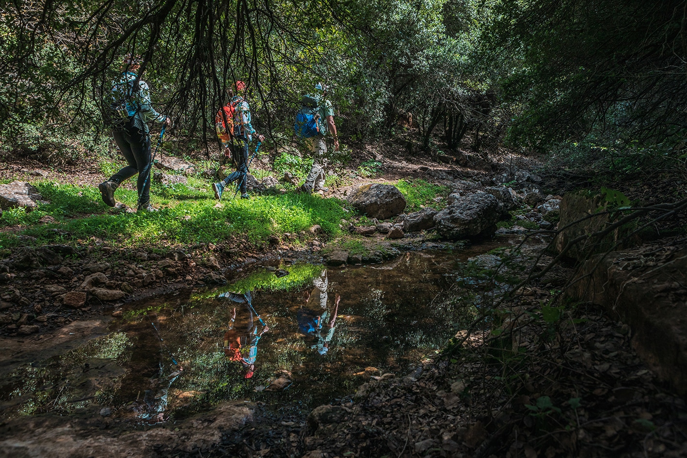
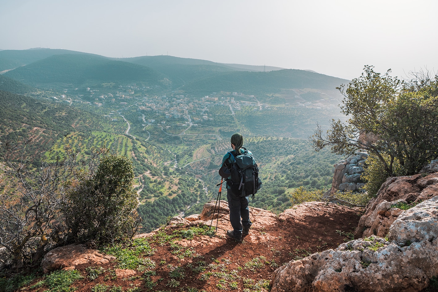
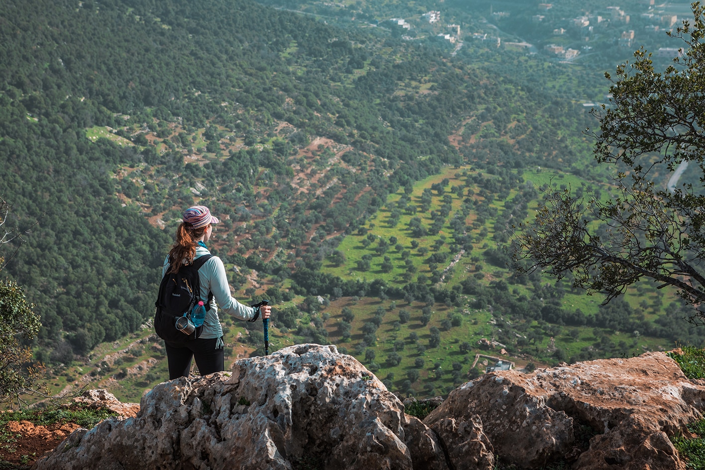
تخرج ممرات ضيقة من شمال قرية بيت إيدس، وتعبر الأجزاء العلوية من وادي سير، لتصل إلى طريق يرتفع عبر مناطق ريفية مشجّرة، ثم ينحدر شمال شرق إلى وادي زوبيا الجميل والمكسو بالغابات الكثيفة. بحسب الموسم، قد تجد ماءً جارياً في مجرى الوادي. اتبع الوادي صعوداً حتى تبدأ الأشجار بالتناقص، لتظهر إلى اليسار خزانات المياه وآثار مدينة قبلا الرومانية. ومن هناك، يصعد طريق فرعي باتجاه الجنوب إلى التلة حتى يصل إلى الطريق الرئيسي، الذي يُتبع غرباً قبل أن ينحدر عبر وادٍ مشجّر ومنحدر، ليعبر وادي عرجان ويصل إلى قرية راسون ومنازل الضيافة هناك.

وسائل النقل
  • التنقّل بين القرى ممكن عبر سيارات خاصة، ويمكن لمقدّمي الخدمات من المجتمع المحلي مساعدتك في الترتيب لذلك.
  • وسائل النقل العامة بين القرى: لا توجد جداول زمنية محددة، وتغادر الحافلات عند اكتمال الركاب، والعديد من الطرق تعتمد على سيارات خاصة فقط. التكلفة من باعون إلى عجلون: بين 5 و7 دينار أردني، ومن راسون إلى عجلون: بين 7 و10 دينار أردني.
جهات الاتصال المحلية / أماكن الإقامة
  • بيت الضيافة: ميسون ومحمد الدويكات, 962776540293+/962772293291+, JT Pass Stamp Rasoun
  • بيت الضيافة: عيسى دويكات, 962779734776+, JT Pass Stamp Rasoun
  • بيت الضيافة: إيهاب شواشره, 962796830414+, JT Pass Stamp Rasoun
  • بيت الضيافة: فيثاء مقداد, 962772089782+, JT Pass Stamp Rasoun
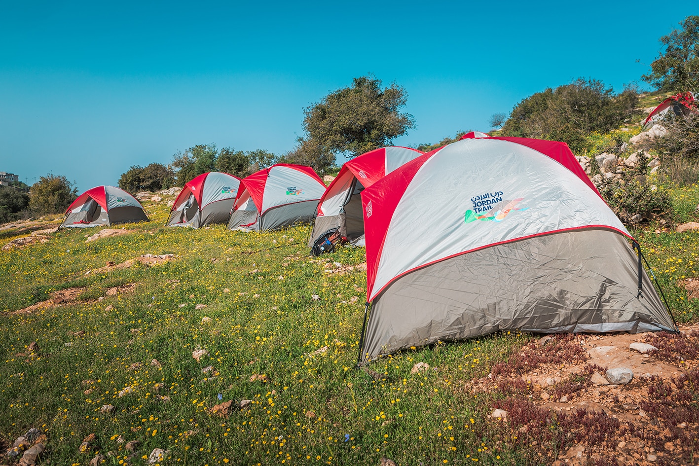
  • التخيم البري: سامر مقداد, 962777516660+,
  • التخييم البري: محمد درويش, 962772398954+, JT Pass Stamp Rasoun
  • مخيم جبل برقش البيئي: للحجز, 962795010959+,
  • محمية غابات عجلون (الجمعية الملكية لحماية الطبيعة - RSCN): للحجز, 96264616523+, www.wildjordan.com
أهم المعالم التي يمكن مشاهدتها
  • النُزُل الملكي. 
  • آثار قبلا.
  • غابة زوبيا، ونبعة في وادي زوبيا.
  • منحدرات طور الأحمر.
  • المقابر الحجرية.
  • محمية عجلون.
  • .سياحة في منطقة العيون
  • راسون.
الطعام والماء

الطعام:

  • المتاجر في بيت إيدس وراسون (سوبرماركت صغير مقابل البلدية).
  • محال بيع الفواكه على الطريق بعد قبلا (حسب الموسم).

الماء:

  • بيت إيدس
  • عين زوبيا (يُفضل تنقية الماء قبل الشرب).
  • قرية راسون في النهاية.
  • منازل متفرقة بالقرب من قبلا.
النصائح والسلامة العامة

النصائح:

  • استمتع بأكثر يوم مشجر على طول درب الأردن بأكمله، وهو فرصة مميزة للاسترخاء في ظل الظلال بعيدًا عن حرارة غور الأردن.
  • تتبع المسارات انحدارات معتدلة في الغالب، مع مسافة يمكن التحكم بها بسهولة.
  • المسار محدد بعلامات ويُستخدم بشكل متكرر.

السلامة العامة:

  • أرض غير مستقرة – تظهر فقط في بعض المقاطع القصيرة.
  • الرجاء تجنب منطقة النُزُل الملكي.
The Jordan Trail is a newly established trail, and is not marked. It is therefore our strong recommendation that you hire a local guide for your safety as many sections are remote with limited water sources and at times no connectivity.
By downloading these maps/GPX you take full responsibility for their use and accuracy; Jordan Trail Association does not warrant the accuracy or completeness of the information, materials or the reliability of any maps as they provided AS IS without warranty of any kind, either express or implied, including but not limited to, fitness for a particular purpose, or non-infringement ;You acknowledge that any reliance on any such maps, shall be at your sole risk and responsibility as Hiking, backpacking, and other outdoor activities all have potential hazards involving risk of injury or death. Outdoor activities have inherent risks and you should ensure you have the skill level and abilities suitable for the activities in Jordan to partake in them and to take all precaution measures.  Check the data on Google Earth or other Apps or Programs before using them.  The Jordan Trail Association shall not be held responsible for any incidents that may occur during your participation in any activity and/or by using any of the maps/GPX.
AGREE
close-link