Search
Close this search box.

SECTION 704 :WADI GSEIB TO WADI AHEIMAR

  • HIKES IN THE REGION

  • DAY 4: WADI GSEIB TO WADI AHEIMAR

  • Distance: 15.6 km

  • Time: 5 - 6 hours ​

  • Physical Challenge: Difficult

  • Trail Challenge: Moderate

  • Waymarked: No

To download the GPS track, click icon  

The Jordan Trail is a newly established trail, and is not marked. It is therefore our strong recommendation that you hire a local guide for your safety as many sections are remote with limited water sources and at times no connectivity.
By downloading these maps/GPX you take full responsibility for their use and accuracy; Jordan Trail Association does not warrant the accuracy or completeness of the information, materials or the reliability of any maps as they provided AS IS without warranty of any kind, either express or implied, including but not limited to, fitness for a particular purpose, or non-infringement ;You acknowledge that any reliance on any such maps, shall be at your sole risk and responsibility as Hiking, backpacking, and other outdoor activities all have potential hazards involving risk of injury or death. Outdoor activities have inherent risks and you should ensure you have the skill level and abilities suitable for the activities in Jordan to partake in them and to take all precaution measures.  Check the data on Google Earth or other Apps or Programs before using them.  The Jordan Trail Association shall not be held responsible for any incidents that may occur during your participation in any activity and/or by using any of the maps/GPX.
AGREE
close-link
Click Icon to download the map
IMPORTANT NUMBERS

Tourism Police:

Hotline: 117777
What’s App: +962 7 7099 1814

* When contacting Tourism Police for emergency identify that you are hiking the Jordan Trail, state your nationality, location and map name & number.


JTA office: +962 6 461 0999

(Working Hours: 9:00 a.m. to 5:00 p.m., Sunday- Thursday)

BASIC INFO
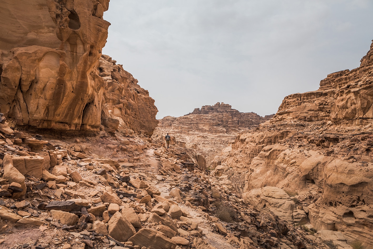
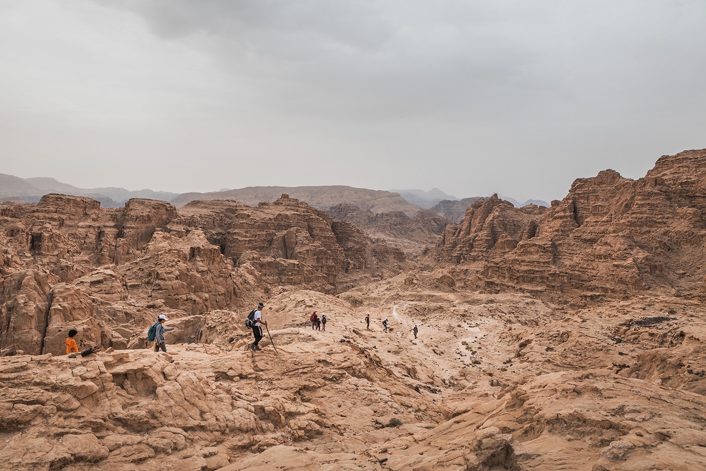
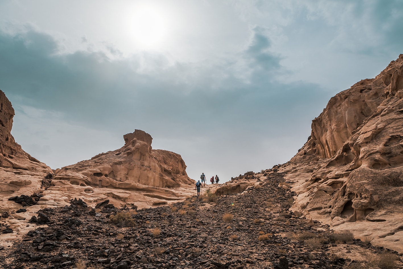
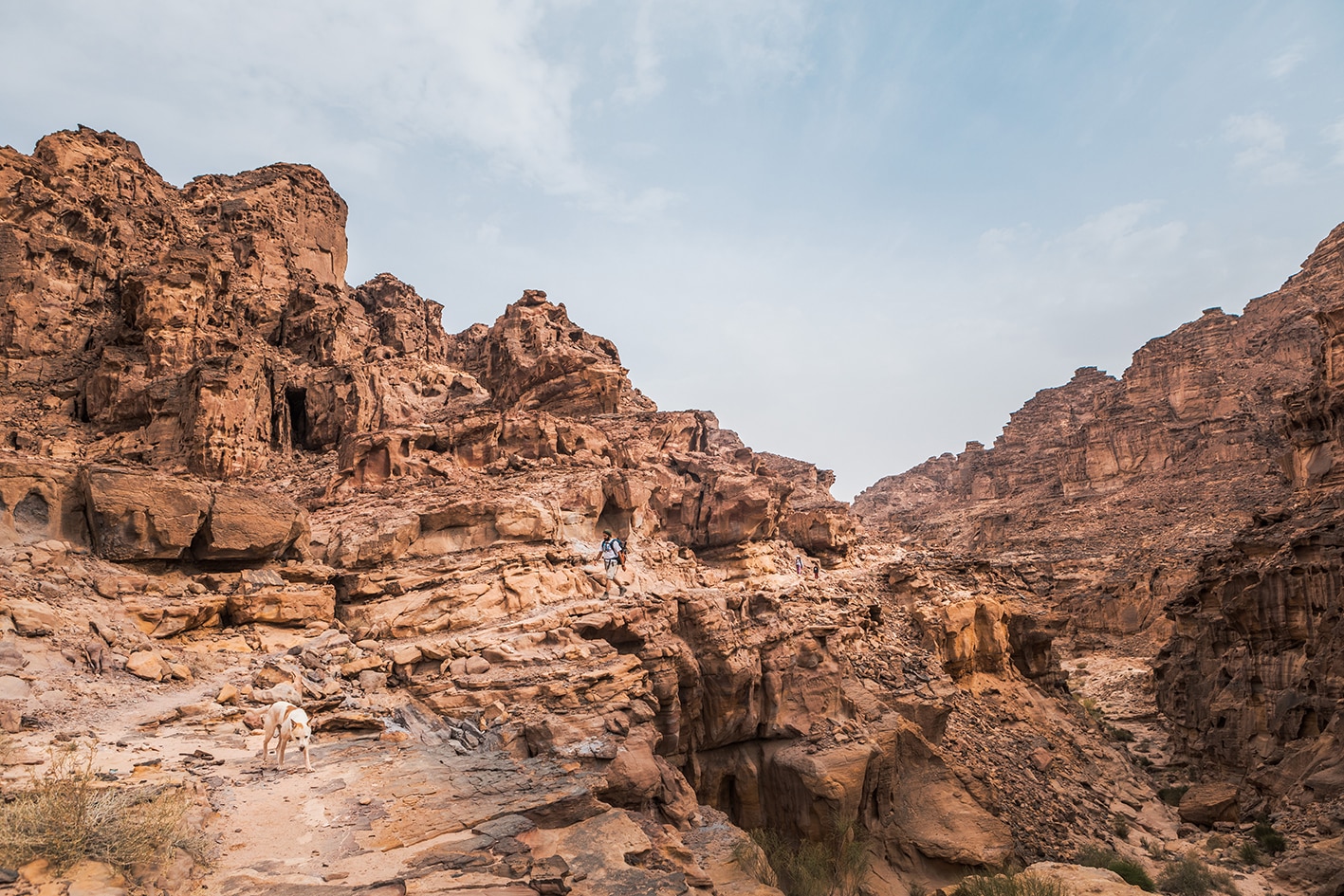
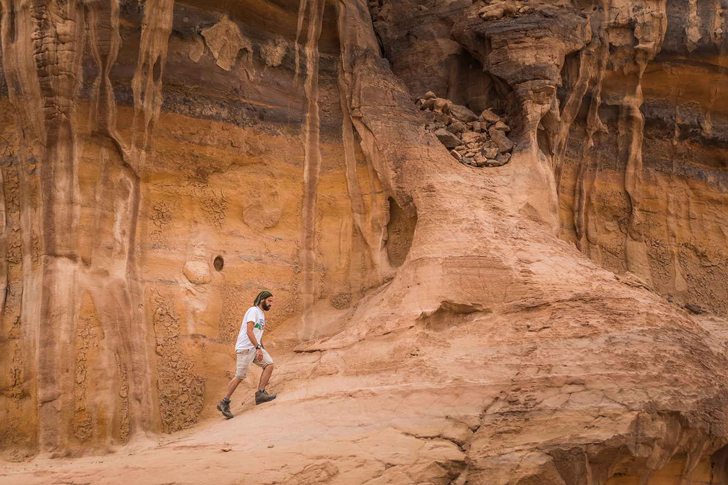
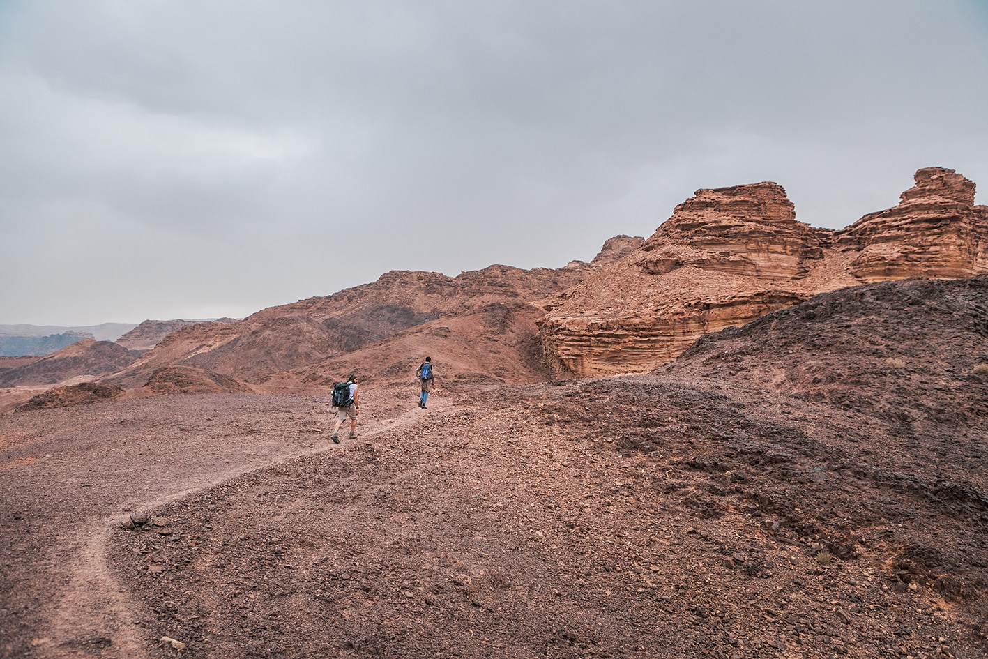
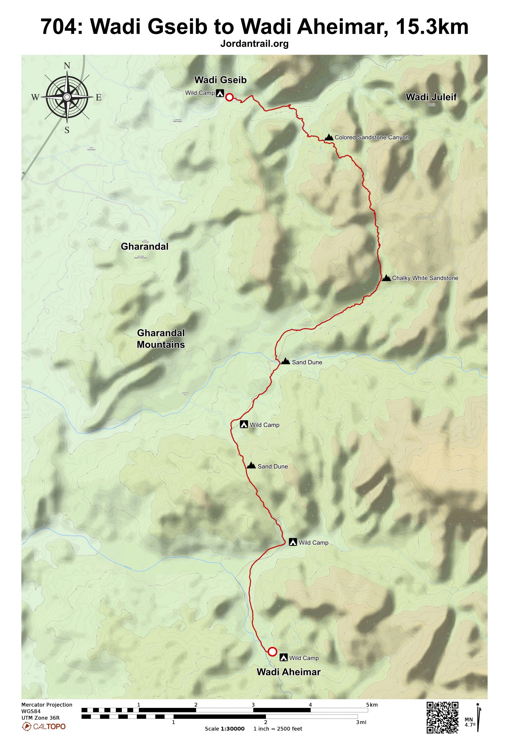
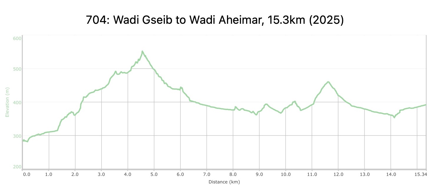
After retracing your steps up Wadi Gseib for about 1km, the route makes its way back into the mountains heading South East for about 3km through a beautiful colored sandstone Wadi, then descending easy cliffs and continuing South then South West across a sandy area into the wide valley of Wadi Al-Seeq. It then rises over and crosses an expanse of dunes, descending into Wadi Rakiya which joins Wadi Aheimir 1 km South West. Nice camping area with sand dunes a little further on above the West side of Wadi Rakiya and farther south into Wadi Aheimar.
TRANSTOPTATION
  • Private jeep/pickup only
  • Pickup access in Wadi al-Seeq
Local Contacts / Accommodation
THINGS TO SEE
  • Colored Canyons
  • Sand Dunes
  • Wadi Rakiya
  • Wadi Aheimar
FOOD & WATER

Food:

  • None.

Water:

  • None.
TIPS & SAFETY

Tips:

  • During the first 5km, there are a variety of stoney and exposed
  • Much of the route involves walking in sand. Be prepared for this to take a little more energy than expected. The route is very challenging to navigate without either local guide or GPS unit. As there are many winding turns in the canyon branches, make sure your GPS is zoomed in enough and that you are paying attention.
  • The first 5km follows old paths with periodic cairns (rujum) showing the way. Pay attention to these routes and note if you leave them. The second half across sandy areas is difficult to navigate with map only. Look for other shepherd tracks or droppings to find best walking paths near GPS tracks, much of it is open country.
  • Best to hike with a local guide

Safety Info:

  • Exposed edges – Near the beginning of the stage when climbing up into colored canyon, one spot is pretty exposed on an old sandstone path. The surface is stable now, could erode away at some point. It’s wise to stay near inside edge on the path along the top of this pass. When descending on white chalky path, there’s a dry waterfall with an exposed section following the old path. It is recommended to take the non-exposed route on the left up through the rocks, which rejoins soon with the other older path.
  • Flash flood dangers – Be careful in all wadis along route. Most are only crossed, except for 1km of wadi Gseib at beginning, and wide Wadi Rakiya and Wadi Aheimar at the end.
  • Loose footing – The path is either sandstone or sand, which can be slippery if loose or wet. Poles are helpful.
  • Dehydration/heat exhaustion – This area can and is quite exposed. Hikers will pass shade trees once in a while, and need to make sure to rest in the shade. There is no water on the route, so plan accordingly.

Mobile Phone Coverage: None all day after the stage beginning at the Wadi Gseib campsite. Next coverage up on plateau near Abbasiyya the following day stage.

The Jordan Trail is a newly established trail, and is not marked. It is therefore our strong recommendation that you hire a local guide for your safety as many sections are remote with limited water sources and at times no connectivity.
By downloading these maps/GPX you take full responsibility for their use and accuracy; Jordan Trail Association does not warrant the accuracy or completeness of the information, materials or the reliability of any maps as they provided AS IS without warranty of any kind, either express or implied, including but not limited to, fitness for a particular purpose, or non-infringement ;You acknowledge that any reliance on any such maps, shall be at your sole risk and responsibility as Hiking, backpacking, and other outdoor activities all have potential hazards involving risk of injury or death. Outdoor activities have inherent risks and you should ensure you have the skill level and abilities suitable for the activities in Jordan to partake in them and to take all precaution measures.  Check the data on Google Earth or other Apps or Programs before using them.  The Jordan Trail Association shall not be held responsible for any incidents that may occur during your participation in any activity and/or by using any of the maps/GPX.
AGREE
close-link