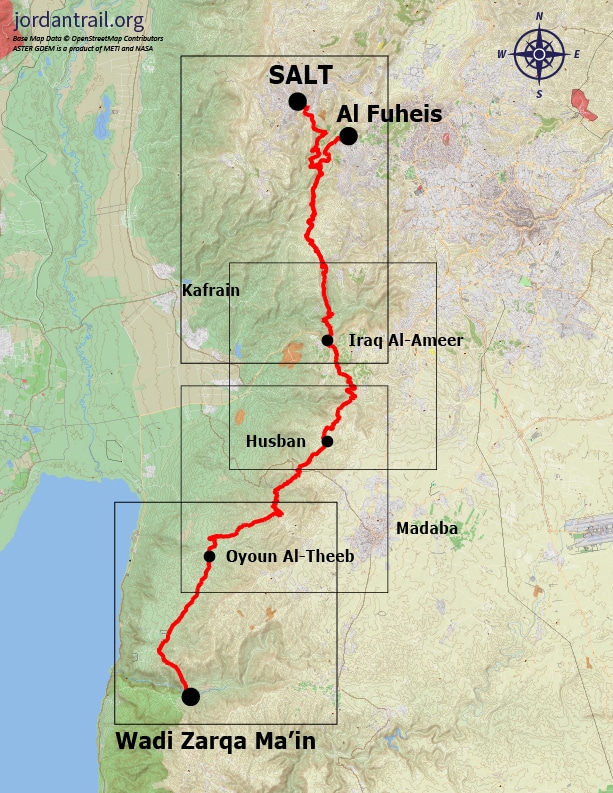
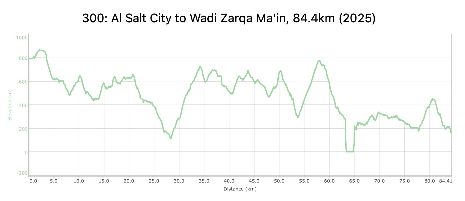
0
0 items
No products in the cart.
0
0 items
No products in the cart.

REGION 3: AS-SALT TO WADI ZARQA MA’IN

  • Details

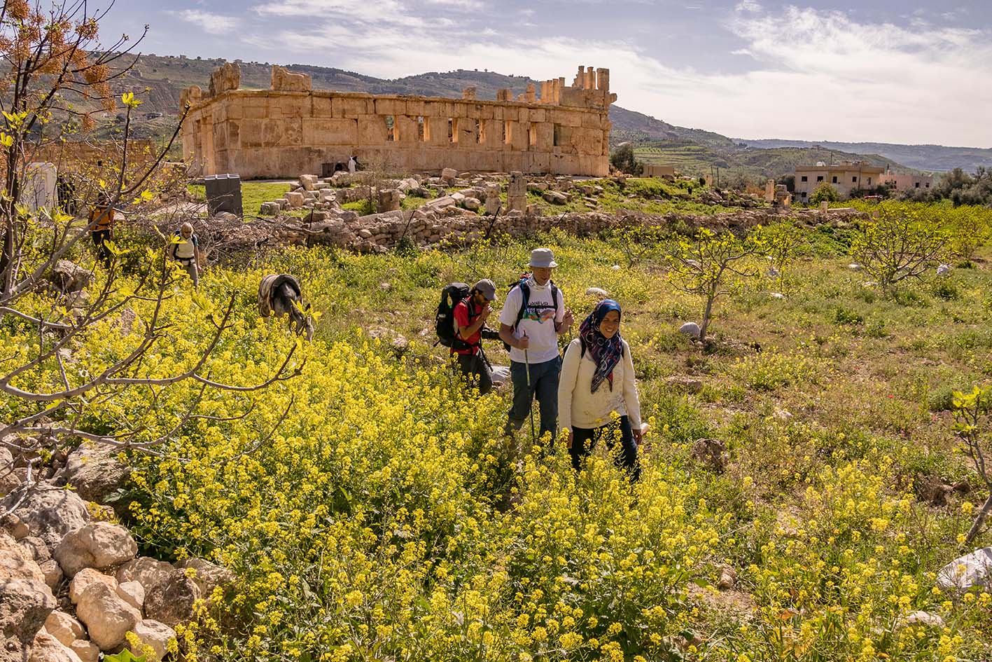
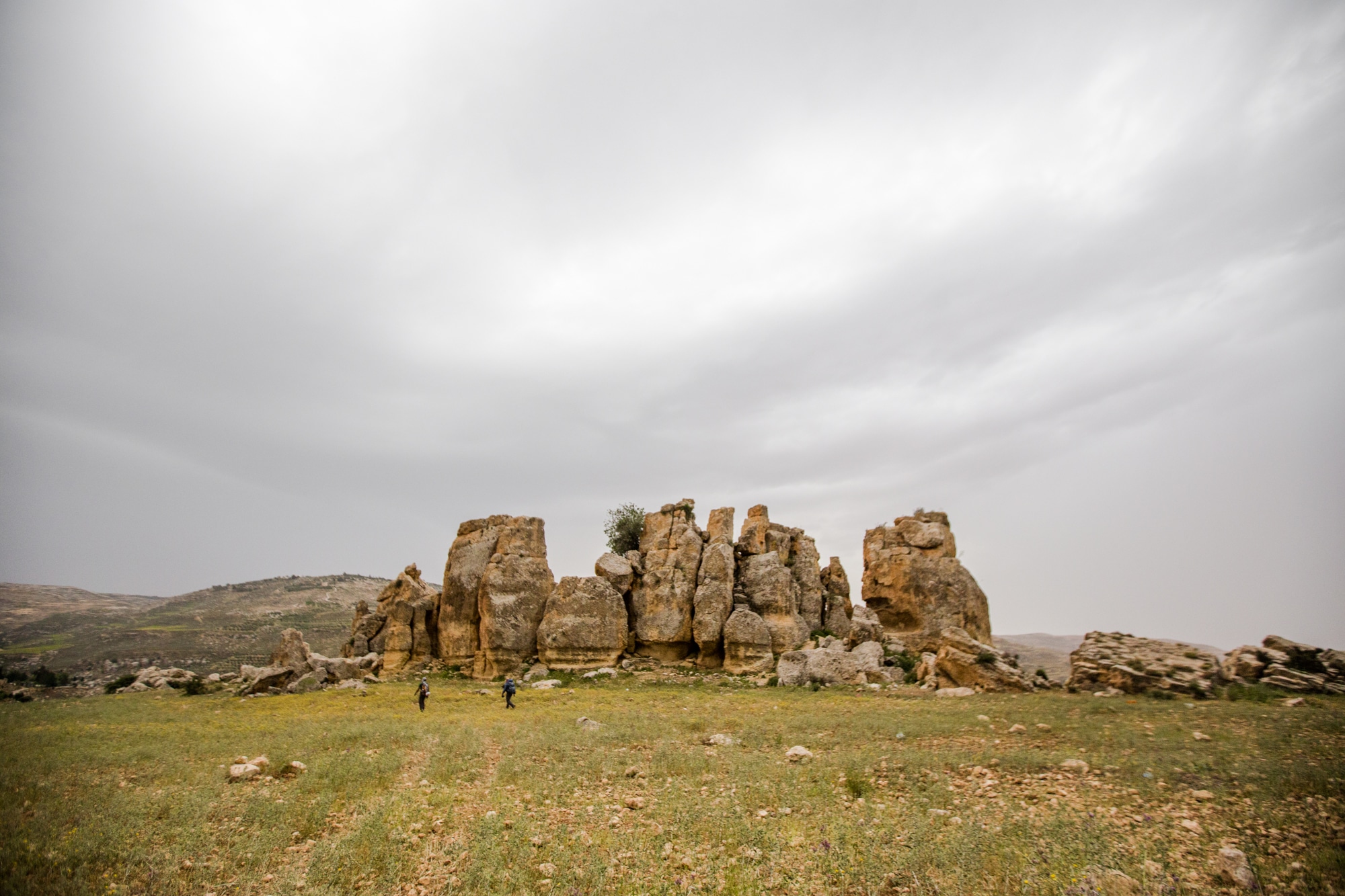
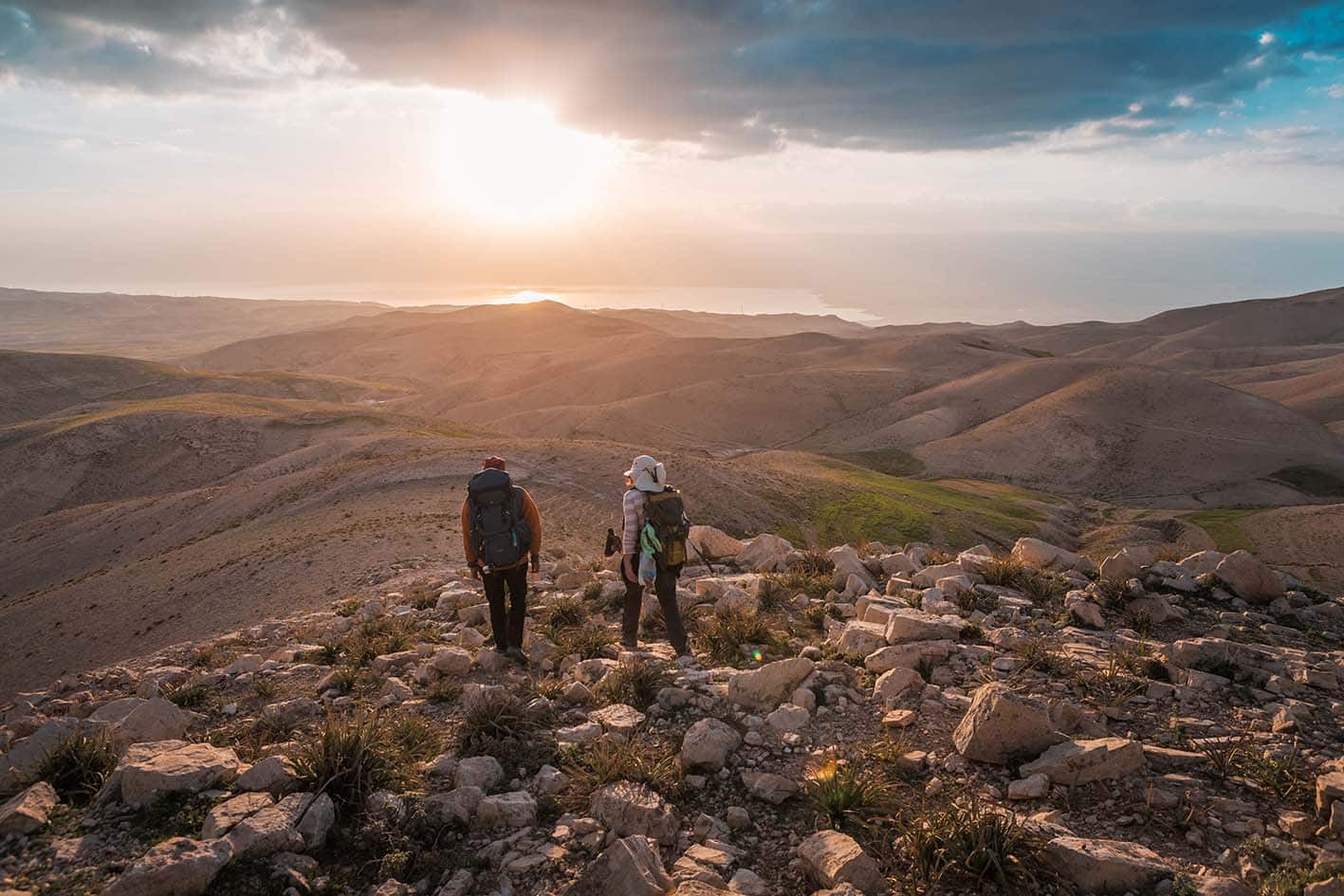
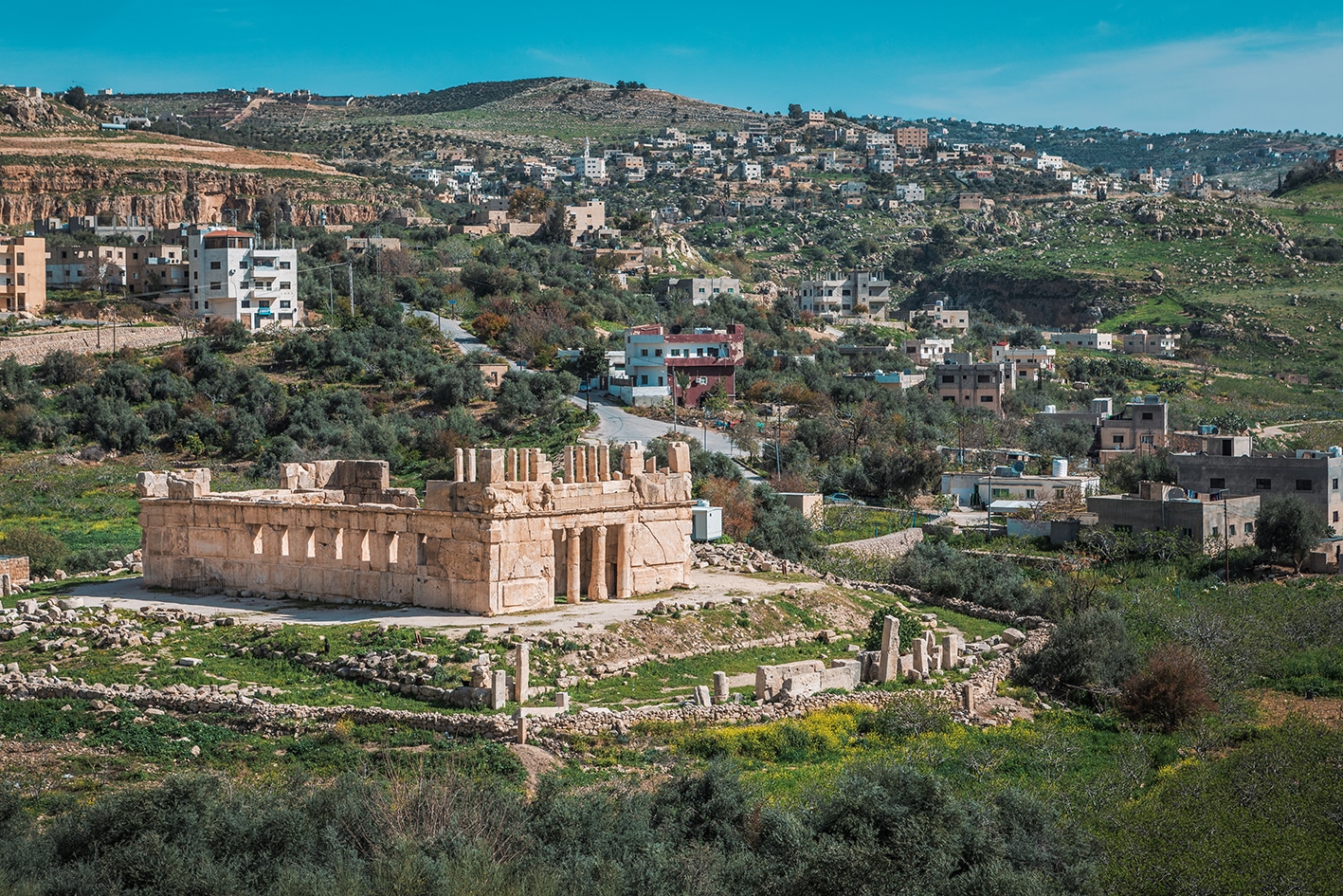
    From Al-Salt city, the trail leads past the Hellenistic palace of Iraq Al-Amir and descends along the dramatic King Hussein’s Rally Road into the Jordan Valley. Here, the climate shifts noticeably, becoming warmer and more arid as the path crosses plateau landscapes overlooking the Dead Sea and intersects with ancient Roman roads that once linked the northern shores of the Dead Sea with the fortress of Mukawir (Machaerus). The route then passes over a ridge before descending through the basalt cliffs and into the flowing waters of Wadi Zarqa Ma'in.

    4 days Distance: 84.4 km Ascent: 3,651 m Descent: 4,275 m Max Elevation: 871 m Min Elevation: 0 m

  • Main sites in the region:

  • As-Salt City (World Heritage Site)

  • Iraq Al-Ameer

  • Qasr Al-Abd

  • Iraq Al-Ameer Women’s Cooperative

  • Roman Road

  • The Dead Sea canyons of Wadi Zarqa Main

To download the GPS track,  Click here.. 

The Jordan Trail is a newly established trail, and is not marked. It is therefore our strong recommendation that you hire a local guide for your safety as many sections are remote with limited water sources and at times no connectivity.
By downloading these maps/GPX you take full responsibility for their use and accuracy; Jordan Trail Association does not warrant the accuracy or completeness of the information, materials or the reliability of any maps as they provided AS IS without warranty of any kind, either express or implied, including but not limited to, fitness for a particular purpose, or non-infringement ;You acknowledge that any reliance on any such maps, shall be at your sole risk and responsibility as Hiking, backpacking, and other outdoor activities all have potential hazards involving risk of injury or death. Outdoor activities have inherent risks and you should ensure you have the skill level and abilities suitable for the activities in Jordan to partake in them and to take all precaution measures.  Check the data on Google Earth or other Apps or Programs before using them.  The Jordan Trail Association shall not be held responsible for any incidents that may occur during your participation in any activity and/or by using any of the maps/GPX.
AGREE
close-link
Click Icon to download the map

REGIONAL TRANSPORTATION

We’re still collecting this information.  Do you know something that might be helpful?  Share it with us!

For general information on transportation in Jordan, click here.

Accommodations

We’re still collecting this information.  Do you know something that might be helpful?  Share it with us!

The Jordan Trail is a newly established trail, and is not marked. It is therefore our strong recommendation that you hire a local guide for your safety as many sections are remote with limited water sources and at times no connectivity.
By downloading these maps/GPX you take full responsibility for their use and accuracy; Jordan Trail Association does not warrant the accuracy or completeness of the information, materials or the reliability of any maps as they provided AS IS without warranty of any kind, either express or implied, including but not limited to, fitness for a particular purpose, or non-infringement ;You acknowledge that any reliance on any such maps, shall be at your sole risk and responsibility as Hiking, backpacking, and other outdoor activities all have potential hazards involving risk of injury or death. Outdoor activities have inherent risks and you should ensure you have the skill level and abilities suitable for the activities in Jordan to partake in them and to take all precaution measures.  Check the data on Google Earth or other Apps or Programs before using them.  The Jordan Trail Association shall not be held responsible for any incidents that may occur during your participation in any activity and/or by using any of the maps/GPX.
AGREE
close-link
EN