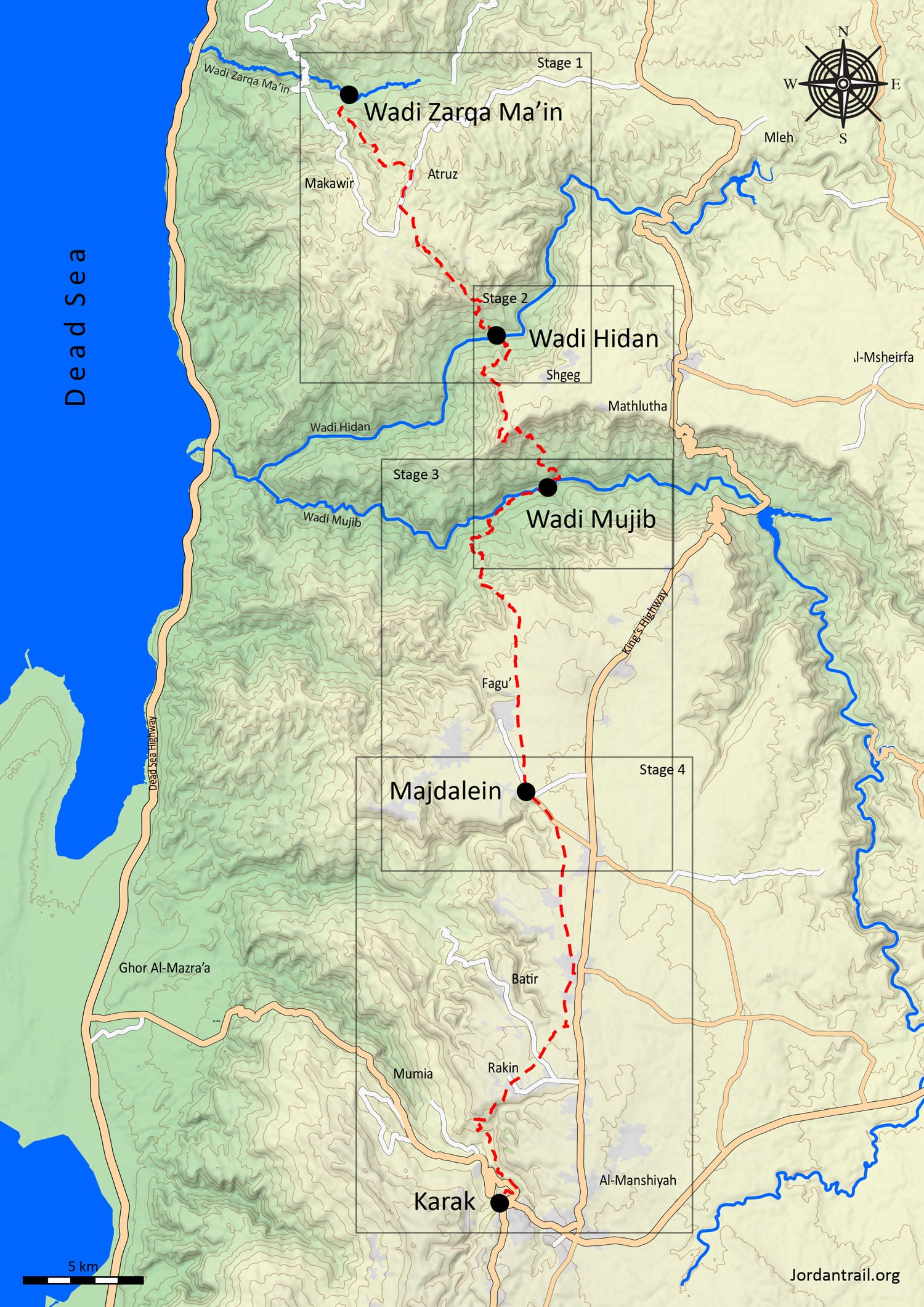
0
0 items
No products in the cart.
0
0 items
No products in the cart.

REGION 4: THREE WADIS TO KARAK

  • Details

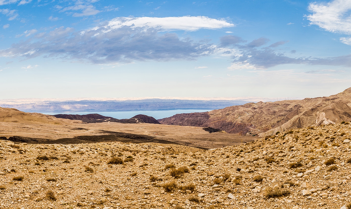
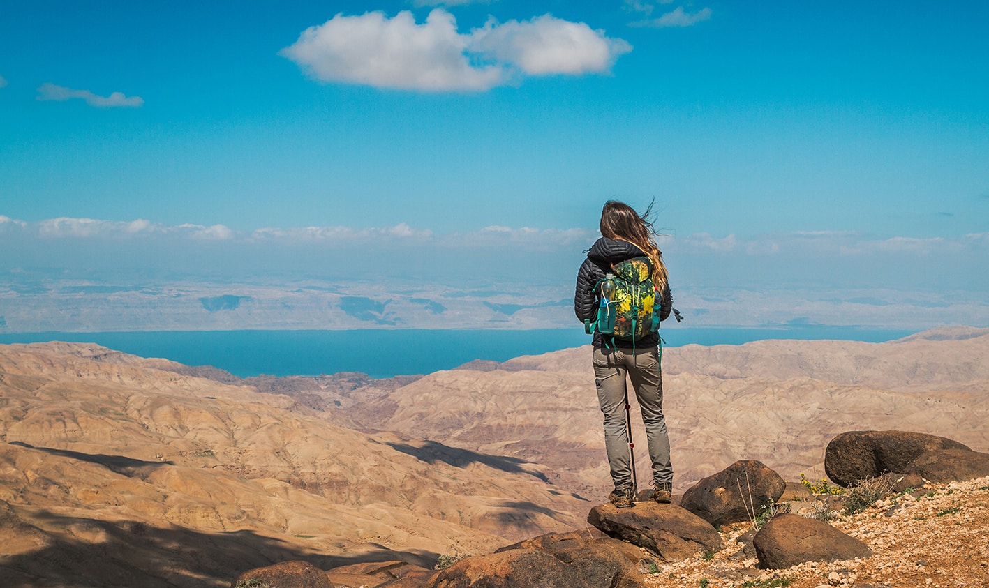
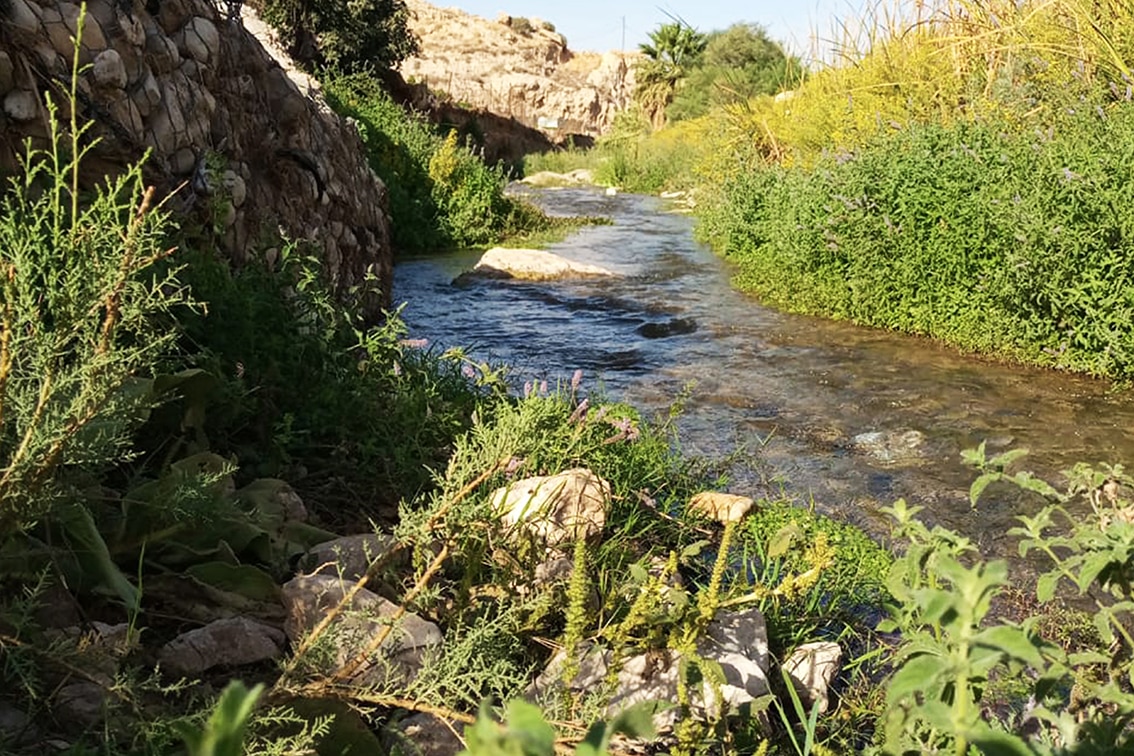
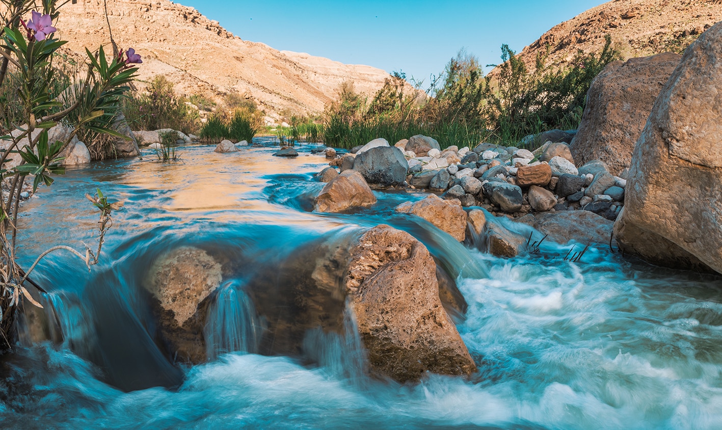
    This section follows a plateau edge offering sweeping views across Wadi Hidan and Wadi Mujib, often described as the “Grand Canyon of Jordan.” Wadi Mujib plunges nearly 800 meters deep, its perennial stream cutting through vast arid expanses dotted with farmland and Bedouin tents. After crossing the wadi and climbing back to higher ground, hikers head south across a fertile plateau with rich red soils and farmlands, passing the ruins of Majdalein near Wadi ibn Hammad (a conservation area) before descending again into Wadi el Tawahin and ascending via Wadi ez Zaiyatin. The stage culminates at Karak Castle, an imposing Crusader fortress that dominates the surrounding landscape..

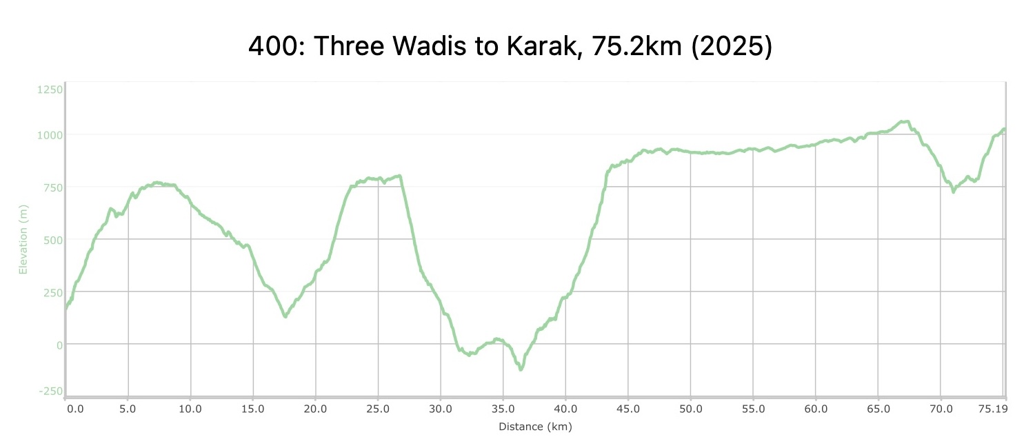
    4 days Distance: 75.0 km Ascent: 3,535 m Descent: 2,678 m Max Elevation: 1,062 m Min Elevation: -126 m

  • Main sites in the region:

  • Wadi Hidan

  • Wadi Mujib

  • Ruins of Majdalein

  • Al-Karak Castle

    Lorem ipsum dolor sit amet, consectetur adipisicing elit. Optio, neque qui velit. Magni dolorum quidem ipsam eligendi, totam, facilis laudantium cum accusamus ullam voluptatibus commodi numquam, error, est. Ea, consequatur.

To download the GPS track,  Click here.. 

Click Icon

The Jordan Trail is a newly established trail, and is not marked. It is therefore our strong recommendation that you hire a local guide for your safety as many sections are remote with limited water sources and at times no connectivity.
By downloading these maps/GPX you take full responsibility for their use and accuracy; Jordan Trail Association does not warrant the accuracy or completeness of the information, materials or the reliability of any maps as they provided AS IS without warranty of any kind, either express or implied, including but not limited to, fitness for a particular purpose, or non-infringement ;You acknowledge that any reliance on any such maps, shall be at your sole risk and responsibility as Hiking, backpacking, and other outdoor activities all have potential hazards involving risk of injury or death. Outdoor activities have inherent risks and you should ensure you have the skill level and abilities suitable for the activities in Jordan to partake in them and to take all precaution measures.  Check the data on Google Earth or other Apps or Programs before using them.  The Jordan Trail Association shall not be held responsible for any incidents that may occur during your participation in any activity and/or by using any of the maps/GPX.
AGREE
close-link
to download the map

REGIONAL TRANSPORTATION

We’re still collecting this information.  Do you know something that might be helpful?  Share it with us!

For general information on transportation in Jordan, click here.

Accommodations

We’re still collecting this information.  Do you know something that might be helpful?  Share it with us!

The Jordan Trail is a newly established trail, and is not marked. It is therefore our strong recommendation that you hire a local guide for your safety as many sections are remote with limited water sources and at times no connectivity.
By downloading these maps/GPX you take full responsibility for their use and accuracy; Jordan Trail Association does not warrant the accuracy or completeness of the information, materials or the reliability of any maps as they provided AS IS without warranty of any kind, either express or implied, including but not limited to, fitness for a particular purpose, or non-infringement ;You acknowledge that any reliance on any such maps, shall be at your sole risk and responsibility as Hiking, backpacking, and other outdoor activities all have potential hazards involving risk of injury or death. Outdoor activities have inherent risks and you should ensure you have the skill level and abilities suitable for the activities in Jordan to partake in them and to take all precaution measures.  Check the data on Google Earth or other Apps or Programs before using them.  The Jordan Trail Association shall not be held responsible for any incidents that may occur during your participation in any activity and/or by using any of the maps/GPX.
AGREE
close-link
EN